A Highland (and Island) Charge

Well, the plan worked out.

I don’t have time for a full length post today, so am just going to bung up some pictures, really. Too many miles have been ridden, and too many still need doing. I’ll hopefully put up a fuller update in a couple more days.

20200825 10 edit

But the plan worked. The wind has been at my back since Thurso. And actually turned around halfway through to remain there. All suspiciously easy. Got a bit wet on the first day, into Durness, but apart from that, have just about managed to stay dry, too, which is always a bonus!

20200825 8 Edit

From close to the north-east corner of Scotland, I’ve pedalled around 140 miles (230 km) in two riding days. First to the west, then to the south. Long-ish days (for me, loaded up) in themselves, but each with over 1400 vertical metres of climbing too.

20200826 4 Edit

The scenery has improved from decent to stunning as I’ve rolled along and onto the West Coast, which has enabled me to occasionally ignore the aching quads and cramping hamstrings.

20200826 6 Edit

And yesterday, an evening ferry at the end, whisking me off Great Britain for the first time for ages, and onto the Outer Hebrides for the first time ever.

20200826 8 Edit

There’s still a breeze out of the north, which makes it chilly, but also means that I’ll keep pushing on for now with the wind more-or-less at my back.

And hopefully, a fuller update will appear in a couple of days.  Once a breather can be had.

Big Skies at the Top

As you get towards the end of the road north, things start to disappear.

Pulling out of Elgin on Thursday morning, I was heading to Inverness, the most northern city. No more cities after that.

20200820 3 Edit

I was also still enjoying Scotland’s cycle infrastructure, including the nice old railway bridge near Forres (above). But, as I dropped into Inverness on yet another well-signposted, segregated cycleway, I knew I wouldn’t be seeing much more for a while.

20200820 6 Edit
North of Inverness, there’s a lower volume of everything. Fewer roads (just the A9, basically), fewer people, fewer towns and shops. And of course, fewer nice bike paths.

But there were more of some things as I pushed north. Oil rigs and threatening clouds. And finally, quite a lot of long-distance cyclists.

20200821 4 Edit

The rigs were parked up in the Cromarty Firth off Invergordon, where many are repaired or decommissioned. The clouds have been threatening me all the way up to the far north, and taking up an undue amount of my mental processing power.

Given the lack of route options, the weather forecast becomes more important. Do you go or stay? Try to outrun the next shower, or wait for it to cross the road ahead of you? Is that rain at lunchtime just a shower, or are you going to be stuck for the rest of the day? Or do you just ignore the whole thing, pull on the waterproofs, and plug on regardless (getting soaked in sweat instead)?

20200821 6 Edit

Where the clouds clear for a while, the skies get bigger as the road goes north. The landscape at the very north end of mainland Scotland is not as imposing as you might think, leaving plenty of room for the sky and the sea to fill the space.

By the time you start the final gentle drop towards John o’Groats (below), you really do feel like you’re getting to the end of something, despite the fact that you’re not, really. You can see the island of Stroma fairly close by, and Orkney in the background, after all, so it’s not really the end of the road at all.

20200822 3 Edit

If you’ve stuck with this blog for a while, you’ll know that I don’t really understand why John o’Groats is any sort of big deal. It’s not the northermost point in the UK, Great Britain or Scotland. And it’s not even really a town; more a collection of tourist-related services massed around a signpost.

But it’s been famous for ages as one end of the Lands End to John o’Groats (‘LEJoG’) route up Great Britain. And, more recently, it’s been included on Northern Scotland’s North Coast 500 route as well. So, for a signpost in the middle of nowhere, it does get a lot of visitors.

20200823 1 Edit

I suppose, technically, arriving at John o’Groats on Saturday meant that I’d completed my own LEJoG ride in 2020, albeit by an extremely convoluted route. Perusing the records, it looks like I took 33 days, compared to most riders taking 8 or 9 in a stright line. But then, most of them don’t go via Kent, or ride 40kg rigs. To be honest, I was happier to have hit 3000 km without any punctures, mechanical issues or physical breakdowns. Had the South America trip happened, I’d be just a few days south of Santiago in Chile by now.

There was a fairly brisk headwind yesterday, as I headed west from John o’Groats. Given the headwind, and a few tough days ahead, I’d already decided to just trundle across to Thurso. A short ride, but it did give me the chance to have a look at Dunnet Bay (below), and the actual northernmost point of Great Britain at Dunnet Head, across the water.

20200823 6 Edit

The current headache is again the weather. There’s a big storm spinning in from the Atlantic, which is a reminder that things will get autumnal soon. It’s also apparently a massive lump of wind and rain, which should make conditions horrendous across the whole country tomorrow (Tuesday). Except for the very, very northern edge, apparently.

So, I’m resting up in Thurso on a perfectly ridable day today, in the hope that the weather forecast is right, and I can get pushed across Scotland by the edge of the big storm tomorrow, but without getting (too) wet.

It’ll be astonishing if that works out…

The Transit of Plague City

Since Perth, where I wrote the last post, it’s been one haar after another. Every morning up to yesterday (Wednesday), things started dark, damp and foggy. And every day, things perked up in the afternoon. The weather forecast dummied me into another rest day in Montrose, with talk of rain which didn’t come. And then the supposedly fine day afterwards turned out wetter than the wet day. At least I do now know the proper name for Scotch Mist…

20200816 1 Edit

Scotland feels more bike friendly in general than England. Although the road surfaces (in towns, especially) can be very poor in places, pretty much every single town now has decent bike routes in and out. And there are loads of converted railway lines and officially-designated ‘Cycling Friendly Roads’, which show how different the attitude seems to be up here. Some of these routes include chainsaw carvings by the roadside. Though I don’t actually know if this is anything to do with the cycle routes.

20200816 3 Edit

I’ve felt the need to make some long-ish miles when I have ridden. There’s always a good chance that a major storm could shut you down for a few days. So as I zipped through Dundee on another lovely riverside cycle path on Sunday, I just had time to grab a couple of pictures of the Tay Bridge (above), and the ship Discovery (below), which was used on Captain Scott’s first Antarctic expedition.

20200816 5 Edit

I made it to Montrose that evening, and was conned by the weather forecast into taking the next day off. This gave me the chance to figure out how to deal with Aberdeen, which is still under ‘local lockdown’ due to Covid-19. Luckily, after reading the regulations, it turned out that, while going in and out of the city is not really allowed, ‘transiting’ the city is fine.

Apparently, Covid transmission all depends on whether you intend to stay in a place or not. Still, it meant that I was OK to shoot straight through the city without breaching any regulations.

20200818 2 edit

The next morning (Tuesday), the haar was back. The fog is probably a decent metaphor for some of the whys and wherefores of Covid regs, but for me, it was just getting a little old, and feeling a wee bit sketchy as vehicles came flying out of it at slightly alarming speeds.

20200818 3 Edit

Still, a slight cross-tail breeze was pushing me up the coast at a decent rate, and meant that I managed to hop across the Covid zone of Aberdeen city in less than an hour, with only two stops for traffic lights, and one for a photo (above). And then it was on up the coast, on flattish roads, to the fishing port of Peterhead.

20200818 6 Edit

Peterhead marks the easternmost point in Scotland, which meant that yesterday’s (Wednesday) ride could only really go in one direction; mainly west. Thankfully, once again, there was yet another nice railway trail out of town, heading pretty much due west for nearly 15 miles. Which was a great start to the ride.

20200819 6 Edit

And, as I hit the coast again, there was plenty more cycle infrastructure to play on, including the seaside viaducts at Cullen (above). Although long, the day turned out to be really fun, with a mix of gravel and tarmac, beautiful seaside views, and a gentle sea breeze nudging me forwards.

I finished up in Elgin. Again, rolling into town on a nearly new, smoothly surfaced, flat bike track by the river. A track which drops you off directly in front of the town’s impressive ruined cathedral.

20200819 10 Edit

The storm rolled in last night. As usual, the weather forecast has been sounding semi-apocalyptic. I don’t know what it’s doing further south, but the initial band of rain has blown through here, leaving beautiful sunshine behind this morning.

So I’ll be pedalling off again shortly. I should be rejoining my 2015 route for a bit in the next few days, before I head off to the west coast after I hit John O’Groats. Assuming no more hold ups from either the weather or the plague…

Scotch Mist

There’s a cliché or two about the weather in Scotland. I’d hate to be one to perpetuate any such stereotypes.

And, in fairness, the drizzle’s only really been an issue in the mornings, and it did start just before I got into Scotland. But it was definitely there, and it’s definitely wetter than mist – I’ve been fairly thoroughly soaked a couple of times.

20200812 1 Edit

Newcastle was as easy to bike out of as it was to get into. Under grey skies for the first time in ages, but scooting peacefully along an off-road bike track to the end of Hadrian’s Wall (helpfully located in the imaginatively-named suburb of Wallsend).

Hadrian’s Wall is often assumed by southerners to be the border between England and Scotland. In fact, there’s an awful lot of England remaining on the eastern side of the country; the border is considerably further from Newcastle than it is from Edinburgh.

20200812 4 Edit

The coast to the north begins in a civilised way; seaside resorts and small ports. But it quickly becomes wilder and more remote as you push on towards border country. The area was contested for hundreds of years. Vikings attacking monasteries, English attacking Scots, Scots attacking English etc, etc, etc.

20200813 2 Edit

As a result, Northumbria is sprinkled with castles, including Bamburgh (above), which look all the more menacing as the fog rolls in from the sea. And the marshes and sands of the remote shore provided a perfect retreat for ancient monks, most famously at Lindisfarne, which requires a causeway to access. The downside of this landscape is that the National Cycle Route 1, which I’ve been trusting on-and-off since Kent as a fairly quick, efficient route, is literally reduced to a sheep track in places.

20200813 5 Edit

And all of this before you even get to Scotland. The last stop is the fortified town of Berwick-upon-Tweed, which has changed hands many times, but currently sits a few miles inside England. Although the local football team plays in the Scottish league, as some sort of bizarre consolation prize.

20200813 7 Edit

I hit the border in the drizzle shortly after leaving Berwick on Friday morning, and soon after ended up in the clouds (the clouds were very low, rather than me doing loads of climbing). The first impressions of Scotland were, well, foggy.

20200814 2 Edit

Thankfully, it’s still August, even all the way up here, so the sun is strong even when you can’t see it, and the dampness seems to be burning off in the afternoons. The run into Edinburgh even came with a tailwind, which was an unexpected little bonus. As was another city with great, well signposted and well used cycle routes.

I even had the chance for a quick wander around Princes Street in the evening, and have a distant look at the castle, which was looking lovely in the evening sunshine.

20200814 8 Edit

Yesterday (Saturday), it was time to head further north. To get north from Edinburgh, you need to cross the Firth of Forth, a huge estuary which almost cuts the country in half. In the olden days, there was a ferry. Then, back in the 19th century, the iconic rail bridge (below) was built.

20200815 1 Edit

It’s now been joined by two road bridges; one from the 20th century (which is the one used to cross by bike), and a new, 21st century crossing. It’s very impressive to see three kilometre-plus long bridges from three different centuries all right next to each other.

Going forwards, there seems to be some heavy rain in the forecast, which may force a day or two off in the next week. It seems hard to believe, as I’ve not had a weather-enforced day off since the south coast of England.

I have, of course, got wet a couple of times. But that was just the Scotch mist – it doesn’t count at all…

Edges, ‘Edges, a Parmo and an Angel – Long Miles To the North East

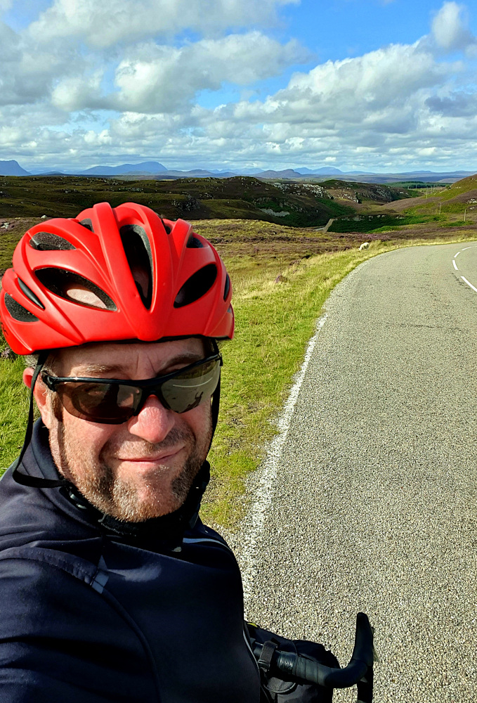
The wind had flipped around as I left Boston on Saturday. It was a bit unfortunate to have a headwind to deal with for the first time since the south west. But also amazing that I’d not had a headwind to deal with since the south west.

Lincolnshire is still largely flat lands, following on seamlessly from East Anglia. And, as I followed the canalised River Witham northwards, progress got easier or harder every time it slightly changed direction, as my angle to the wind altered.

20200808 2 Edit

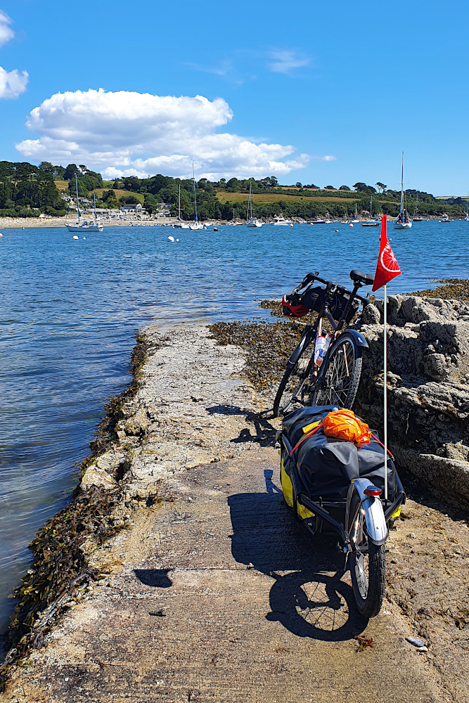
You could argue that I cheated ever so slightly by trimming the edge off Lincolnshire. Being Saturday, I thought it was probably better to avoid the hordes of potentially Covid-infested day-trippers at the big seaside resorts on the coast, so cut inland along the river instead. Or maybe this is just an excuse for avoiding the worst of the headwinds along the coast.

In any case, I was doing a quick roadside map check, when an elderly chap on a light touring bike screeched to a halt next to me (he really needs to replace his brake pads). The encounter didn’t last long, as I was treated to a high-speed monologue ranging from my trailer to his £1000 Rohloff hub, to his planned ride for the day, and where he was going to have lunch.

This was where I realised that I’d definitely entered the North of England. I’d been vaguely thinking about the edges of the country. He was worried about edges too, or at least that I wasn’t going to be getting much shelter from the wind up on the riverbank. There weren’t any ‘edges there, though there were on the ‘ills, where he was heading.

It took me a while after he’d gone to realise that he was talking about hedges. I’ve not heard very many aitches since.

20200809 1 Edit

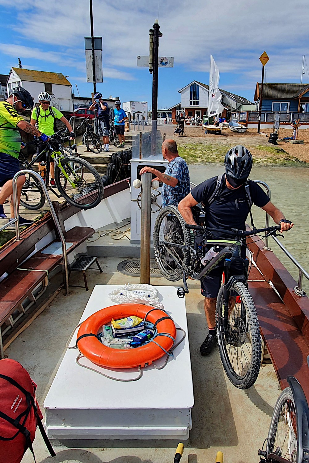
Crossing the Humber Estuary on the huge suspension bridge removes (I think) any doubt as to whether you’ve left the midlands behind.

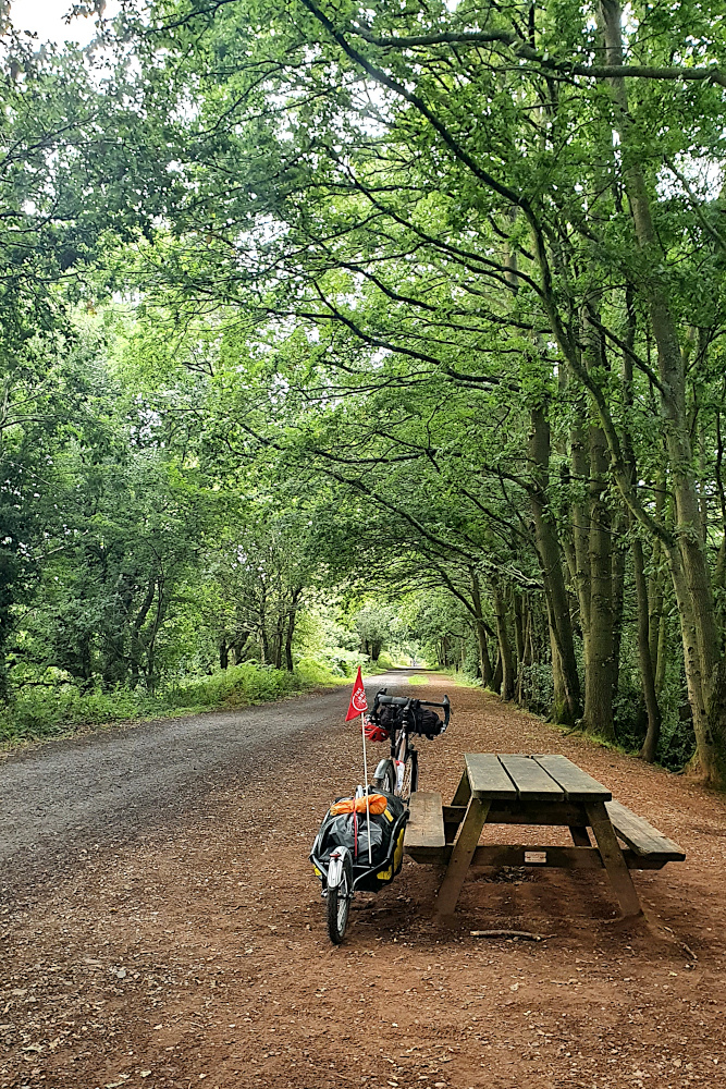
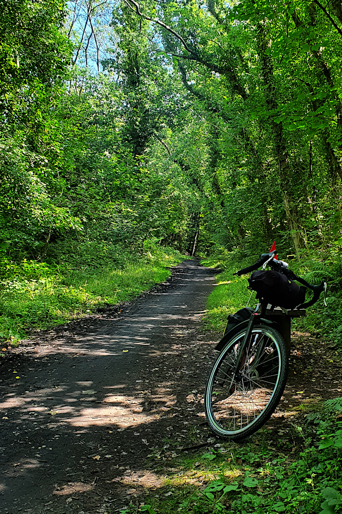
Since the Humber, it’s mainly been old railway lines (first from Hull to the coast, then the Cinder Track from Scarborough to Whitby) and hills. Mostly not the nicely surfaced, commuter-friendly sort of rail paths that I’m used to in the South, but the sort of dusty, rough, rocky paths that keep your speed frustratingly low, and would probably break a road bike in half. On the plus side, like most railway paths, they were surrounded by ‘edges, so the headwind stopped being a major problem.

20200810 2 Edit

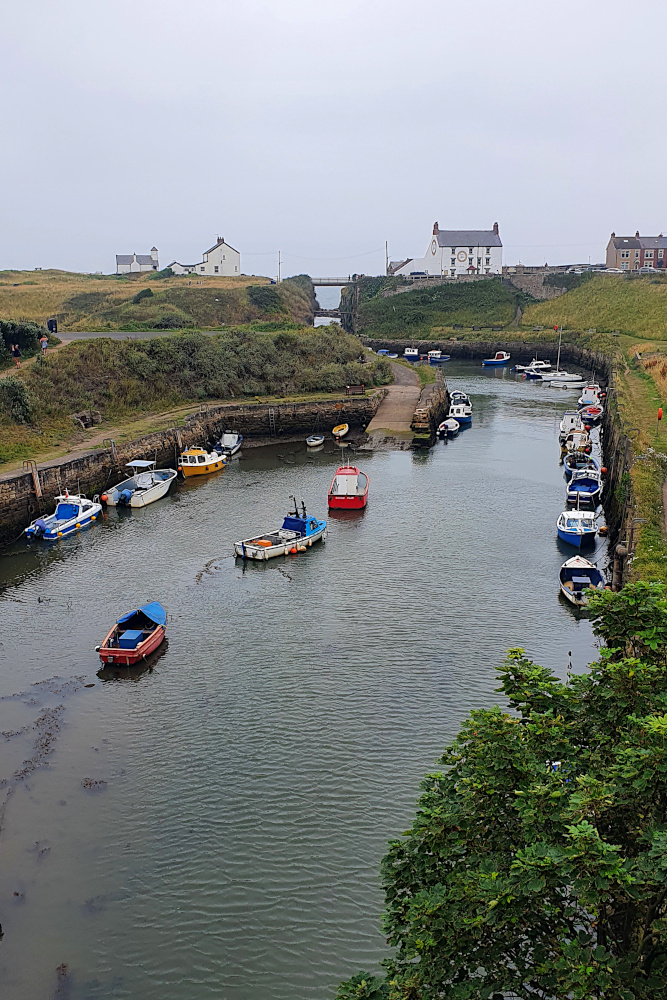
The Cinder Track, in particular, put me back right on the edge of land and sea. It’s a beautiful route, including some lovely views, like Robin Hood’s Bay (below).

20200810 3 Edit

Though I’d give yourself a day for it rather than the half day I pushed through it in. The drop into the bay was a rutted, bumpy test of both me and the trailer; we both passed, just, though with the front wheel sliding around in a somewhat alarming manner. And the track was hard enough going that it didn’t set me up well for the rest of the afternoon.

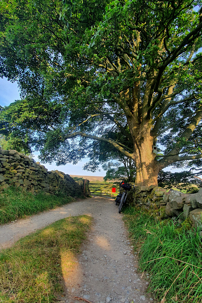
Which was unfortunate, as I needed to cross the North York Moors National Park. This is a beautiful place, and somewhere I’m very familiar with, as it’s where my Dad’s family came from. So I knew what was coming; stunning countryside, but with ups and downs as steep and frequent as Cornwall.

20200810 8 Edit

It didn’t especially help that I’d gone a bit too deep on the Cinder Track. But it also didn’t help that the National Cycle Route planners had seen fit to drop a couple of miles of very rough, very steep gravel into the mix, just when I thought I’d got through the tough parts.

20200810 9 Edit

It looks a little like the ‘White Roads’ of Italy, where the pro road racers take in sections of gravel road. But once again, it’s steep, and pitted, and the gravel is a bit too big to actually ride on. It was a beautiful end to the day, but I really need to learn to take things easier sometimes. I should be old enough to know when I’m biting off more than I can chew by now.

Dropping off the Moors into the flatter lands around Middlesbrough puts you right in line for one of the UK’s biggest calorie injections; the Teesside Parmo. I was immediately biting off more than I could chew again. A Parmo is effectively a deep-fried double chicken-breast schnitzel, knee-deep in bechamel sauce and melted cheese. They’ve been clocked at over 2000 calories each, including the chips. That’s a day’s worth of energy on one plate; not normally advisable, but just the thing to fill the tank of a touring cyclist who’d slightly overdone things.

20200811 3 Edit

And so, rather than being completely destroyed on Tuesday morning, I was ready to press on northwards. After negotiating Middlesbrough and Stockton-on-Tees, is was another old railway line that took me into County Durham. Although not sealed, the surface was smooth, and the progress quick. I wonder why some railway path builders can make them smooth, and others can’t?

After the railway line, I was already approaching Gateshead, and then Newcastle. After wiggling through a bunch of small mining and industrial towns, a short climb led me to the symbol of the region; the Angel of the North, standing guard over the main road into Tyne valley.

20200811 4 Edit

And then, an unexpected delight. You never hear about this region in discussions about cycling infrastructure in the UK.

But, for the very first time on this trip, I rolled through Gateshead, and across the river into Newcastle on well-signposted, smooth cycle tracks. I just followed large, clear signs through cycle-specific traffic lights, along clearly demarcated, wide shared paths, and segregated bike tracks. No frustrating map checks, no close passes, no conflict with pedestrians. Someone has actually designed this properly.

With the posssible exception of London, I’ve never seen a UK city which is easier to navigate by bike than Newcastle / Gateshead. It should be embarrassing for so many other cities and towns that I’ve been through, which still seem not to get it, but it’s great to know that at least one city region is doing bike infrastructure properly. I wonder why some councils can do it properly and most can’t?

Windmill Whirlwind

Flat lands, water and winds.

East Anglia is defined by water and wind, in just the same way as the similar lands on the other side of the North Sea. The winds also define your rides on the flat, and the winds have been good since Essex.

20200805 4 Edit

The water can get in the way, but then, much of the region would be either marshland or under water entirely without extensive sea defences and drainage. So the odd ferry is entirely acceptable, in my book. In any case, some of the ferries are quite fun, like the one above, just north of Felixstowe.

20200805 6 Edit

With the multiple ferries of south Suffolk out of the way, it was full speed up the coast to Lowestoft (above), and the monument marking the easternmost point of England / Great Britain / the UK. As you can see, Lowestoft Ness is also home to a massive wind turbine, and all the way up the east coast, the sea is dotted with huge wind farms.

20200805 8 Edit

The other things that were really noticeable about Suffolk were that the road surfaces are relatively lovely by UK standards, and that there was a lot of sand around. Quite a lot on the beaches, but also quite a lot by the roadsides inland. It’s only the sea walls here that keep the shape of the land as it is. I passed Dunwich, which was a major port in the early middle ages. The vast majority of the town was lost to the sea due to coastal erosion.

20200806 1 Edit

Wind and water continue to be the driving forces over the border in Norfolk. Much of the county is below sea level, leading to odd (for Britain) scenes with old windmills surrounded by waterways which are above road and ground level. It looks like chunks of the Netherlands.

Wind power is not a new idea in these parts, and it adds to the mystery as to how humankind forgot about it for so long in the last couple of centuries. Imagine how far ahead we’d be if we’d not been distracted by the weird practice of burning dead sea creatures… The wind was still pushing me along at a decent speed too, despite finding a lump or two in the route around the north coast.

20200807 3 Edit

Anyway, after a quick transit of the Queen’s estate at Sandringham, there was one last stop in Norfolk at King’s Lynn before crossing the border into Lincolnshire yesterday, ending up at Boston (above). Boston gave its name to a bigger town in the USA, and also had a small part in the story of the Pilgrim Fathers – a part which (as is not unusual with history) been expanded enormously as time has gone on.

It would be hard to say that the landscape has changed much so far in Lincolnshire. It is also hard to judge whether I’m already in the North of England, or will enter it shortly. Lots of place names shifted to Viking-sourced rather than German-sourced as I headed through Norfolk, but I’m not sure how much of Lincolnshire is northern, and how much is midlands.

Whichever it is, the landscape will remain pretty flat for a few days, and the wind direction will dictate how far I can go, and how much fun it is. And I will be in the North very soon, if I’m not already. And at some point, I’ll lose the windmills, which I feel are beginning to stalk me. This is what’s outside my window as I write this:

20200807 4 Edit

***Note: Although I have collected a vast number of images of windmills in the last few days, rumours that I’m planning a coffee-table Book of English Windmills are not true. Sorry for any disappointment this may cause.***

Roaming Roman Roads

London’s a big, big city.

As we’ve already established, riding a bike in most UK towns is not without its frustrations. So, as there was no real need to go through the biggest city of all, I’d always intended to brush London as lightly as possible.

20200801 1 Edit

But London’s been unavoidable for ages. You need to cross the Thames at some point, and most of the bridges are in town. And ever since Roman times, the capital has been the hub of the country’s major roads. All roads in England seem to lead to London.

Coming in towards town from Kent, I was running along the line of the main Roman route from the English Channel. A route so important that it was fortified and defended for centuries. Rochester’s impressive castle (above) guards the route’s crossing of the river Medway.

And coming out of London into Essex over the last couple of days, I’ve been pushing north-east on another major Roman road, which led out of the metropolis to the garrison town of Colchester. These old Roman routes have the great advantage of being built in mostly dead-straight lines, making them fast, if slightly boring riding. Although it’s always interesting to think that you’re following a route that’s been used for thousands of years, and imagine how many feet, hooves and wheels have passed this way before you.

20200802 2 Edit

I lived in London for a long time, so making distance was not the key point of the last few days. I had friends and family to catch up with (in a responsibly socially-distanced way, of course). As a result, the mileage has been down, and there’s been a certain element of consuming beverages which are, let’s say, somewhat counter-productive to athletic performance.

The other key issue was getting across the Thames. On Sunday, the ferry at Gravesend was not operating, but I was slightly surprised to discover that there’s a free shuttle service for bikes across the monstrous Dartford Crossing (pic above). Arrive at one end, find the magic telephone, and a grumpy driver appears to whisk you from Kent to Essex.

After which, a few uninspiring miles through London’s eastern suburbs took me to some drinks in Romford. A few more similar miles the next morning took me back out of Greater London, and I was soon heading for my final planned social stop in Essex, where I met the newest arrival in my friend’s family (providing a rare opportunity to add a kitten picture to a cycling blog).

20200803 1 Edit

Things are not always exactly as they seem, and despite being cute, the kitten in question is a proper little psychopath.

But things are sometimes exactly as they seem, and the landscape after Chelmsford has quickly begun to fit the East Anglian stereotype. I’m entering the UK’s flat lands, and the cliffs and hills of the south west and the south coast are a memory. Most of the eastern side of England is likely to be big skies, big fields, and an almost total lack of big gradients.

20200804 3 Edit

This will be great with tailwinds, and awful if there are headwinds. I’ll have to wait and see which combination I get as I head north into Suffolk and Norfolk.

I did notice one sign yesterday that there may still be some surprises ahead. Stopping by the side of the road for a map check, I was admiring the hand-painted advert below for a local honey producer.

20200804 2 Edit

Then I noticed that they seem to sell bears as well. I never quite got to the bottom of this, but I think that’s illegal in the UK, as well as impractical, and I’m surprised they are willing to announce this sort of thing by the roadside. Maybe East Anglia will be more interesting than the landscape suggests.

Anyway, the weather still seems OK, and the legs are still pushing the pedals around. I’m on a ferry across into Suffolk this morning (Wednesday), so I’ll find out pretty quickly…

The South Coast is All Wight

Apologies for the laboured pun in the title – I should have done better.

Those last two words have been rattling annoyingly around my skull ever since I hit the island in question on Tuesday, and I’m disappointed that I’ve not managed to come up with a better heading in all that time…

After the rain in Bournemouth, Tuesday saw me released along the flat, straight sections of the South Coast of England, with a super tailwind meaning the miles could finally start piling up properly. Three days was all it took to polish off most of the Channel, before turning another corner in Kent.

20200728 1 Edit

The Isle of Wight is England’s biggest island, which isn’t really saying that much. However, there are several interesting things about it. It was one of Queen Victoria’s favourite haunts. It has one of the few remaining red squirrel populations in England. It’s often full of sailors. And it was the test bed for the abortive UK Government Covid App (whatever happened to that?).

For me, the main attraction was that, despite involving two ferries, the Isle of Wight provided the quickest route into the fast, flat-ish (if you ignore the odd cliff!) sections of the south coast. Although the riding has been easier and faster, it’s been a few days with some odd contrasts.

I’ve seen both the best (on the Isle of Wight) and the worst (Kent – inexcusably bad) road surfaces of the trip so far. And the traffic has ranged from negligible (again on the island) to traffic jams on the cliffs as I pushed properly into the South East from Brighton.

20200729 2 Edit_141226

The other strange contrast is a Covid-related one. While most people are managing to keep a reasonably level head about the crisis, there are a lot more exceptions than I expected. Some people don’t trust the government because they think we’re all going to die, and some don’t trust the government because they think the whole Covid thing is some sort of scam to persuade us all to get microchipped.

And you see this weird bipolar split in the old seaside resorts of the English Channel and Kent. Today (Friday) was the hottest day of the year, and saw roads blocked, traffic jams all over the place, and people happily squeezing themselves into three square feet of beach.

20200729 7 Edit_184735

But I spent Monday night in Bournemouth, Wednesday night in Eastbourne, and Thursday in Folkestone (all major Victorian resorts). And when the evening comes, those towns are suddenly dead; complete with hotel rooms in the big hotels going for less than a campsite in places. Yes, some of the pubs are open, but everything else is shut up tight, and there’s a very peculiar, almost deserted feel.

It makes it look like the country’s not bothered about the virus during the day, but terrified and hiding at home in the evenings. Odd, odd, odd…

20200730 8 Edit

The south coast is also England’s invasion corner, where most attempts to take the country over by force have been focused. William the Conqueror launched his successful takeover bid around Hastings, and I spent a little time riding alongside the Royal Military Canal, which formed part of the unused defensive lines against Napoleon, before being re-fortified in case Hitler managed to make it across the Channel.

20200731 2 Edit

The reason he didn’t was the Battle of Britain, and a long drag up onto the clifftops above Folkestone takes you to the memorial (above).

After Folkestone, it was time to turn the corner out of the Channel, and into the North Sea. The coast was rammed (it was daytime, after all), but the country lanes were much quieter a little inland, and provided a bit of shade from the hottest day of 2020.

20200731 5 Edit

Next, it’s the fringes of London. Things will get a little slower, as there are some (socially-distanced) meet ups to do with people I’ve not seen for a while. Given the abnormally good weather, I’m hoping to drop in a couple of half-days, rather than taking another full day off just yet. I know, this being the UK, that I’ll hit a bad patch at some point, so I want to keep moving for now.

Hopefully, I’ll be able to get away towards the north before any more interruptions…

***NOTE – not sure how clear this was before, but the map and stats for this ride are now working properly, and can be found under the ‘The Rides’ tab***

Rest Day 1 (Or, a Bit of a Rant about the UK’s Cycling Infrastructure)

It feels like a couple of days ago that I started. It feels like months ago that I started.

Bike touring’s time-mutating magic has kicked in. On the road, a day flashes past, while a single hill or town can take ages to get through. On a rest day (like yesterday), time drags itself out, and you wonder how you’re not making more distance when you ride all day.

The hills and towns of southern Devon have been the backdrop for the last few days, and have certainly made their contribution to things taking longer than expected.

20200723 1 Edit

First up was the relatively small city of Plymouth (above), which took ages to get across, despite apparently having loads of cycle routes. As is depressingly usual in the UK, spotty bits of randomly-disappearing (and / or poor-quality, badly-signposted) bike infrastructure are the problem. It’s not specifically Plymouth’s fault; it’s a general urban UK issue. But having to stop 10+ times to map-check when crossing a city centre is clearly not going to encourage more cycling.

Plymouth Hoe, where the picture was taken, is where Francis Drake was allegedly playing bowls when the Spanish Armada was sighted. It’s just as well he didn’t have to get to his ship on a bike, or the UK would by now have a long tradition of afternoon siestas.

You can probably see that the clouds were threatening already. Once finally free of Plymouth, I’ve felt like I’ve been stalked by heavy showers ever since, although they didn’t properly catch up with me until yesterday, as I fled eastwards.

20200724 1 Edit

I had a bit of deja-vu while lumping up and down the hills after Plymouth; there was a long-ish stretch where I was following exactly the same route along the fringes of Dartmoor as I did in 2015 (on the Scilly to Shetland ride). And it was drizzling a little, just like it was back then. Soon enough, though, it was time to peel off back towards the coast (above), and the Starcross Ferry across the river Exe estuary.

You might well expect a ferry which is heavily used by cyclists to avoid a detour around the estuary to be easy to access for touring cyclists? Well the crew on the boat were all great, and dealt with the large number of bikes (plus one idiot with a trailer) excellently. But… to access the western side of the crossing, you need to carry your bike (and trailer, or bags, or anything else heavy and bulky you have) up about forty steps, over a railway footbridge, and back down again – beware if you’re running a heavy touring rig!

20200724 3 Edit

Once across the Exe, you’re in Exmouth. It’s a fairly small town, and seems pleasant enough, but is plagued with some of the same cycling issues as Plymouth. On the road out of the centre to rendezvous with a nice bike track on a disused railway, I suddenly noticed a brand new, wide shared bike and pedestrian path right next to me. I had no clue where it began, as I’d seen no signs, and I couldn’t get on it, as there was no access from the road. Grrr!! And when, just a few minutes later, I came across the astonishing piece of ‘infrastructure’ pictured above, I had to actually laugh at it.

The abomination above actually comes between two sections of a traffic-free railway path, which is actually very nice (see below). But between them, the two pictures encapsulate the problem with UK cycling infrastructure; it’s good to ride anywhere where there are no cars. But if you’re anywhere near a road, expect cycling to be a time consuming 2nd class hassle, unless you’re willing to play with the traffic on the main roads.

20200724 4 Edit

Phew. Think that’s rant over on the infrastructure. Devon’s other time-bending tool is the hills. I’ve got one more big set to go today, as I (hopefully) shoot eastwards. They do hurt (especially when they start at 8%, and just get steeper and steeper before maxing out at 20% ish, like the one below). And they’re not that quick on the way down, either, as the trailer needs a little bit of management at higher speeds.

20200724 5 Edit

But, although they slow you down, the hills do give you some lovely views of the countryside, which has been pretty throughout. There have been thatched villages and rolling farmland, and a full-on Fawlty Towers guesthouse experience in Torquay. Devon’s been pretty good in general.

Having avoided the first wet day of the trip by having a rest yesterday, it’s back on the road today into Dorset. There’s another, bigger, storm coming in tomorrow, so it looks like the first phase of the flatter run along the south coast may be a little disrupted.

On the plus side, the rain is rolling in on rapid tailwinds at the moment, so it could be that the time-bending can continue, and surprising amounts of progress can be made. Who knows?

Kernow

Legs get stronger with time. And with tailwinds.

The pain of the first few days of this ride is fading into memory. Dots are advancing on the map (you can find it via the ‘Rides’ tab above). And the weather’s been very kind. Progress is being made.

20200719 2 Edit

The climbing still goes on, but that’s the nature of a rocky coastline. Amazingly, I’ve already climbed 70% of the height of Everest on this trip in just over 300 miles / 500 km. Thankfully, it should only be another few days before I hit the flatter parts of the south coast, although it’ll stay tough for a while.

The rocky coast gave rise to Cornwall’s big industry of previous times. The landscape is dotted with old tin mines and the engine houses which kept them pumped out. Many of these are ruins now, although I found this one, which has been converted into a holiday cottage.

20200719 3 Edit

The other thing that Cornwall is famous for is its tourist towns. It’s an odd situation at the moment, with many places operating under capacity, and many non-tourist towns still feeling very quiet. Meanwhile, tourist areas like St Ives (below) feel almost normal – though presumably with less traffic.

20200720 1 Edit

I say ‘presumably’ less traffic, because there is still loads of it. One of the features of Cornwall is that there are not many direct routes. It’s a skinny peninsular, which obviously gets skinnier towards the tip, so there’s not a lot of space for major roads. So all the big roads are pretty rammed. And driving standards are a little heart-in-mouth at times due to some very inappropriate overtaking tactics. The only option is the tiny country lanes, which are beautiful, but incredibly slow to ride, due to the endless hills, endless potholes, and the occasional need to wait for tiny ferries across rivers (don’t forget your face mask if you want avoid long rides around estuaries this year!).

20200721 1 Edit

But, if you can take your time, and avoid the main roads, Cornwall’s a lovely place to be in the summer sunshine. The only exception so far is Lands End, which has been turned from a fairly insignificant headland into a bizarre cliffside theme park. I was pretty happy that getting to the signpost indicating the end of the country was not a big issue for me. But I’d be quite upset if I’d done the length of Great Britain as a lifetime challenge, or charity ride, only to have to pay to finish. I skipped the theme park, and just completed the turn that the finish of the road dictates. There’s no more south west on the mainland.

20200721 2 Edit

For me, Lands End was just a corner to turn; the first major change in direction. It’s taken me out of the Atlantic, and into the English Channel, which I’ll now follow up to Kent. There’s just half a chance that the wind might be about to turn again to assist, but that’s surely in the realms of fantasy cycling…