infrastructure

Escaping the Pembrokeshire Dangler

As you may have gathered from the previous post, Covid-19 (or rather, the various UK authorities’ reaction to it) is finally having a major impact on my route and plans.

It’s left it very late in the day, thankfully. And it seems to have left just enough of a gap for me to squeeze over the finish line before the gates slam shut.

Just a few minutes after I last posted here on Wednesday morning, I was already firming up plans to re-route to avoid the local lockdowns in South Wales. I was also being soaked by a continual band of heavy showers, and getting somewhat upset with the weather forecast, which had promised me a nice sunny, if breezy, day.

The rain eventually cleared in the afternoon, and I continued south with a tailwind before hitting the huge inlet of Milford Haven (though I was well inland of the town of the same name). As well as being a base for local yachties, Milford Haven also contains a colossal gas terminal further towards the sea, keeping the UK’s fossil fuel addiction burning.

Although increasingly unbelievable, the forecast for Thursday was awful, so I decided to risk one final rest day to plan how to finish up without getting trapped.
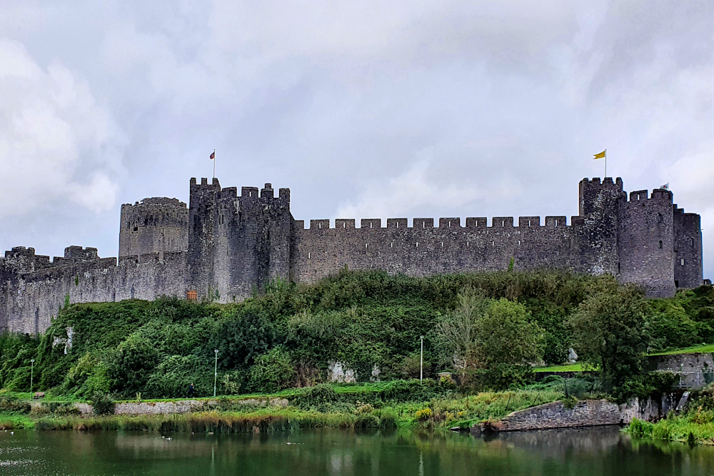
Pembroke is not a bad place to be stuck on a rainy day, with possibly my favourite castle of the whole trip (though there’s stiff competition) parked in the centre, and another old and wiggly town built around it. There’s a lot of history there, too, as there’s been a castle in Pembroke since the 11th century, and it’s the birthplace of King Henry VII.

Meanwhile, out in Covid land, there were more rumblings from the Welsh government about adding even more areas to the local lockdowns, including Cardiff and Swansea, Wales’ two biggest cities. This would wipe out any small chance that I could zip through the Covid zones on each side of Cardiff.

I had to give up on following the coast, commit to the hilly inland route via Brecon, and get planning.
The Covid ‘second wave’ in Wales is actually not as bad as it is in England, but the Welsh government seems to tend towards stricter lockdown measures. During Lockdown 1, back in the springtime, they had a five-mile travel limit. I don’t want to risk getting stuck with that sort of thing, so am aiming at the quickest possible route back, without touching the exclusion zones in the south.

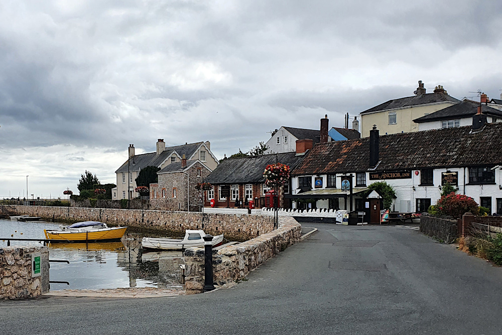
After a wetter than expected day, and a fully wet day, I was fully expecting yesterday (Friday) to defy the weather forecast and be wet too. In fact, it turned out OK, with just the odd (very heavy) shower scudding through the area on a strong northerly wind. I headed slightly north of east through the sunshine towards Carmarthen (above and below).

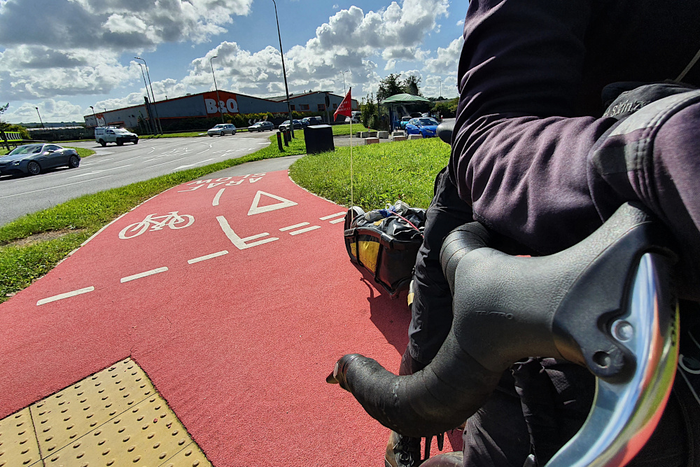
As well as the Welsh road surfaces being by far the most consistently decent in the UK, they’re also making some decent strides on the bike infrastructure side of things. Some rubbish signposting aside, Carmarthen boasted both some extremely bright (and therefore easy to follow) bike paths, and a fairly spectacular cycling / pedestrian bridge.

Carmarthen is also the gateway to the pretty Towy valley, which provided a gentle route towards the big hills of the Brecon Beacons. Even as I was heading up the valley yesterday, the expected Swansea and Cardiff lockdowns were announced, so it looks like I made the right call on the route.

Today, it’s a big hill pretty much straight out of the gate, up onto the Brecons. Fingers crossed, that’ll take me to the start of an exceptionally long (by British standards) downhill run across the top of the Brecon Beacons National Park, avoiding the Welsh Covid zone.

And one more day should take me home, and the end of the trip. Suddenly that’s tomorrow, which seems slightly insane. It remains to be seen whether things will actually be that simple.

And the Pembrokeshire Dangler? Nothing rude, and not a peculiar local delicacy. Nor even a medical condition or the local serial killer. No. It’s a line of rain showers which occur when there’s a northerly wind picking moisture up off the Irish Sea. Beautiful weather on either side, and a constantly miserable time for anyone stuck underneath.

Sounds very familiar. But I’m not in Pembrokeshire any more…
Bright Lights, Big City. Eventually.

The Lake District is one of the most impressive areas of England, with towering (by English standards) hills dropping almost straight into the sea. Unfortunately, it took a while before the hills made themselves apparent. Everything over about 200 metres remained thoroughly shrouded in clouds until the day I left the area.

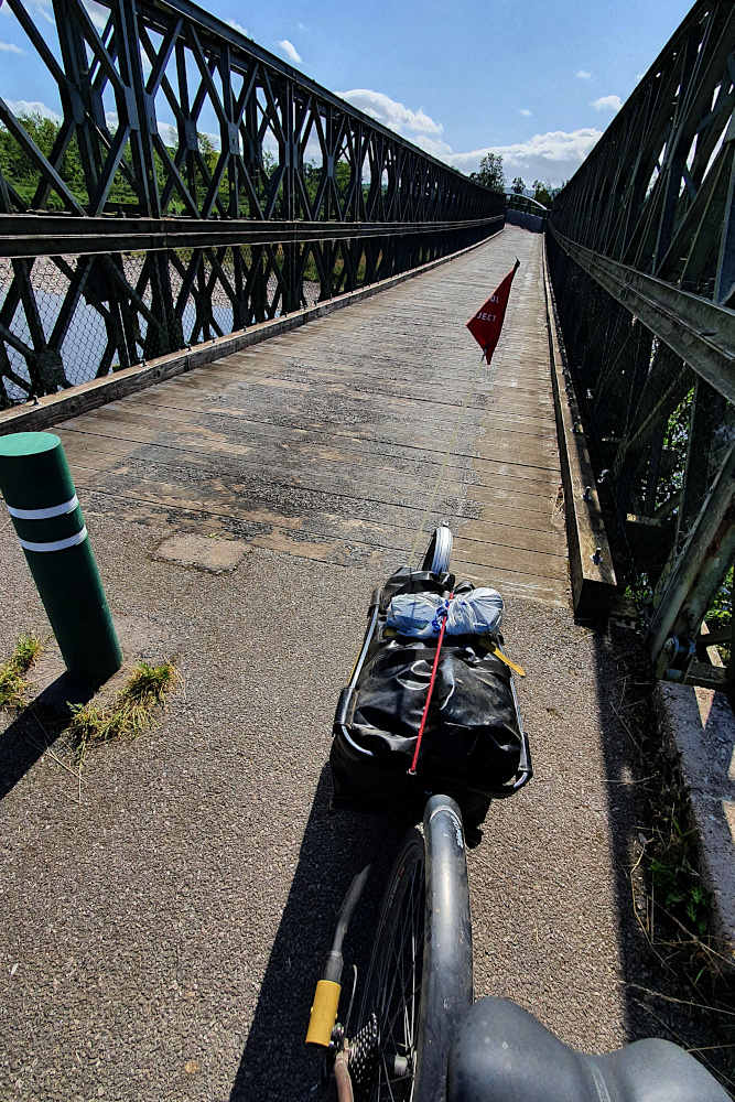
But the coast was nice. Possibly not including the waste nuclear fuel site at Sellafield, but otherwise nice. There was quite a lot of decent infrastructure, including this bike bridge at Workington:

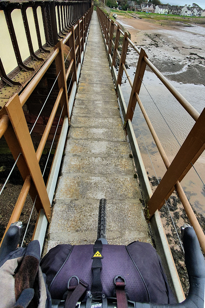
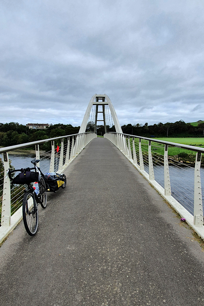
And some crazy infrastructure, like this shared footpath / bike track bridge over an estuary a little further south:

Both these bridges are on the UK’s National Cycle Network. And while it’s nice to have a bit of variety, it gets very tricky to plan routes when the surface, size and quality of the bike path, off-road track or main road can change so much within in a few kilometres.

The weather kept some of the nicer bits of countryside hidden from me until I turned the corner, and began heading in another estuary-interrupted zig-zag along the south of the area. Monday was a beautiful day meandering along, including the bay at Grange-over-Sands (below).

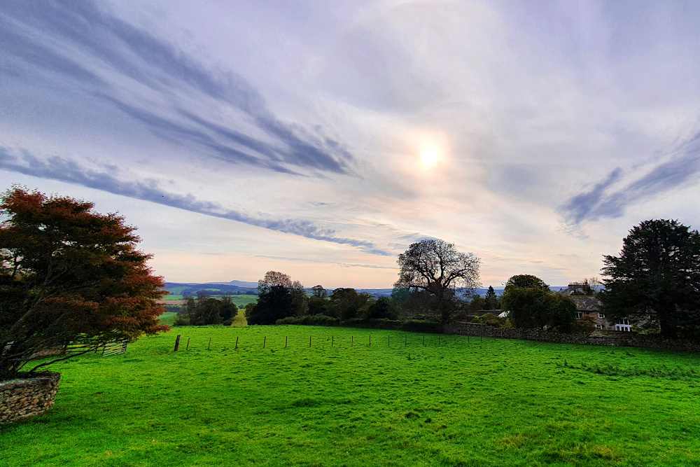
Having cleared the ‘bulge’ of the Lake District, it was time to hit Lancashire and head south. The landscape changed almost immediately, with just a few smallish hills (below) as I parallelled the M6 motorway for a little while.

But I was pretty quickly into the flat lands of the Lancashire coast. I rode straight into Lancaster on the canal towpath, with suburbs below me as I followed the water. I always find it slightly bizarre when water is above the surrounding land, and was delighted to come upon this aqueduct (below), carrying the canal over the river Lune on the edge of Lancaster.

And from Lancaster, there’s barely been a bump in the road. Or, more accurately, the sea wall for much of the time. There’s been a lot of easy cruising along traffic-free sea defences, and paths through sand dunes. It’s generally been pretty relaxing.

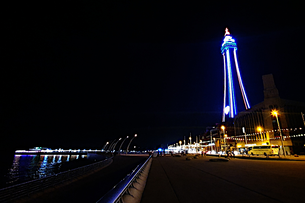
On Tuesday, I finally got to the bright lights of Blackpool. The illuminations are already looking quite impressive, but there are lots of closed hotels. The centre, much like every other large town and city in the UK, felt eerily quiet in the evening.

Blackpool’s big time was in the late Victorian era, as a seaside resort for workers in the Industrial Revolution’s heartlands of Lancashire, Manchester and Liverpool. There’s a bunch of similar resorts, which sprang up for the same reason along this part of the coast, most of which then fell on hard times in the late 20th century as people went abroad on holiday.

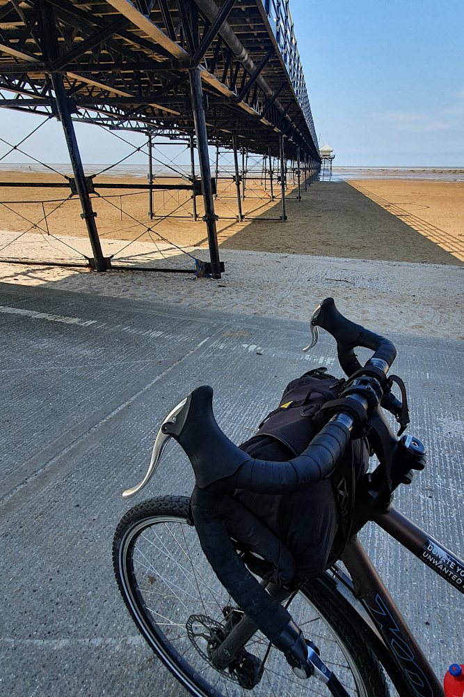
You’d think that the Covid crisis this year would have resulted in a massive surge of business back to these struggling towns, and a virus boom, but there’s not a lot of evidence. After an astonishing event – my first puncture after over 3000 miles! – more easy beach cruising took me to Southport (above), which again felt half-empty, despite the sunshine.

And yesterday evening, I rolled into Liverpool, to find a host of big hotels fighting over no business. I’ve taken advantage, and popped into a major brand place right in the city centre for only £25. While this is great for me, it can’t be great for the city.

I’ll be across the Mersey on the ferry, and then on into Wales today, which is really the final leg of the trip. From where I sit in Liverpool, it’s actually only a comfy three-day ride to Bristol. It’ll take much longer going around the edge, but once Wales is done, it’s only a few miles home.

It should be ‘interesting’ – Wales is getting hit with some major Covid spikes, which may complicate things, and they still have more restrictive travel rules than most of the rest of the UK. Fingers crossed I can get around without the road getting locked down in front of me…

Big Skies at the Top

As you get towards the end of the road north, things start to disappear.

Pulling out of Elgin on Thursday morning, I was heading to Inverness, the most northern city. No more cities after that.

20200820 3 Edit

I was also still enjoying Scotland’s cycle infrastructure, including the nice old railway bridge near Forres (above). But, as I dropped into Inverness on yet another well-signposted, segregated cycleway, I knew I wouldn’t be seeing much more for a while.

20200820 6 Edit
North of Inverness, there’s a lower volume of everything. Fewer roads (just the A9, basically), fewer people, fewer towns and shops. And of course, fewer nice bike paths.

But there were more of some things as I pushed north. Oil rigs and threatening clouds. And finally, quite a lot of long-distance cyclists.

20200821 4 Edit

The rigs were parked up in the Cromarty Firth off Invergordon, where many are repaired or decommissioned. The clouds have been threatening me all the way up to the far north, and taking up an undue amount of my mental processing power.

Given the lack of route options, the weather forecast becomes more important. Do you go or stay? Try to outrun the next shower, or wait for it to cross the road ahead of you? Is that rain at lunchtime just a shower, or are you going to be stuck for the rest of the day? Or do you just ignore the whole thing, pull on the waterproofs, and plug on regardless (getting soaked in sweat instead)?

20200821 6 Edit

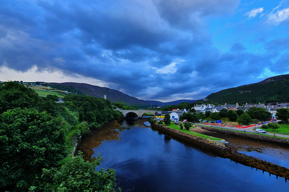
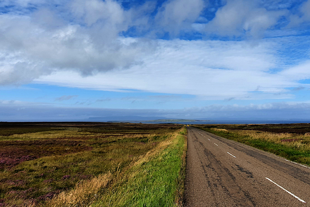
Where the clouds clear for a while, the skies get bigger as the road goes north. The landscape at the very north end of mainland Scotland is not as imposing as you might think, leaving plenty of room for the sky and the sea to fill the space.

By the time you start the final gentle drop towards John o’Groats (below), you really do feel like you’re getting to the end of something, despite the fact that you’re not, really. You can see the island of Stroma fairly close by, and Orkney in the background, after all, so it’s not really the end of the road at all.

20200822 3 Edit

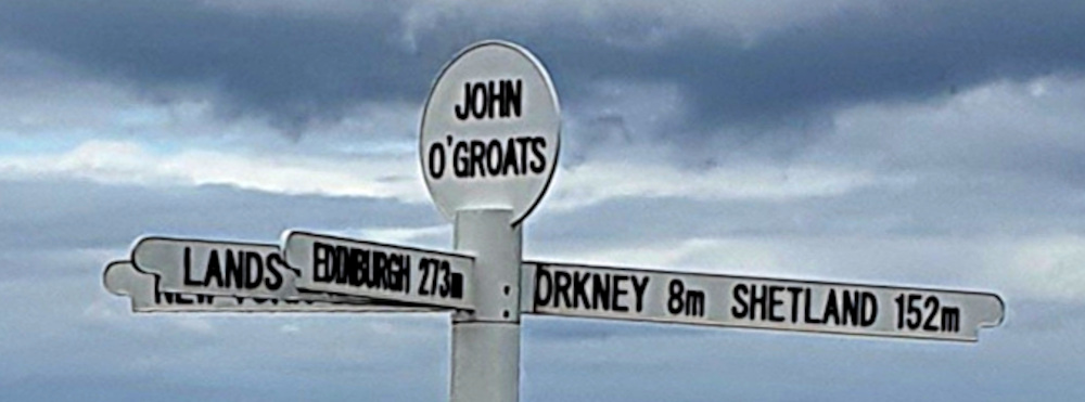
If you’ve stuck with this blog for a while, you’ll know that I don’t really understand why John o’Groats is any sort of big deal. It’s not the northermost point in the UK, Great Britain or Scotland. And it’s not even really a town; more a collection of tourist-related services massed around a signpost.

But it’s been famous for ages as one end of the Lands End to John o’Groats (‘LEJoG’) route up Great Britain. And, more recently, it’s been included on Northern Scotland’s North Coast 500 route as well. So, for a signpost in the middle of nowhere, it does get a lot of visitors.

20200823 1 Edit

I suppose, technically, arriving at John o’Groats on Saturday meant that I’d completed my own LEJoG ride in 2020, albeit by an extremely convoluted route. Perusing the records, it looks like I took 33 days, compared to most riders taking 8 or 9 in a stright line. But then, most of them don’t go via Kent, or ride 40kg rigs. To be honest, I was happier to have hit 3000 km without any punctures, mechanical issues or physical breakdowns. Had the South America trip happened, I’d be just a few days south of Santiago in Chile by now.

There was a fairly brisk headwind yesterday, as I headed west from John o’Groats. Given the headwind, and a few tough days ahead, I’d already decided to just trundle across to Thurso. A short ride, but it did give me the chance to have a look at Dunnet Bay (below), and the actual northernmost point of Great Britain at Dunnet Head, across the water.

20200823 6 Edit

The current headache is again the weather. There’s a big storm spinning in from the Atlantic, which is a reminder that things will get autumnal soon. It’s also apparently a massive lump of wind and rain, which should make conditions horrendous across the whole country tomorrow (Tuesday). Except for the very, very northern edge, apparently.

So, I’m resting up in Thurso on a perfectly ridable day today, in the hope that the weather forecast is right, and I can get pushed across Scotland by the edge of the big storm tomorrow, but without getting (too) wet.

It’ll be astonishing if that works out…

Rest Day 1 (Or, a Bit of a Rant about the UK’s Cycling Infrastructure)

It feels like a couple of days ago that I started. It feels like months ago that I started.

Bike touring’s time-mutating magic has kicked in. On the road, a day flashes past, while a single hill or town can take ages to get through. On a rest day (like yesterday), time drags itself out, and you wonder how you’re not making more distance when you ride all day.

The hills and towns of southern Devon have been the backdrop for the last few days, and have certainly made their contribution to things taking longer than expected.

20200723 1 Edit

First up was the relatively small city of Plymouth (above), which took ages to get across, despite apparently having loads of cycle routes. As is depressingly usual in the UK, spotty bits of randomly-disappearing (and / or poor-quality, badly-signposted) bike infrastructure are the problem. It’s not specifically Plymouth’s fault; it’s a general urban UK issue. But having to stop 10+ times to map-check when crossing a city centre is clearly not going to encourage more cycling.

Plymouth Hoe, where the picture was taken, is where Francis Drake was allegedly playing bowls when the Spanish Armada was sighted. It’s just as well he didn’t have to get to his ship on a bike, or the UK would by now have a long tradition of afternoon siestas.

You can probably see that the clouds were threatening already. Once finally free of Plymouth, I’ve felt like I’ve been stalked by heavy showers ever since, although they didn’t properly catch up with me until yesterday, as I fled eastwards.

20200724 1 Edit

I had a bit of deja-vu while lumping up and down the hills after Plymouth; there was a long-ish stretch where I was following exactly the same route along the fringes of Dartmoor as I did in 2015 (on the Scilly to Shetland ride). And it was drizzling a little, just like it was back then. Soon enough, though, it was time to peel off back towards the coast (above), and the Starcross Ferry across the river Exe estuary.

You might well expect a ferry which is heavily used by cyclists to avoid a detour around the estuary to be easy to access for touring cyclists? Well the crew on the boat were all great, and dealt with the large number of bikes (plus one idiot with a trailer) excellently. But… to access the western side of the crossing, you need to carry your bike (and trailer, or bags, or anything else heavy and bulky you have) up about forty steps, over a railway footbridge, and back down again – beware if you’re running a heavy touring rig!

20200724 3 Edit

Once across the Exe, you’re in Exmouth. It’s a fairly small town, and seems pleasant enough, but is plagued with some of the same cycling issues as Plymouth. On the road out of the centre to rendezvous with a nice bike track on a disused railway, I suddenly noticed a brand new, wide shared bike and pedestrian path right next to me. I had no clue where it began, as I’d seen no signs, and I couldn’t get on it, as there was no access from the road. Grrr!! And when, just a few minutes later, I came across the astonishing piece of ‘infrastructure’ pictured above, I had to actually laugh at it.

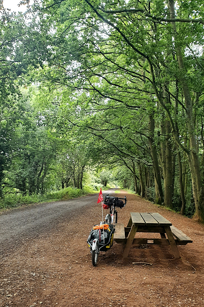
The abomination above actually comes between two sections of a traffic-free railway path, which is actually very nice (see below). But between them, the two pictures encapsulate the problem with UK cycling infrastructure; it’s good to ride anywhere where there are no cars. But if you’re anywhere near a road, expect cycling to be a time consuming 2nd class hassle, unless you’re willing to play with the traffic on the main roads.

20200724 4 Edit

Phew. Think that’s rant over on the infrastructure. Devon’s other time-bending tool is the hills. I’ve got one more big set to go today, as I (hopefully) shoot eastwards. They do hurt (especially when they start at 8%, and just get steeper and steeper before maxing out at 20% ish, like the one below). And they’re not that quick on the way down, either, as the trailer needs a little bit of management at higher speeds.

20200724 5 Edit

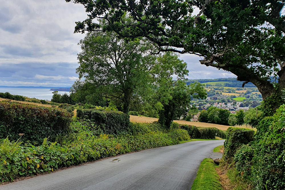
But, although they slow you down, the hills do give you some lovely views of the countryside, which has been pretty throughout. There have been thatched villages and rolling farmland, and a full-on Fawlty Towers guesthouse experience in Torquay. Devon’s been pretty good in general.

Having avoided the first wet day of the trip by having a rest yesterday, it’s back on the road today into Dorset. There’s another, bigger, storm coming in tomorrow, so it looks like the first phase of the flatter run along the south coast may be a little disrupted.

On the plus side, the rain is rolling in on rapid tailwinds at the moment, so it could be that the time-bending can continue, and surprising amounts of progress can be made. Who knows?