lejog

Big Skies at the Top

As you get towards the end of the road north, things start to disappear.

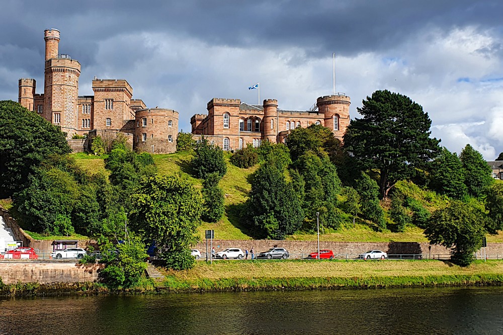
Pulling out of Elgin on Thursday morning, I was heading to Inverness, the most northern city. No more cities after that.

20200820 3 Edit

I was also still enjoying Scotland’s cycle infrastructure, including the nice old railway bridge near Forres (above). But, as I dropped into Inverness on yet another well-signposted, segregated cycleway, I knew I wouldn’t be seeing much more for a while.

20200820 6 Edit
North of Inverness, there’s a lower volume of everything. Fewer roads (just the A9, basically), fewer people, fewer towns and shops. And of course, fewer nice bike paths.

But there were more of some things as I pushed north. Oil rigs and threatening clouds. And finally, quite a lot of long-distance cyclists.

20200821 4 Edit

The rigs were parked up in the Cromarty Firth off Invergordon, where many are repaired or decommissioned. The clouds have been threatening me all the way up to the far north, and taking up an undue amount of my mental processing power.

Given the lack of route options, the weather forecast becomes more important. Do you go or stay? Try to outrun the next shower, or wait for it to cross the road ahead of you? Is that rain at lunchtime just a shower, or are you going to be stuck for the rest of the day? Or do you just ignore the whole thing, pull on the waterproofs, and plug on regardless (getting soaked in sweat instead)?

20200821 6 Edit

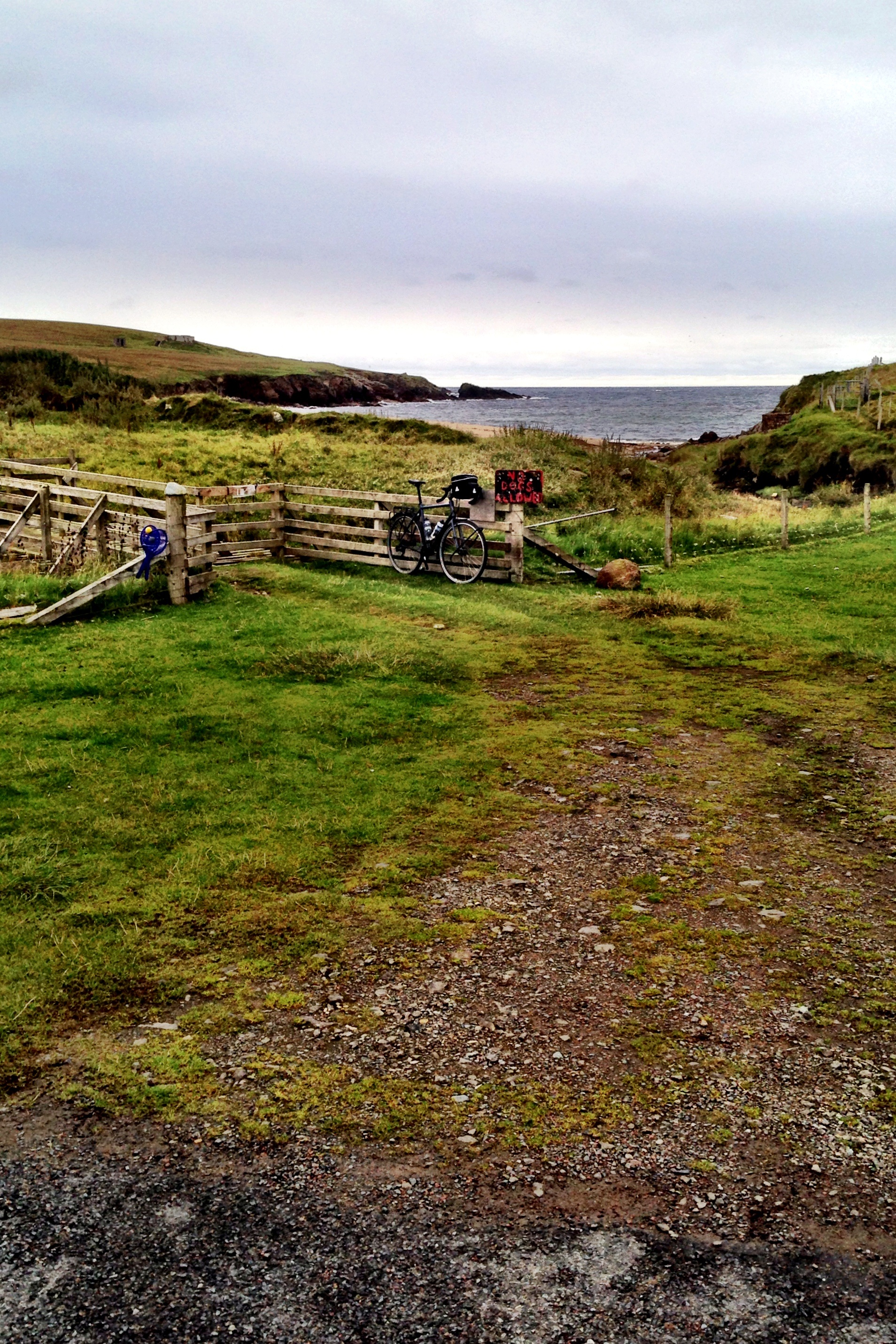
Where the clouds clear for a while, the skies get bigger as the road goes north. The landscape at the very north end of mainland Scotland is not as imposing as you might think, leaving plenty of room for the sky and the sea to fill the space.

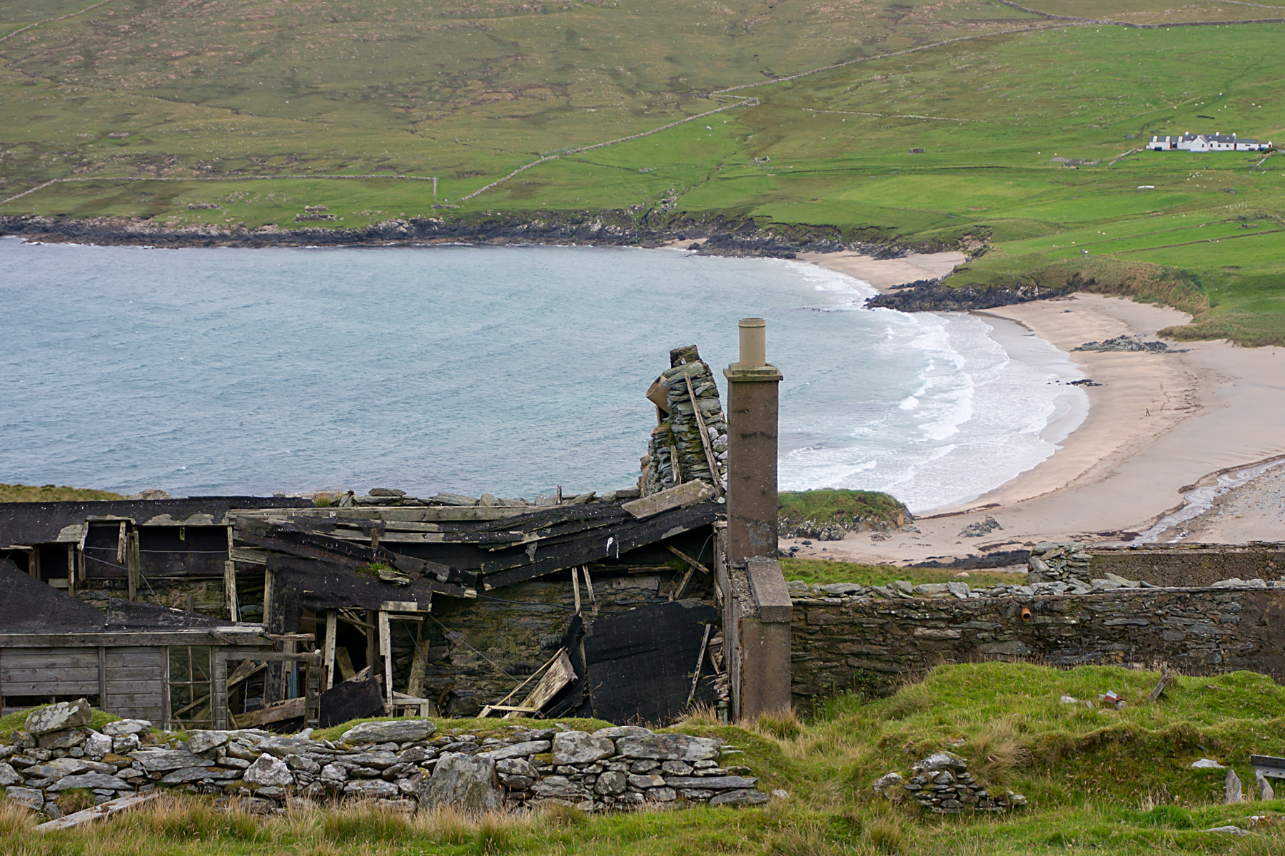
By the time you start the final gentle drop towards John o’Groats (below), you really do feel like you’re getting to the end of something, despite the fact that you’re not, really. You can see the island of Stroma fairly close by, and Orkney in the background, after all, so it’s not really the end of the road at all.

20200822 3 Edit

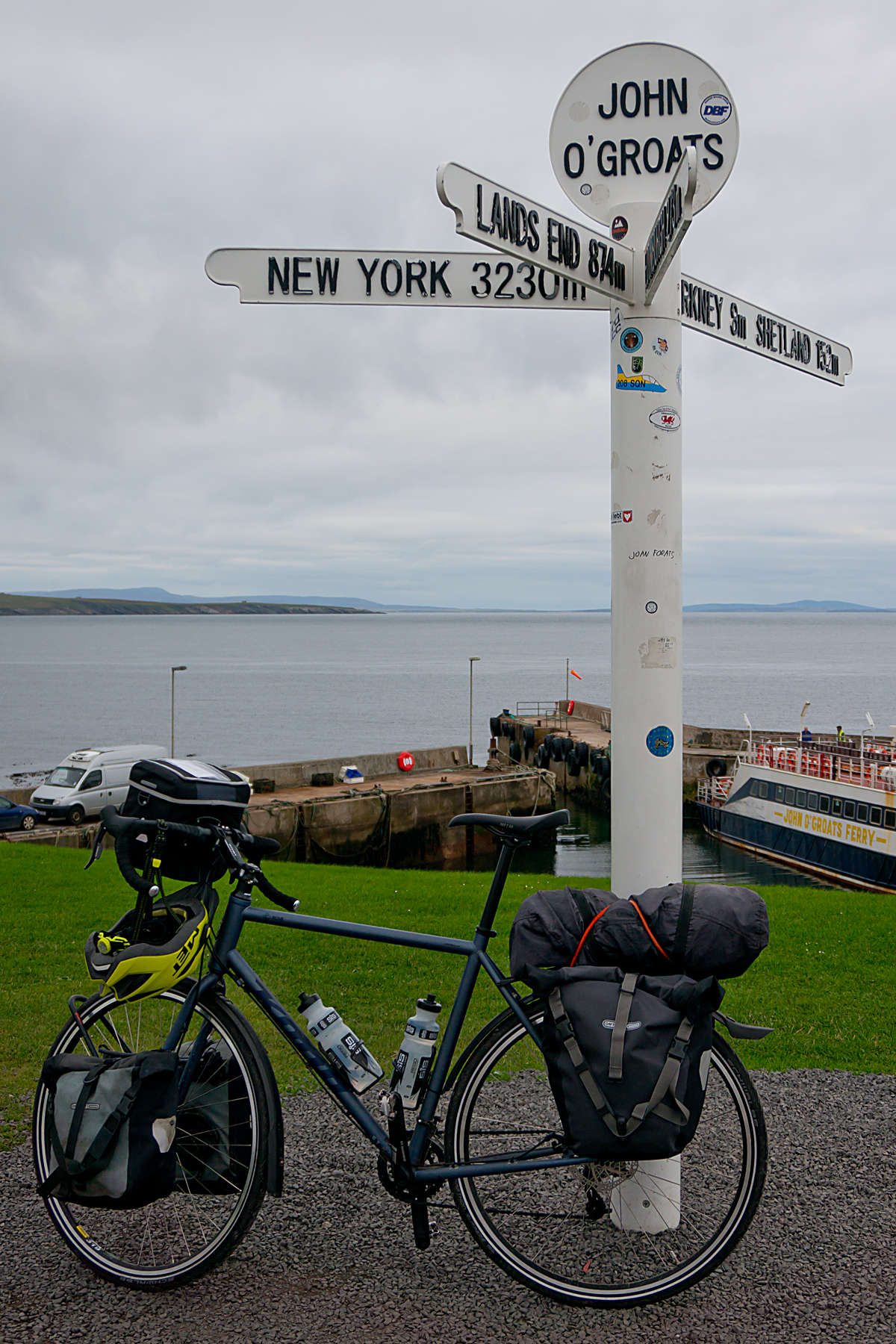
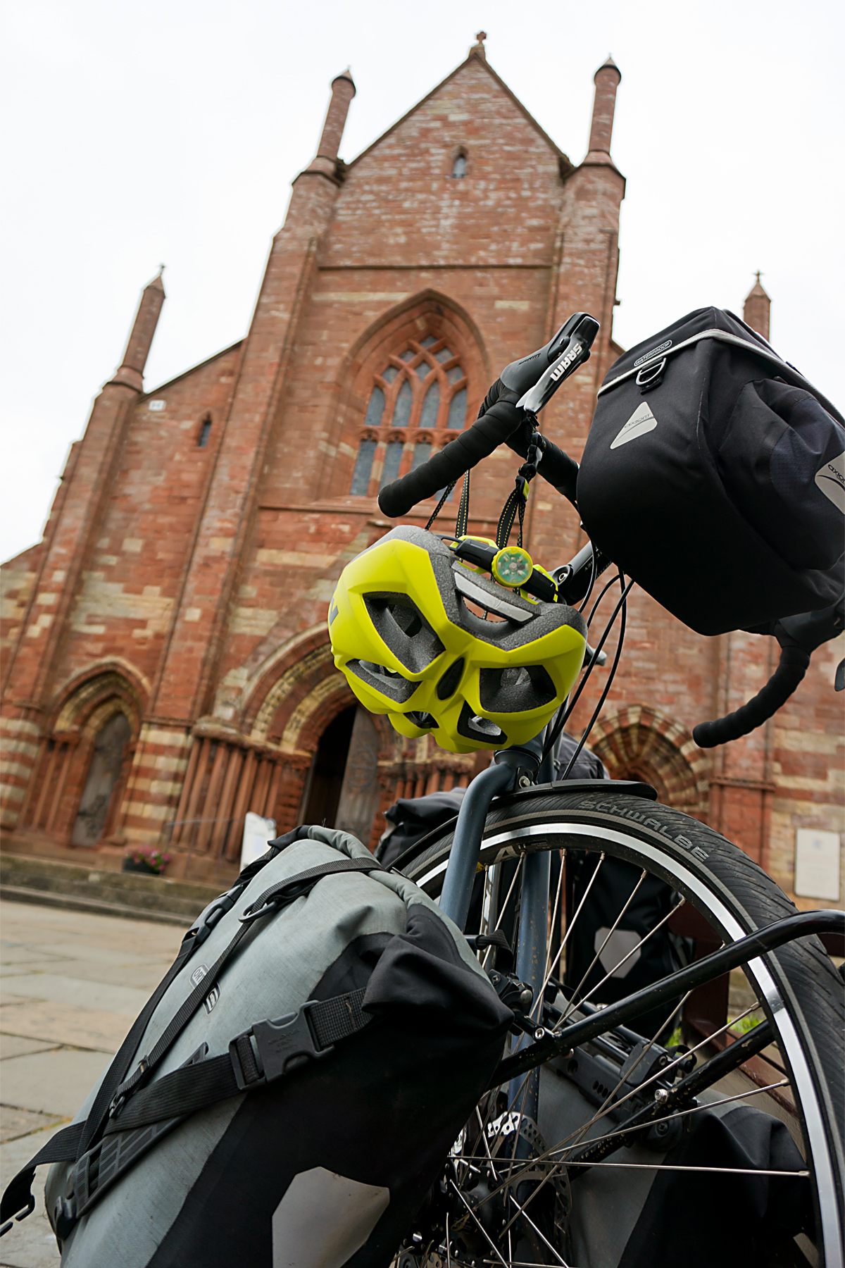
If you’ve stuck with this blog for a while, you’ll know that I don’t really understand why John o’Groats is any sort of big deal. It’s not the northermost point in the UK, Great Britain or Scotland. And it’s not even really a town; more a collection of tourist-related services massed around a signpost.

But it’s been famous for ages as one end of the Lands End to John o’Groats (‘LEJoG’) route up Great Britain. And, more recently, it’s been included on Northern Scotland’s North Coast 500 route as well. So, for a signpost in the middle of nowhere, it does get a lot of visitors.

20200823 1 Edit

I suppose, technically, arriving at John o’Groats on Saturday meant that I’d completed my own LEJoG ride in 2020, albeit by an extremely convoluted route. Perusing the records, it looks like I took 33 days, compared to most riders taking 8 or 9 in a stright line. But then, most of them don’t go via Kent, or ride 40kg rigs. To be honest, I was happier to have hit 3000 km without any punctures, mechanical issues or physical breakdowns. Had the South America trip happened, I’d be just a few days south of Santiago in Chile by now.

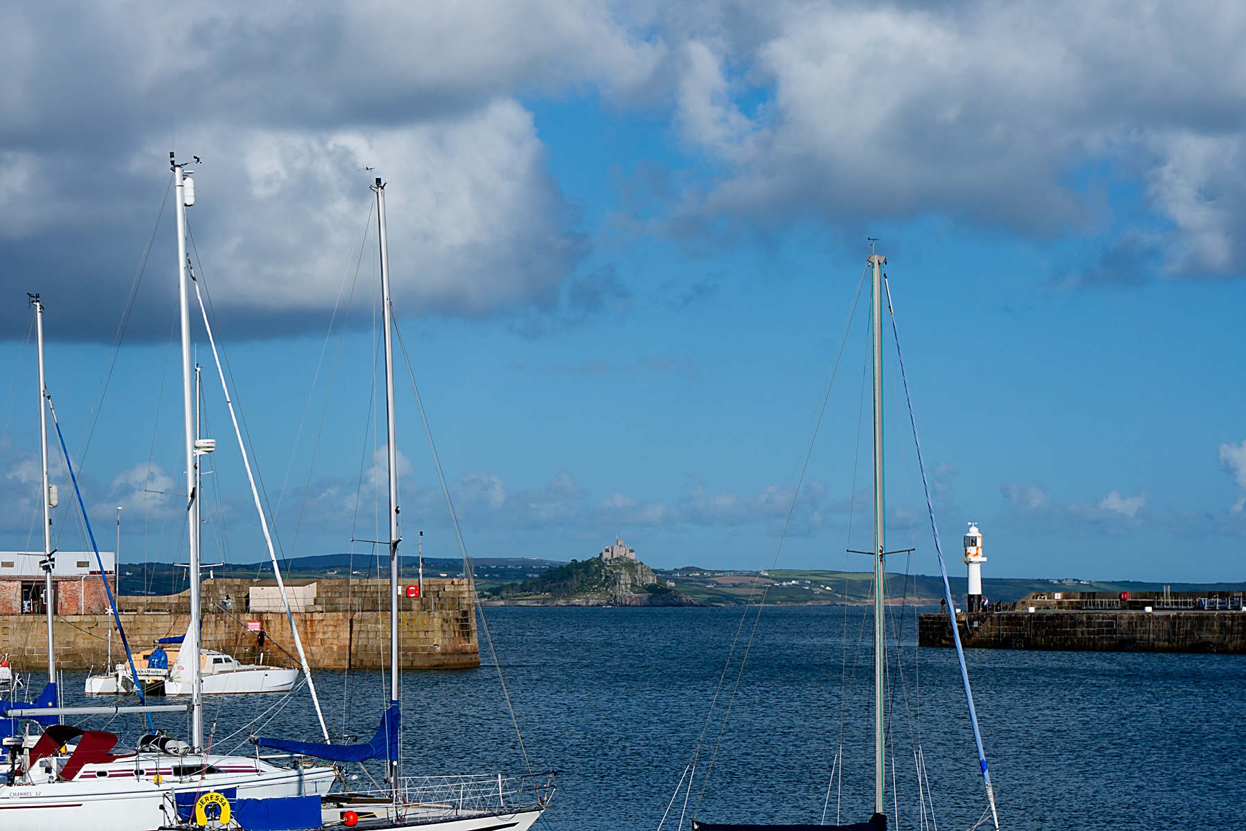
There was a fairly brisk headwind yesterday, as I headed west from John o’Groats. Given the headwind, and a few tough days ahead, I’d already decided to just trundle across to Thurso. A short ride, but it did give me the chance to have a look at Dunnet Bay (below), and the actual northernmost point of Great Britain at Dunnet Head, across the water.

20200823 6 Edit

The current headache is again the weather. There’s a big storm spinning in from the Atlantic, which is a reminder that things will get autumnal soon. It’s also apparently a massive lump of wind and rain, which should make conditions horrendous across the whole country tomorrow (Tuesday). Except for the very, very northern edge, apparently.

So, I’m resting up in Thurso on a perfectly ridable day today, in the hope that the weather forecast is right, and I can get pushed across Scotland by the edge of the big storm tomorrow, but without getting (too) wet.

It’ll be astonishing if that works out…

Advertisement

The North (Finally!)

UK Tour Stage 5 (Inverness to Unst, Shetland):
Cycling Distance – 360 km / 224 miles
Ascent – 2351 m / 7711 ft (0.27 times the height of Mount Everest)
Toughness Index – 65.25 (100 = Really Tough)

Total UK Tour Cycling Distance – 1715 km / 1066 miles
Total UK Tour Ascent – 10448 m / 34269 ft (1.18 Everests)

NB: I’ve been trying to post this for 36 hours now; please pretend that I’m not at Aberdeen Railway Station waiting for a train south 😉

There should probably have been an update between Inverness and here, but it just didn’t quite work out (my new habit of falling asleep while typing reared its ugly head again, compounded by the severe lack of decent internet access at the top of the country – sorry!).

There have been a lot of miles and a lot of islands since the last post.

And, in a carefully-planned attempt to undermine any sense of suspense, and just in case you didn’t see the mini-post earlier, I guess it’s worth starting with the fact that the road north finally ran out on Monday at around eleven-fifteen:

image
That’s it.  The northernmost bit of road in the UK.  Just next to the northernmost house in the UK.  Just over the insanely steep hill from the northernmost phone-box, bus stop and brewery in the UK.

20150830RTW_13
The target of the last few weeks.  Since the sunny Isles of Scilly (above) at the southern end of the UK.  Four countries.  Over a thousand miles.  Climbing more than the height of Mount Everest.  Lugging 25 kgs of bags.  A proper test of my shoulder and back (which they’ve passed with flying colours – and a bit of ibuprofen).  Journey’s end.  Phew!

Except for another sixty-odd miles back down to the ferry south.  And, given how well my body has held up, another eight or nine thousand miles to finish the round-the-world trip in the fairly near future.

But that’s all to come.  Where have I been for the last few days?

20150917RTW_6
After leaving Inverness, the road north basically hugs the east coast all the way to the top end of Great Britain.  The landscape changes quite slowly (essentially, it rolls, sometimes by the shore, sometimes on clifftops), with lots of dives into little harbours, like the one above at Brora.

But one thing is immediately obvious to the road user.  Through the Highlands, all the signs are bilingual, with English and Scottish Gaelic (British language number – what? – six ish?) sharing space.  From Inverness northwards, on the coast at least, they’re not.

Why not?  Because heading north, you’re heading into Viking country.  There are many parts of the UK with Viking place names (they got around a bit, the Vikings), and they’ve tended to stay more-or-less the same, so there’s no real need for bilingual signposts.  That said, there’s nowhere I’ve been before in this country where the Nordic influence is as strong as in Orkney and Shetland.

20150920RTW
After John O’Groats, which is the northern end of the Lands End to John O’Groats ‘end to end’ (and which, as a pedant, I should point out – probably for the tenth time – is neither the northernmost point of Scotland nor Great Britain), I hit another ferry, this one to Orkney.  You can see Orkney pretty clearly from John O’Groats, so it would be hard to be happy with finishing there, in my little world, at least.

20150920RTW_14
And Orkney’s where you really start to feel the Scandinavian influence.  Kirkwall, the capital of Orkney, is home to St Magnus’ Cathedral (above, behind the Beastlet).  You don’t get much more Nordic than Magnus as a name.  And the accents are fantastic; a beautiful mixture of soft Scottish pronunciation with lilting Scandinavian intonation.  Like a cross between Highland Scots and Swedish accents.  I’ve just changed ‘accent’ to ‘accents’ in the last sentence, as a couple of conversations in the bar in Shetland made it clear that locals up here can spot the difference in speech between one island and the next, let alone between Orkney and Shetland.

20150920RTW_26
Anyway, once in Orkney and Shetland, you really are in the Viking sphere of influence.  Both have flags with off-centre crosses (like Norway, Sweden, and so on).  And there’s a lot of shared history.  Shetland (Hjaltland) was actually part of Norway for a long time before becoming part of Scotland.

Heading north into Shetland, you can appreciate how beautiful, and how isolated it is (the picture above gives you a good idea).  And Shetland itself is an archipelago, within the larger one of the British Isles, so there are more ferries between islands with fantastic names; from slightly boring Mainland, through Yell (or YELL?) to Unst.

20150921RTW_9
Unst is definitely Norse; I stayed in Baltasound, and headed to the top of the country through Haroldswick (above), which sounds as Scandinavian as you could want.  It’s just as beautiful and harsh as the rest of Shetland, and the working farms and inhabited houses are regularly interspersed with reminders of how tough life up here was in the past:

20150921RTW_2
The end of the road nearly came as a nasty shock.  Just a couple of hundred yards from the end, I discovered just how slippery sheep droppings can be.  That would have been close to the ultimate catastrophe; being taken out by dense woolly creatures within touching distance of my goal.

Still, one heart-in-mouth front-wheel skid later, I was there.  Job done after a little over three weeks and a little over a thousand miles.

I’m rushing for a ferry south at the moment, so will provide a more measured summary of the trip (maybe even with a working map!) in a couple of days, once I’m back in southern England.  But it’s been a good little ride, and I’m sorry it’s over.

Now I just have to keep the fitness up to take on the rest of the world later in the year…

Here I Go Again…

The bags are packed.  The bags are on the bike.  One of the bags is hanging off a bit, which is not so good.  And the bags, the bike and me are in (currently) sunny Cornwall, ready to begin touring again.  That’s a good day (even after getting drenched on the four miles to the station this morning).

Here’s The Beastlet raring to go at Bristol Parkway station this morning, fresh from its early shower:

IMG_0510
So, where am I going?  Well, I’m riding (as close as sensibly possible) the length of the United Kingdom from south to north.  And I’m going to all four of the UK’s countries on the way.  This sounds deceptively simple, but even among my fellow British Citizens, there may be a little confusion about exactly what it means.

There are a lot of misconceptions and misunderstandings about where the UK starts and stops.

Many people I met in the US, for example, think that England and Britain are the same thing, and labour (or ‘labor’) under the odd impression that there’s such a thing as a ‘British accent’.  They aren’t, and there are hundreds, including a bunch of Scottish, Northern Irish and Welsh ones.

At the same time, as a citizen of the UK, I had to check whether (for example) the Channel Islands or Gibraltar are part of the country.  They aren’t.  Good job, too, as it would be a much longer ride from Gibraltar…

So, first off, a little geographical ‘clarification’ for you.  This may need reading carefully if you’re not over-familiar with our little archipelago.

UnitedKingdomCitiesandTownsOMC

Deep breath.  Here we go…

The archipelago known as the British Isles lies off the coast of mainland Europe.  It’s made up of hundreds of islands, and is shared between two nation-states, the UK and the Republic of Ireland.  The two biggest islands are Great Britain and Ireland.  All of Great Britain (comprising most of England, Scotland and Wales), a bunch of other islands, and the north-eastern chunk of Ireland (Northern Ireland) are in the UK.  The rest of Ireland (and some other islands) is a separate nation-state, but was part of the UK until independence in the 1920s.  So, Ireland is an island.  And most of Ireland is not in the UK, but some is.  And all of it used to be.

Clear as mud, isn’t it?  Let’s simplify things by looking at sport.  In the Olympics, the UK competes, slightly confusingly, as ‘Great Britain and Northern Ireland’.  In football, England, Scotland, Wales and Northern Ireland play as separate countries, and so does the Republic of Ireland.  Obviously, as it is.  Except in Rugby, Ireland and Northern Ireland play in a united Irish team, meaning that the one team represents two nation-states.  But one island.

That might still not be clear enough for some people.  So here’s one more try.  The UK is a proper country.  It’s on the UN Security Council and everything.  It issues its own passports and money (the pound).  It’s governed from London, which is in England and in the UK (technically, it’s governed from Westminster, which is next door to London, but that’s an entirely different set of ancient confusions).  It has military forces, a single foreign policy, and a single Prime Minister who deals with that sort of stuff.

So, it’s a country.  But…  England, Scotland, Wales and Northern Ireland are also called countries.  Together, these four countries make up the UK, which is a country.  Banks in Scotland and Northern Ireland (but not in Wales) can issue their own banknotes.  They are authorised to do this by the Bank of England, which manages the currency and sets interest rates for the whole of the UK.

Scotland and Northern Ireland (but not Wales) have their own legal systems.  England and Wales share the same one.

Scotland has its own parliament, Wales and Northern Ireland have their own assemblies.  England has neither, just relying on the UK Parliament in Westminster.  Which obviously has elected members from Scotland, Northern Ireland and Wales in it.

And all four countries have their own capital cities; England’s just happens to be the capital of both England and the UK.  And everyone who has a UK-issued passport is British.  Including lots of people from places which aren’t part of the UK.  Or Great Britain, which, as we established at the start, is an island, like Ireland.

Clear enough?

Well, finally (I promise!), there’s one place from where, on a clear day, you can apparently see all four of the UK’s constituent countries.  It’s right in the middle of the UK.  This place is another of the British Isles; the Isle of Man.  The sportspeople of the Isle of Man (for example, the great cycling sprinter Mark Cavendish) compete for Great Britain and Northern Ireland.  Unless it’s the Commonwealth Games, of course, when they compete as the Isle of Man.  The island uses the pound, and is protected by the UK military.  And obviously, the Isle of Man isn’t part of the UK at all.

It strikes me that it might be easier just to say where I’m going.

After a lot (and I mean a lot) of internet-bashing, I finally worked out that the southernmost point of the UK is in the Isles of Scilly, three hours south-west by ferry from Penzance in Cornwall, where I now sit.  And the northernmost point is in the Shetlands, which are a surprisingly long way north.  You get palm trees down here in Cornwall.  The north of Shetland is roughly level with Anchorage, Alaska, and the bottom end of Greenland.  It’s about 200 miles from Bergen, in Norway, and over 600 miles from London.  Thankfully, they’re both marked on the map (thanks, Wikipedia!) up above the confusing stuff.

Here’s the plan.


[Edit – don’t think the map’s showing up as it should be – try this instead – https://www.google.com/maps/@55.357832,-3.658619,5z/data=!3m1!4b1!4m2!6m1!1szZYTuYtj57uU.k2f-gGvpi1Xo – and if that doesn’t work, either, I need to do some sort of Google Maps course…]

I’m setting sail for the Isles of Scilly tomorrow morning (Friday), and then heading over to Land’s End, which is back on the mainland.  Then it’s back up to Bristol for my first day off (I’ll hopefully update the ‘Progress’ page on the website with some more realistic stats and maps while I’m there).  Then it’s up through the Welsh borders and Liverpool to Lancashire, then another ferry to the Isle of Man (I know, I know, it’s not in the UK).  From there to Northern Ireland, then across to Scotland, and all the way up to the top of Great Britain.  Then Orkney, then Shetland.

Roughly a month, and there are quite a few ferries involved…

P1000818 Edit

The Beastlet has recovered well from its conversion to a touring bike.  New wheels, a mountain-bike chainset, and the mandatory racks have made it considerably heavier, but it feels pretty rugged, and rides really nicely with the bags on.  All should be well.

And Cornwall, which I’ve unforgivably never visited before, looks lovely (if very hilly).  This picture is looking out from Penzance; the castle on the hill in the distance is St Michael’s Mount, which is more-or-less an island.

20150827RTW_2

So, a day-trip with minimal cycling tomorrow to get things kicked off.  Then the business of touring begins in earnest on Saturday.

Shetland, here I come!