asia

The Last Continent (and the First)

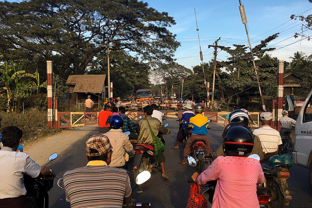
It’s a little bit of a shame that EU border guards don’t stamp EU passports when you pass the border.

I’ve pedalled my little heart out, uphill and down, into the wind and through the hellish blue skies and sunshine of early summer.  I’ve crossed from Asia to Europe (geographically).  And then, I’ve crossed from Turkey into Greece.

And all I have to show for it is one smudgy exit stamp from the Turkish border this lunchtime.  Well, that and several shops full of tzatziki (and other assorted dips that I don’t like) around the corner…

IMG_1643 Edit

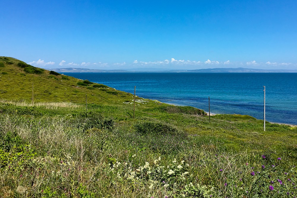
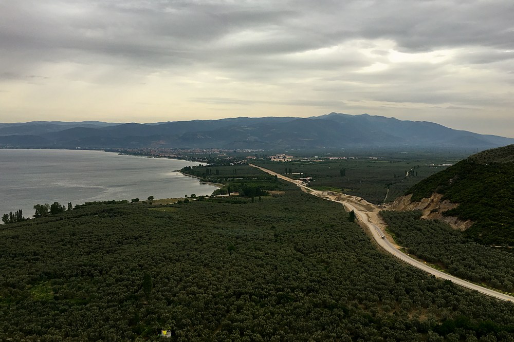
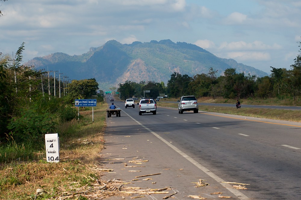
I caught sight of Europe on Sunday morning.  I was lucky it was a shortish ride, as the headwinds were really giving me a kicking, for the third day in a row.  The incessant whistling in my ears was doing my head in.  As well as making the riding much harder than it needed to be.  I needed some good news.

And then, the headland I was slowly rounding (above) curved south to form the eastern edge of the Dardanelles strait.  That landmass in the background, which is part of Europe, was only a couple of miles away.

20160515RTW_1 Edit
I found the ferry, and prepared to hop across the narrow waterway to my final continent of the trip.  Of course, it was also my first continent, and I still have to cross pretty much the whole thing to get home…

The boat was a nice surprise.  Somewhat bizarrely, there’s a charge for cars, a charge for trucks, and a charge for pedestrians.  But, apparently, no charge for cyclists.  You can’t get better value than a free intercontinental cruise!

IMG_1654 Edit

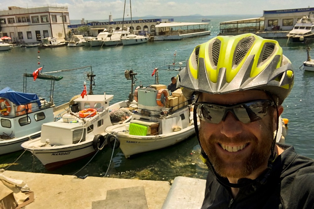
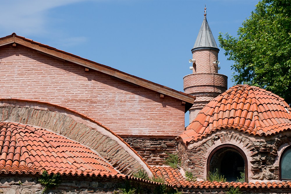
And so I landed in Europe.  At Gelibolu, on the peninsular of the same name.  For the British, and more especially, for Australians and New Zealanders, the English name is more significant – Gallipoli.

During World War One, the British Empire (as it still was at the time, including British, Indian, Canadian, Australian and New Zealand forces), and the French, decided to attack the Ottoman Empire (as it still was at the time), which had joined the war on the German side.  Somehow, this degenerated into an eight-month stalemate.  Presumably, they weren’t expecting the Ottomans to fight back.  The invasion never got far beyond the beaches, and by the time the Allies withdrew, there were a total of nearly half a million casualties.

Which, along with the rest of the First World War, is an astonishing waste of life.

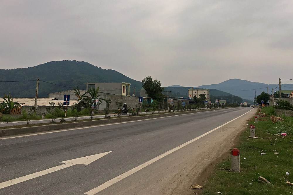
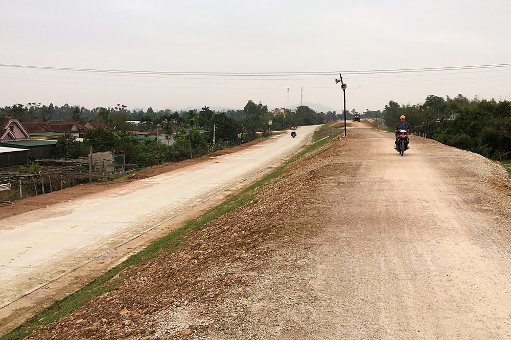
In any case, from Gelibolu, it was just a gentle day-and-a-half’s riding to the Greek border.  Up the peninsular, and across eastern Thrace.  The wind finally shifted to a slightly more sensible direction (much to the dismay of a French tourer who I met going the ‘wrong’ way yesterday; he was trying to wrestle a tandem through the wind by himself, aiming to meet his girlfriend in Izmir).  So it was a reasonably gentle run for me, spoiled only by a valve problem on one of my inner tubes, which is now forcing me to pump the tyre up every 90 minutes or so.

IMG_1656 Edit
This afternoon (Tuesday), feeling reasonably fresh, I arrived in Alexandroupoli.  It’s a pretty standard seaside town nowadays, but, like Gallipoli, its short history is a reminder of what a turbulent part of the world this has historically been.

The town was founded by the Ottomans, only about 150 years ago.  Since then, it’s been controlled by the Russians, the Ottomans again, the Bulgarians, the Greeks, the Bulgarians again (World War One), the French, the Greeks again, the Bulgarians again (this is now World War Two), and finally, so far, the Greeks.  Amazingly, it’s not suffered any significant damage through this whole period.

But those shifts of control have shaped the history of the whole area I’m now moving into; the Balkans.  Empires have washed over this region from the dawn of written history, from Alexander the Great onwards, leaving a bewildering mixture of ethnic, religious and cultural influences behind.

The next couple of weeks should be fascinating, as I head north and west.  I’m having what feels like a well-deserved rest day tomorrow (Wednesday), trying to finalise a sensible route through the region.

But I think it’ll be interesting, whichever way I go…

Advertisement

Last Night in Asia

It’s been a tough few days, with a constant headwind trying to batter me into submission.  And a few more hills than expected.

But I’ve made it to where I want to be; just 60 km (38 miles) from the narrow strait between Asia and Europe.  I should get to the Asian side of the crossing just after lunchtime tomorrow (Sunday), from where a ferry should whisk me effortlessly across the (roughly) three mile gap between two continents.

20160511RTW_3 Edit

Leaving Iznik was hard, though.

Partly because of that interesting mix of history and culture that I discussed last time (the Ayasofya mosque, above, sums it up pretty well; an ancient church converted into a mosque, just like its much bigger and more impressive namesake in Istanbul).

Partly because it was a really nice, chilled-out little place with loads of lakeside cafes.  And partly because, from Iznik, the only way out is upwards.

IMG_1630 Edit

At least I got a last view of Iznik as I left.  The vast majority of Turkish towns I’ve been to have been flat, meaning there’s rarely a vantage point on the road to see the whole place at once.  And, despite a little shower as I hit the top of the hill, the short(ish) run to Bursa was unproblematic.

The only big issue in Bursa (which is regarded as the birthplace of the Ottoman Empire, by the way) was the traffic, which got a bit manic in the city centre.  It’s the biggest Turkish city I’ve ridden in, so I suppose this is excusable to an extent.  Although it made me very glad that I decided against riding through Istanbul, which is many times bigger (and therefore the traffic’s likely to be many times worse).

IMG_1634 Edit

Another reason that I was happy not to be riding into Istanbul on Thursday was that there was (yet) another bomb attack there that afternoon.  In the eastern suburbs, which may have put me nearby if I’d headed that way.

Then again, there was also a suicide bombing in Bursa only a fortnight before I got there (27th April), which I thought it was probably better not to mention until I was through, in case people worried.

It seems to be a grim, almost daily occurrence in Turkey at the moment.  And the frequency may go some way to explaining why neither attack appears to have made it anywhere near the news at home (along with obsessive Euro referendum navel-gazing, I’d guess).

In any case, unless you’re unlucky enough to be in the wrong place at the wrong time (and that could happen just as easily at home), you’d never even know they’d happened.  Bursa city centre was a scene of total, big city normality.  I’m sure Istanbul’s the same.

It’s a real shame that things like that seem to be putting tourists off coming to Turkey.  I’ve had a great time here so far, but I’ve lost count of the amount of people in the tourist trade bemoaning the lack of business this year.

I was much more worried about the bike’s health, to be honest.  It had developed a distinct wobble at the back end.  And wobbles at the back end can’t be good news.

As usual, it took a while to work out that it wasn’t something mechanical (and therefore expensive, and maybe problematic).  It was just the rear tyre finally giving up the ghost.

IMG_1637 Edit
I’d decided not to rotate the tyres this time, just to see how long they actually last.  The front will be fine all the way home, I think.  Maybe even for ever; it still looks almost new.

But the rear, having carried most of the weight, and delivered all the traction for 11,500 fully-loaded kilometres (including the UK Tour) had finally had enough.  As you can probably tell from the badly-focussed picture above; the replacement tyre (identical to the old one) is on the left, obviously.

Still, 11,500 kms is pretty good.  Especially as it still showed no signs of actually falling apart.  One puncture in all that time (way back in Myanmar).  Dirt roads, potholes, mud, rocks and glass dealt with with aplomb.  It’s just a shame that it didn’t quite last until Europe.  But, in the end, the wobbling was driving me nuts, and making the whole bike shimmy, so it had to go.

It’s possible that I just spent slightly too long mourning the loss of a tyre.

IMG_1640 Edit

For the rest of the bike and me, Europe awaits.  Although I’ve been roughly following the south coast of the Sea of Marmara for the last few days, I only got to see it for the first time today (above).

Tomorrow should take me pretty much along the coast, until it narrows into the Dardanelles (that strait between the two continents I mentioned before).  The ferry will take me to the town of Gelibolu.

Which, as well as being my entry into Europe, also gives its name to the peninsular on which it sits.  In English, its name is Gallipoli.  Site of one of the most appalling wastes of life in the First World War.

And that should certainly put today’s relatively tiny risks of terrorism into perspective…

On the Edges

Borderlands are always interesting places.

Mountains plunging into the sea provide stunning landscapes.  Places where cultures bump into each other produce fascinating history (even where they also – all too often – provoke conflict).  It’s at the edges where things are most compelling.

I’ve been in border country since the last post, although I’ve only really appreciated it today.

IMG_1598 Edit
Bolu (above) was the last proper city in the hills.  Since then, it’s been small towns and smaller climbs (and some immensely fun downhills), as I’ve crossed from the mountainous interior of Turkey back towards the Sea of Marmara.

And the sea (together with the Aegean, immediately to its south, and the city of Istanbul at its northern end) has been a cultural crossroads since people started writing history.

So the borderland between the hills and the coastal areas is also the edge of a fuzzy cultural boundary.  Although I’m not in Europe yet, things are changing already.  Up in Bolu, things still felt very Asiatic, with the fairly mono-cultural cityscape of mosques, minarets and square buildings dominating.  Within a couple of hundred kilometres, things are much more cosmopolitan.

But the noticeable changes had already begun at Bolu.  Just a few kilometres east of town, my road had been joined in its valley by a motorway.

IMG_1600 Edit

That’s not just a road with a designation beginning with ‘M’, as was the case in the former Soviet countries.  It’s a proper, European-style motorway (the main drag between Ankara and Istanbul).  The sort of road where bikes are not allowed.  It’s the first road I’ve seen for months that I can’t ride.

I know that this will be the new normal from here on (and that it’s my normal normal in any case).  But I’ve got so used to rolling along whichever road I want that it feels like a big change.  So does the fact that the chocolate bars in petrol stations have suddenly become the same as at home, where further east, they are all Turkish versions.

I think my perspective might have got a little skewed somewhere along the way…

There are still plenty of reminders that I’m not home just yet.  It’s pretty certain that a flatbed van in Europe wouldn’t be allowed on the road with a ton of apples tied loosely on the back with string.

But that appears to be what caused me a twenty minute delay this morning:

IMG_1621 Edit

Thankfully, things got slightly more organised after the big guy in the red shirt started waving his arms and shouting.

This afternoon (Tuesday), the cultural variety and complexity of this area became clearer.  I dropped down to lake Iznik.  I’d been trying to get to a town on the edge of the lake, which is marked up on Google Maps as ‘Nicaea’.  And I’d been getting increasingly concerned that I’d not seen it signposted.  I was just following signs for ‘Iznik’, and hoping that Nicaea would become obvious.

It turns out that Iznik and Nicaea are the same place.  Google uses the Greek name for some unfathomable reason.  Although that was the town’s name when it was established (by a Greek mythological character, apparently), it’s been Iznik for ever as far as the locals are concerned, and Google should probably have caught up by now.

IMG_1628 Edit
But it’s not just the names of the town that show how many cultures have had a say in this region over the full course of recorded history.  The city walls, which I casually parked the bike against on the way into town, were originally built by the Ancient Greeks.  The local tourist guide notes, sadly, that ‘only Roman and Byzantine construction remains’.  And that’s still not counting the role of this area of Turkey in the birth of the Ottoman Empire.

There’s an intimidating amount of history in this part of the world, on the edge of so may empires.

I’m going to have a day off tomorrow (Wednesday) to have a proper look around Iznik, and digest some of this stuff.  It’s only about half a mile across, but has ancient churches, mosques, Roman arches, and so on.  It even has a mosque called the Ayasofya, which used to be a church.  Just like Istanbul.  But much, much quieter.

20160510RTW_6 Edit
I’m happy I can get all the layers of history around here, as I’ve decided not to head to the metropolis on the Bosphorus.  I could probably have got to the outskirts today, and entered European Turkey tomorrow.  But I’ve been to Istanbul before, and I’m not quite done with the Asian continent just yet.  And I’ve heard a lot of nightmarish stories about the Istanbul traffic.

Instead, once I’ve had my rest, I’ll head along the south of the Sea of Marmara.  It’ll take an extra few days to get to Europe, but I should see some more interesting places, and enjoy the coastline.

There’s one other, slightly fuzzy edge which merits a quick mention (in my book, at least).  And that’s the edge of space.  This is usually considered to be the Karman Line, and is 100km (62 miles) above the surface of the Earth.

Why is the Karman Line of any interest?  Because, yesterday, while grinding up yet another incline, I reached 100,000 metres (or 100 km) of vertical gain on the round-the-world trip.  I’ve climbed to the edge of space on a bicycle with bags hanging off it.

No wonder my legs need a break…

On Ancient Roads

I was pretty tired by the time I got into Samarkand last night (Sunday).

Well over 300 kilometres from Tashkent in three days, through rain, over hills, and into headwinds.  It was fairly hard on the bike.

I’m not sure I’d want to try it on a camel.  Or on foot.  I’ve been on some very long, straight roads, which left me plenty of time to imagine travelling this route seven or eight hundred years ago.

But people really did travel this route on their camels and their feet for hundreds (maybe thousands) of years, bringing silk and spices from the far-away Orient to the edge of Europe.  And they left some quite impressive monuments behind them.

This is right next-door to my guesthouse here:

20160321RTW_7 Edit

Which is undoubtedly a good landmark to finish the first section of the Silk Road.

But it didn’t start well on Friday.  After all the rain during my stay in Tashkent, the Internet said that Friday was going to be overcast and cold.  But dry.  And it was all those things as I started off.

Two hours later, I was clear of town, and well on my way to the middle of nowhere, when the rain began.  It didn’t stop all day.  And so, my first day riding in Uzbekistan degenerated into a sorry, soggy, shivering mess:

IMG_1195 Edit

Thankfully (and partly due to gracefully declining the first of two wedding invitations I’ve had on the road already), I made it to Gulistan just before hypothermia set in.

I knew there were a couple of hotels there, but I couldn’t find them (the signposting here is generally awful).  In the end, I asked a policeman.  Although this is generally accepted behaviour at home, the general word on cops in former Soviet countries is to leave them well alone.  But I didn’t have a choice.  I needed to get inside, and quickly.

Either because of my pathetic state, or because he was just a nice bloke, I ended up following a police car through the streets for the last two kilometres of the day.  The third hotel we went to had space, and I was absurdly grateful to get under a hot shower, knock back a steaming pot of tea, and collapse onto a sofa for a while.

I was also quite relieved that the rain drifted off towards the mountains during the night, and hasn’t been back since.

IMG_1209 Edit

What with the random wedding invitations and helpful policemen, Uzbekistan’s character is starting to reveal itself.  Friendliness definitely seems to be a strong trait.  Including hugs from total strangers.  It’s definitely got the former Soviet feel.  I get especially strong flashbacks from people with vodka on their breath before lunchtime, and gold teeth.  Though huge wall murals like the one above are also good reminders, albeit with no hammers or sickles any more.

But as the Registon in Samarkand (below) and the many other bits of spectacular Islamic architecture remind you, this is also a country with a strong Muslim culture.

IMG_1210 Edit

And I think it’s probably the Muslim tradition of hospitality that’s leading to the invitations and general helpfulness that I’ve encountered so far here.  It’s really nice, although there is the slight drawback of ending up in a twenty minute conversation every time I stop by the roadside.  Which is definitely slowing my average speed a little.

And it’s also Navro’z (Uzbek spelling, there are many variations) at the moment, which means that Samarkand today was like a ghost town as everyone (including the restaurant owners and shopkeepers) had a day off.

20160321RTW_17 EDit

Still, it’s definitely so far, so good in Uzbekistan.  The roads are reasonable (mostly).  The driving, which is often slated by those coming on bikes from Europe, is so much better than in India that it seems really, really good.  And yet again, people (as they seem to be almost everywhere) are being marvellous.

Back on the road tomorrow for another near-300 kilometres towards Bukhara, the second of the major Silk Road cities.  That should be another three days.  Assuming I can restrain myself from joining in the three-country, vodka-fuelled political debate that’s going on in the guesthouse courtyard at the moment.  I’m tempted.  But I’m just not convinced that strong alcohol is necessarily the best preparation for more long days on the Silk Road…

Hills, Temples, Beards and Monkeys

A hot, dry day in central Myanmar.  A thirsty cyclist pulls up at a battered lean-to cafe at the side of a dusty, but surprisingly smooth road.

It’s a quiet day, just before lunchtime, and the owners are happy to see a customer (once they’ve stopped giggling at the sweating mass before them).

Then their toddler starts screaming.  And screaming, and screaming.  The cyclist waves, smiles, pulls faces and removes his reflective shades.  Nothing works.  The screaming just goes on and on, until the poor child is eventually removed to next door by his grandmother.

It’s the beard (the family explained in sign language).

As well as irritating me by its continued presence (it’s close to preventing me from eating properly now), it means small children think your head’s the wrong way up.  Which would be a little scary, I guess.

It’s staying ’til the end of Myanmar, though.  It’s itchy, and probably quite heavy, as well as apparently terrifying.  But it’s saving me a lot of sunscreen.

IMG_0817 Edit

Anyway, it’s been a few miles since the last post.

I never did find the centre of Nay Pyi Taw (if, indeed, it has one).  I entered from the south, crossed the urban area, and left to the north.  Plenty more massive and empty roads (above).  Quite a few imposing buildings in colossal plots of land.  But barely any people, and no city to speak of.  Very peculiar.

Soon enough, I was back on the bumpy highway, and heading through many towns and small villages, all with populations which might well be bigger than the capital’s.  A couple of humdrum and rattly days later, I’d made it as far as Meiktila.

20160118RTW_1 Edit

It’s an unsung little town, but was significant to me for three (I think) very good reasons.  It was rather beautifully located on a lake (above).  It was the point where I left the highway on a long, westward detour.  And it had a giant golden duck in the town centre.

Heading west, away from the highway, I was expecting the roads to get worse.  After all, the surface on the main road was (generally) pretty ropey, so the minor roads were bound to be hopeless, weren’t they?

So it was with some surprise that I found myself cruising along on the nicest road I’ve seen here in Myanmar (except for that lovely Thai highway at the start).  It’s not that the smaller roads are any better built than the highway.  They seem to be exactly the same – tarmac poured pretty much straight onto the ground, and then patted listlessly with shovels.  But the lack of trucks ploughing the road up makes a big difference.

It was great until that kid started screaming…

And so, after a relatively long, but pleasant run yesterday (Tuesday), I arrived at Mount Popa.

20160119RTW Edit

Mount Popa is, for obvious reasons, a very literally big landmark around here.  To give you some scale, the temple complex (on the separate ‘little’ hill to the left of the picture) sits at about 750m above sea level.  Popa is just a bit bigger, as you can see.  And given that most of this part of Myanmar (in fact all the way up from Yangon) is at only around 100-200m altitude, it sticks out like the proverbial sore thumb.

Of course, I’d decided that a mountain-top finish was just what I needed after 100km in the saddle.  Not all the way up, obviously (that would just be silly), but up to the base of the temple rock.  How hard could that be?

IMG_0833 Edit

Well, it was a beautiful location, but the hill was a bit of a beast.  To say the least.  After a few kilometres of gently rising road, the last push to the summit was 350 vertical metres (call it 1000 ft).  No big deal, right?  Even after a longish ride.  With a 40-kilo bike and bags combo.  No big deal at all…

That’s true if the 350 metres is knocked off over 10 km or so.  The issue with Popa is that the 350 metres is reached in only two-and-a-half kilometres.  That’s just 2500 metres.  Or an average gradient of over 14%.  Now, I can do that sort of steepness with the bags on for a short while.  But 10% is about the most I can sustain for any length of time.  So trying to recover on a 7% or 8% section, before another 25% ramp heaves you skywards again, is just ridiculous.  Especially when there are monkeys trying to hitch a ride (or rob your bags) for the last few minutes of the climb.  Ouch!

Thankfully, it’s highly unlikely that I’ll have to ride another hill that steep on this trip.

Because I’ll be very carefully avoiding them.

Of course, there’s a major upside to overnighting high up.  It means that it’s (usually) all downhill the next day.  Today (Wednesday) was an absolute joy.  A steep, twisting descent off the mountain, followed by a fairly constant gentle downhill all the way (well, all of thirty short miles) to Bagan.

20160120RTW_3 Edit

And Bagan is an absolute gem (at least, if you’re into temples, pagodas and ruins).  It’s essentially a large plain between the mountains and the river Ayeyarwaddy (which used to be the more-easily-spelled Irrawaddy).  And the entire area is covered in archaeological marvels, dating back, basically, forever.

I had a poke around this evening.  You pretty much can’t walk for a hundred yards without stubbing your toe on another piece of history.

20160120RTW_10 Edit

And it looks pretty good as the sun goes down.  Well worth the (long) detour from the straight line to Mandalay.

It’s been a good few days, all in all.  I’ve even worked out how to fix a broken pannier with a water-bottle bolt –  a skill which I’m sure will be immensely useful in future.

Now I just need to sort out the scary beard…

Records and the Elusive Capital

It’s been a long few days since Yangon.  Over 400 km.  Two (sort of) records set.  And my first puncture of Part 2.

And yes, punctures are noteworthy enough to get a mention.  That’s only the sixth I’ve had in 12,000 miles of loaded touring.  I like my tyres.

Anyway, most of that mileage has been undertaken on the old Yangon to Mandalay Highway, which essentially runs pretty vertically northwards along the spine of Myanmar.  It’s remained crowded, bumpy, dusty and diesely.  But also flat, which is a bonus.

IMG_0795 Edit

After the excitement of my first day with zero climbing last week, you’re probably salivating at the thought of what other records could have been set in the last few days.  I’ll warn you now that they may also be slightly underwhelming.

The first ‘record’ was set on the first day out of Yangon (Tuesday).  I stopped overnight at Bago.  I’d also stopped at Bago on the night before I got to Yangon.  Which makes it the first place I’ve stayed overnight on two separate occasions.  In fact, if the rest of my planned route remains as it currently is, it’ll be the only place on the whole round-the-world trip to achieve this honour.

Well, I hope that met your expectations.

The second record is marginally more impressive, as I managed to put together the longest day I’ve yet done on Wednesday: 101 miles (162 km).  And all because of another glitch in the world of online maps.  They really don’t seem to have Myanmar dialled in properly yet.

It was hot, dirty and bumpy, but I did get to meet Marisa and Jiri, an Austrian / German couple, who were heading in the opposite direction.  We had the usual long-distance cyclists’ comparison of notes before they headed south and I headed on north.

After those hard miles, it was great to finally find the first of the smooth, empty highways I was obsessing about last time.  It’s the ‘Expressway’ between Yangon and the new, artificial capital of Myanmar, Nay Pyi Taw.  For some reason, while running parallel, and only a few miles apart from, the old highway, it’s barely used.  Maybe the tolls are too high, or something.

Unfortunately, it was only about 20 km of beautifully smooth dual carriageway before I had to turn off.  And the road (also kindly recommended by online mapping) suddenly looked like this:

IMG_0800 Edit

Still, I was well on the way to Nay Pyi Taw by then.  If you haven’t had enough of Myanmar’s oddities yet, Nay Pyi Taw is a classic.  The country had a perfectly good capital, Yangon, but the government decided to move to, essentially, the middle of nowhere.  They built several dual carriageway ring roads, and masses of hotels, conference centres and so on.  It covers a truly massive area.  I think they expected that everyone else would follow them here.

Nobody has, yet.

IMG_0807 Edit

This was one of those ring roads this afternoon.  Again, beautifully smooth.  With absolutely nothing on it, except for me and an ox-cart (or are they buffaloes? Some research required…), which was on the wrong side of the road (so clearly not expecting to face a huge amount of oncoming traffic).

I arrived in the city itself just after five this evening.  I’m about a mile from the city centre, apparently, although I’ve not seen it yet.

But this is what the Friday afternoon rush hour looks like in Nay Pyi Taw:

IMG_0811 Edit

Yup.  An entire herd of buffalo (or oxen?) crossing the main drag.  They would have been holding up the traffic, if there was any.

And so, I’ve apparently arrived at the heart of the capital city of Myanmar.  Anything resembling a city is elusive in the extreme.  But it seems like an extremely odd place, and I quite like odd places.

I should find out more tomorrow (Saturday), as I’m having another rest day.  Recovering from the road before, and looking forward to some more big miles afterwards.  So hopefully, a bit more intrigue and mystery, and a few more smooth and empty highways to come…

To the Border – the Hard Way

I moan when it’s flat.  I moan when it’s hilly.  I haven’t really moaned enough about the 30C heat yet, but I’ll get round to it, I’m sure.  Or when it’s too cold, or too wet, or too windy somewhere else…

I’m fully aware that I moan too much.  Especially when I’m having a good time (at least in retrospect; it’s that Type 2 Fun thing again).

Off the central hills of Thailand in time for New Year, and it then looked like a pretty easy run to the edge of the country, and the Myanmar border.  Three relatively short days, two flat and one (today) a bit lumpy.  And the ancient Thai capital of Sukhothai to have a poke around on the way.

20160102RTW_9 Edit

Well, in three days of extremes, it was only really Sukhothai which delivered what was expected.  Stacks of ancient stupas and temples from Thailand’s ‘Golden Age’.  I got on there on Saturday afternoon, in time to have a shower, some food, and then a stroll around the historical park (tick off another World Heritage Site) as the sun went down, and it was beautiful.

20160102RTW_14 Edit

The reason I was there so early was simple.  The single flattest ride I’ve ever done on a bike.  I know I was having a little whine about how flat it was when I first arrived in Thailand, but this was ridiculous.

In all the 300-and-odd days on the road touring (including the UK Tour), plus every short ride I’ve ever done, I’ve never finished with a climb count of 0 metres before.  There’s always, always one little ramp or even a bridge, or something.  Not on Saturday, there wasn’t.  Not a single metre climbed.  A record.  And one which is unlikely to be beaten, too…

After a much more average ride to Tak yesterday (a few ups and downs, a lot of sunshine, a handful of trucks and exuberant dogs), the switch was firmly flicked today.  Where I couldn’t find a single metre before, there was suddenly a glut.  I’m not actually sure if you can have a glut of climbing.  But there was definitely a surfeit of metres.

IMG_0739 Edit

The road started to rise straight out of town, and pretty much just kept on going.  A few relatively gentle miles, followed by two ranges of steep hills (one climbing to around 900 metres, the second to nearly 700).  And a lot of bumps in-between.  The Thai border with Myanmar is nothing if not hard to get to…

You can tell you’re in serious hill country when your average speed takes a beating.  Across central Thailand, I was still averaging around 20 kph (12 and a bit mph) through the hills.  Today, I was 20% down on that; every steep ramp followed by a typically grudging Thai descent, followed by another ramp.  Urgh!

20160104RTW_1 Edit

Still, there were some fairly decent views.  And a really testing ride always leaves you feeling like the massive dinner you trough down afterwards is well-earned.  Perhaps more importantly, it also boosts your morale.

Because while I may moan about the hills, the non-hills, or the weather, it’s days like these (when they finish well, at least) that make the trip worth doing.  Testing myself is part of the whole experience.

And never knowing quite what’s coming each day is the whole point.  There won’t be many days where I’m less sure about what’s next than tomorrow (Tuesday).  Just six kilometres (call it four miles) down the road is Myanmar.

I know they only began to open up to the outside world a few years ago.  I know they drive on the right, but that most of their cars are designed to drive on the left.  And I know that the border post at Myawaddy is reputed to be one of the friendliest in the world, for some reason.

But apart from that, I don’t know much.  Should be quite exciting.

Can’t moan about that, at least, can I?

The Hills at Last

First things first…  A very happy 2016 to you all.

I got my New Year’s wishes early.  I was moaning last time about the extreme dullness of the Thai roads I’d so far encountered.  Ploughing along for hours in a straight line, on the flat, is a very efficient way to get around.  But it’s not especially interesting.  Or interesting at all, in fact.

Still, that changed on Wednesday, as I hit the hills.

20151230RTW_1 Edit

You could see them coming from a distance.  And, with the temperature over 30C, I knew things were going to get harder.  Things did.  After 30 miles of flat road to soften me up, a 600-vertical metre hill on a brutal gradient got things started.  There wasn’t even a descent at the end of it; just a heavily-forested, bumpy plateau infested by wild animals:

IMG_0698 Edit

Although, in fairness, I never actually saw any wild elephants.  There were some ‘signs’ on the road that they were about (which needed severe swerving, while checking behind for trucks).  But thankfully, having had my route obstructed by cows, goats and dogs already in south-east Asia, there were no elephant roadblocks to deal with.

The downhill was incredibly grudging, dropping a few metres at a time before presenting me with another 15% incline.  It hurt by the time it started dropping properly.  On the plus side, the countryside finally opened up a bit, and I got some proper views of Thailand.  It’s not a bad looking country in places…

IMG_0705 Edit

The next day (yesterday) was New Year’s Eve.  So, of course, I’d set myself a little end-of-year challenge.  The same sort of amount of climbing, but with the eminently sensible additional aim of putting in 130km (around 80 miles).

And, despite the hard miles in my legs from Wednesday, it went much easier.  The road reminded me of some of the big climbs in the Rockies, back in 2014 (without the effect of altitude, of course).  Wide, perfectly surfaced roads on reasonable gradients.  Another big uphill slog, but with masses of encouraging honks and waves and thumbs-up from festive Thais.  There was even a big Buddha at the pass, which gave a nice target to aim for.

20160101RTW_4 Edit

There were a few more ups and downs along the way (and the ups in Thailand do seem to be especially steep).  But, after a lovely, long, gently downhill run, back onto the plains, I made it to Phitsanulok just in time for the last sunset of 2015:

IMG_0724 Edit

A nice day off today, and a chance to catch up with my family, thanks to the magic of the Internet.  It’s amazing to think that the first time I went outside Europe, you had to go to the post office to make a call home…

Anyway, tomorrow it’s back on the road, westwards towards Myanmar.  Hopefully, three more days should do it; still a long way to get home.  Plenty of miles still to come in 2016…

The Wet, Muddy and Slightly Spooky Way to Perfect Cycling Country

The story of a day of two halves (and the day after, too)…

Sunday started damp in Vietnam, at the foothills of the mountains which form the physical frontier with Laos.  It had rained most of the night, so the roads were wet.  Which translates into dirty.  But, by the time I was ready to go, the weather had decided to restrict itself to low, dark clouds.  So I set off.

The road deteriorated into mucky dirt for a little while.  Then it turned into a four-lane highway for a few hundred metres.  Then it stabilised into a normal, average road.  Gently rising through smaller and smaller villages.  With very little traffic, which was a plus.  If a little odd for one of the main routes between Vietnam and Laos.  Maybe it’s busier during the week?

Then the climb began.  I knew it was about a 15 km, 600-odd metre haul to the border.  Which is just a little different from the Dutch-style flatness of the Vietnam coast, but I was prepared for that.  Jens and Bjorn (the two German cyclists I’d met the night before) had said that the hill to the border was really steep on my side, but that I’d have a great run on the other side in Laos.  So I was prepared for that, too.  And in the end, it wasn’t too bad; three or four steep sections of around 10-12%, with decent stretches of false flat in-between to get my breath back.

What I wasn’t so happy about was riding more than half the climb in the clouds.  Which really means light drizzle, with visibility down to less than 50 metres near the top.  I ended up putting the high-viz jacket and lights on to give the logging trucks half a chance of seeing me.  Several sections of the hill, where the surface had been removed for repairs, had deteriorated to mud and slimy puddles.  One of the muddy puddles was deep enough for me to get my feet wet.  Grr!

And, if I wasn’t happy about it, the Beastlet was even less so, as it clicked and ground its previously spotless drivetrain (and even the disc brakes) on mud:

IMG_0645 Edit

I finally clattered and wheezed my way to the top of the hill to find the spookiest border crossing I’ve yet encountered.  The visibility was down to maybe 20 metres, and I spent a while on the Vietnamese side circling parked trucks, shouting “Lao?” at the handful of ghostly figures who emerged from the gloom from time-to-time.

IMG_0639 Edit

Eventually, I found my way to the apparently deserted border post on the Vietnam side.  I checked a couple of empty rooms which might have been passport control.  I began to worry that I might accidentally leave the country and enter Laos without even seeing an official, let alone having visas or stamps or anything in my passport.  About the fifth ghostly trucker I asked finally pointed me to the passport desk.

I knocked on the glass to wake up the sleeping border guard (as you do), who dealt with my stamp very efficiently, and then, slightly bizarrely, offered me some chewing gum.  I’m still not sure exactly what he was trying to say, but I was out of Vietnam.  Almost.

There’s about a mile of no-mans-land between the two frontiers, with another huddle of parked buses and lorries, and a massive building, which I guess will one day be a new Vietnamese border post.  It’s still completely deserted at the moment, but with near-zero visibility, cost me another few minutes trying to work out if I needed to do anything there.

I gave up in the end, and started down the hill, hoping to come across a border post for Laos.  The clouds began to lift almost immediately.  By the time I glided in to the well-staffed and friendly Laos border at Nam Phao, sorted out my visa on arrival, and had my passport stamped (all of which all only took about 15 minutes, but cost me an extra $2 because it was Sunday), it was dry, and the sun was threatening to put in an appearance.

By the time I’d negotiated my way around a comically aggressive miniature poodle, and got a couple of kilometres down the road, it was wall-to-wall sunshine.  On a perfectly smooth, almost empty road.  With a tailwind.  That is a decent recipe for a big smile on a muddy cycle-tourist’s face.

And I even got a nice sunset, just after I got into Lak Sao, the first town of any size (or the last, I suppose, if you’re going the other way).  I’d only been in Laos for a couple of hours, but I already liked it.

IMG_0643 Edit

If the first impressions of Laos were good, yesterday (Monday) blew me away.  I was only going 60-ish kilometres (still easing in to the ride, so not piling the miles on too hard).  But what a 60 km!

20151222RTW_1 Edit

The road from Lak Sao was stunning from the start, with mountains on both sides.  There was still virtually no traffic.  The sun was out, but up at around 400m altitude, the temperature was around 25C, and the humidity negligible.  And after the permanent haze, diesel fumes and clammy dampness of northern Vietnam, the air was crystal-clear.  Beautiful cycling in a beautiful country.

Towards the end of the ride to the little village of Na Hin (where I’m having my first full rest day of Part 2 today), there was a short, sharp 200 metre climb, with some properly steep (15% plus) sections.  So I got a decent workout.  And then, over the top, a superb, fast, twisty 400 metre decent to Na Hin.  I nearly hit a snake and a deer (not at the same time), and I did hit 40 mph on a loaded touring bike for the first time in ages.  An absolutely spectacular day’s riding.  I’m still smiling now, just writing about it.

20151222RTW_3 Edit

So, what next?  Well, it’s nearly Christmas, apparently.  In marked contrast to Vietnam (which left me never needing to hear Wham’s ‘Last Christmas’, or any form of dance-remixed carols, ever again), it’s no big deal here in Laos.

I’m thinking at the moment of riding through the big day to Vientiane (I should be able to get there by Christmas afternoon if I can get across the mountains to the Mekong river tomorrow; it’s less than 300 km in total), and then having a mini-celebration and another day off on Boxing Day.

But we’ll see.  In case I don’t get another update in beforehand, I hope you all have a great Christmas.  I’ll certainly update this again before New Year.

Meanwhile, I’ll be enjoying this spectacular country on two wheels.  Which feels like a pretty decent present at the moment…

The Flat Country – Cake, Coffee and Communism

I’m slightly surprised to find it’s my last night in Vietnam already.

I probably shouldn’t be, though.

I’ve ploughed mostly straight down the main road for hundreds of kilometres, mainly with a handy tailwind to this point.  And coastal Vietnam is one of the flattest places I’ve ever ridden.  But it still seems too soon to be leaving.

IMG_0623 Edit

For the main part, the road’s been a bit dull.  Wide, flat, well-surfaced and mostly straight.  It’s only really been enlivened by the entertaining traffic, though there’s been quite a lot more of that than the picture above may suggest.  Certainly enough to keep the adrenaline spiking every so often.

On the other hand, I’ve got sore smiling muscles, arms and vocal chords from the amount of ‘Hellos’ and waves I’ve had to return all the way down from Hanoi.  I’ve also drunk a significant quantity of coffee in a variety of formats (who knew that Vietnam was the world’s second-biggest coffee exporter?).

20151218RTW_5 Edit

And I’ve really enjoyed the country’s interesting mixture of cultures; the usual south-east Asian hotchpotch of cultures and religions, with an added dash of French patisserie and 21st-Century-style Capitalist-Communism (all highly appropriate when the father of the nation – Ho Chi Minh – once worked as a pastry chef on a cross-Channel ferry, at least as Wikipedia tells it…).

IMG_0633 Edit

Anyway, after the heavy miles of the first few days, I settled for a couple of half days in preparation for tomorrow’s (Sunday’s) big climb to Laos, with the border nearly 700 metres uphill from where I start in the morning.

As a result, I was on a slow meander today, with only 50-odd kilometres to ride.  This gave me the opportunity to discover that certain well-known mapping software is not always entirely accurate.  The road I was on looked like a highway on the map.  For a while, it looked a lot like the first picture above.

And a few minutes later, it looked like this:

IMG_0628 Edit

It still looked like a highway on the map.  A lesson learned…

So, with a bit of luck, it’s on to Laos tomorrow.  Hopefully just as interesting and as much fun as Vietnam has been.  I met a pair of German tourers this evening, accounting both for the fact that it’s now well past my target bedtime, and for my optimism about the road ahead.  They’ve run a lot of my route in reverse, and are (fairly) nearly finished with their ride from Germany to Beijing.

Luck, it appears, may be required with the weather.  Having been dry since the morning I left Hanoi, it’s currently tipping down outside.  So I may have the choice of getting extremely soggy, or having a day off after all.

Decisions, decisions…