border

Deja Vu All Over Again

Once upon a time (in 2015) I got on a ferry to Northern Ireland with a bike, did a bit of a twiddle around, and then got on a ferry to Cairnryan in Scotland, and headed up the Ayrshire coast. I moaned about headwinds and rain, while marvelling at the beauty of the countryside. I wrote about it here.

Considering I’ve been (mostly) travelling in the opposite direction this time round, and deliberately changed the route where possible, I might have expected a different experience. In fact, it’s been much the same, but with added wise fish and castles.

20200901 2 Edit

I was amazingly lucky with the winds around northern Scotland, so I’m not going to whine now that things have returned to normal, and the Atlantic westerlies are sporadically chucking rain in my chops. Besides, the occasional forced route change or dive for cover can throw up the unexpected.

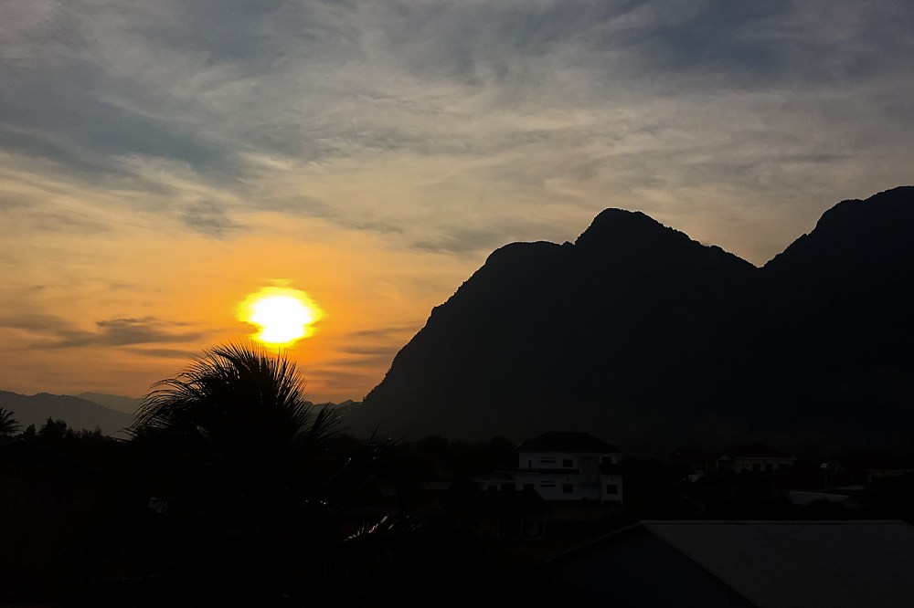
Staring down the barrel of over 110km into the leading edge of a storm on Tuesday, I found the spooky castle above by the simple means of cutting inland by a mile or two rather than plugging straight down the Scottish coast.

20200901 3 Edit

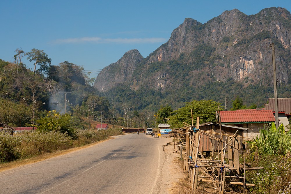
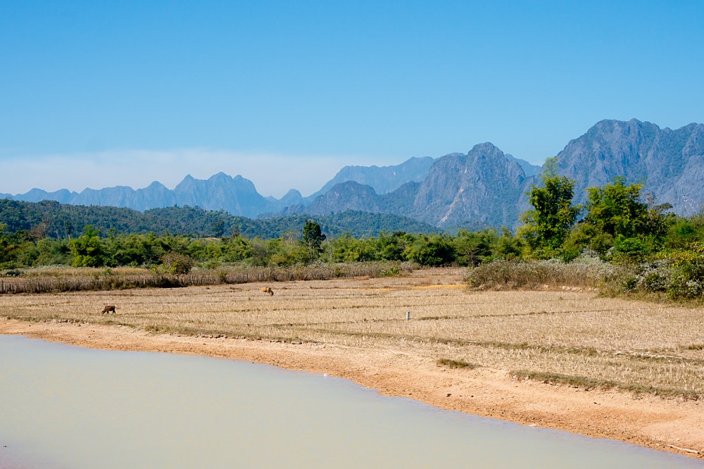
And, despite the best efforts of a 30mph headwind, the road along the coast was as beautiful as when I’d followed it in the opposite direction half a decade ago. Though I was struggling to convince myself that only being able to reach 9mph was good, because I had more time to appreciate the scenery.

Wednesday was predicted to be a washout, with rain warnings to add to the strong winds. I decided to spend as much of it as possible hidden in a ship, crossing to the capital of Northern Ireland. My cunning tactics kept me surprisingly dry until a cloudburst just as I approached Belfast’s Big Fish (below) in the city centre. The internet tells me that it’s actually a Salmon of Knowledge. Which means it should really have been able to tell me I was about to need emergency shelter…

20200902 2 Edit

I’d never spent any time in Belfast before, so a quick wander around was nice, despite the rain. Like every other city I’ve seen in the UK in the last few weeks, it’s got a ‘ghost town’ feel to the city centre at the moment.

Covid effects aside, it has a slightly different feel to other UK cities (and not just because of the impact of the Troubles on the inner suburbs). To me, the centre feels a little bit American somehow, maybe reflecting the historic links between the island of Ireland and the USA. It also has the habit of juxtaposing old buildings right next to new ones, in a way which would be rare elsewhere in the UK.

20200902 4 Edit
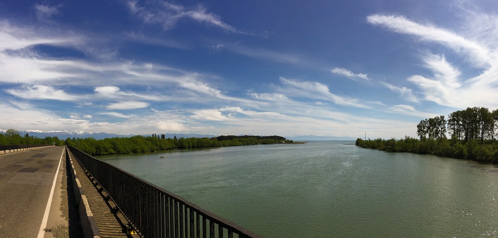
By Thursday morning, it was time to head into the countryside. Having taken the decision to skip the lovely, but strenuous, Antrim coast this time (I’d had a good look on my previous trip), I was a bit surprised to find myself at the double bridge below.

20200903 1 Edit

I’ve got a very similar, but more cloudy, picture of a touring bike at this bridge from five years back. I’m still not entirely sure how what I thought was a brand new route turned out to be the exact road I’d taken before. But I did soon make sure I was into new territory by turning left at Coleraine.

20200904 1 Edit

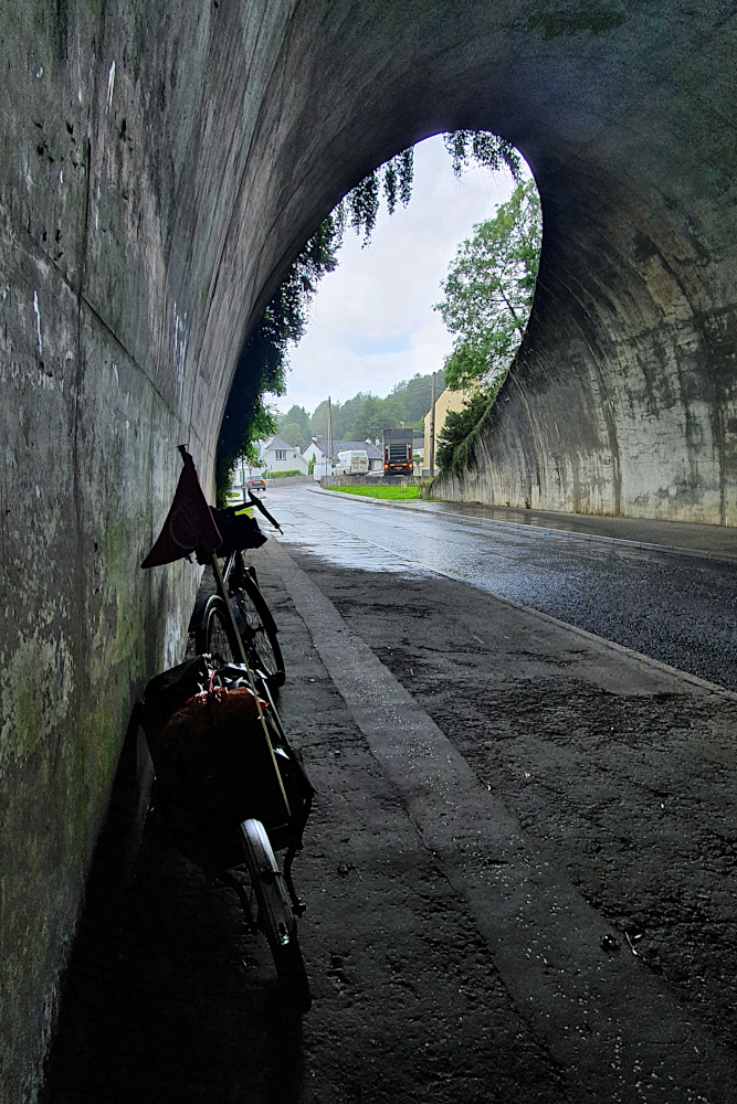
This took me along the north of Northern Ireland towards the western edge of the UK. More significantly, it was taking me straight towards a fleet of heavy showers, which made yesterday’s (Friday’s) riding, erm, interesting.

With bright sunshine between the showers, and another howling headwind, I spent the day sprinting along soaking roads before diving under cover as another cloudburst hit. Thankfully, with countryside more similar to England than Scotland, there’s usually a little shelter from the wind, and plenty of cover from the rain, including the odd tunnel.

20200904 4 Edit

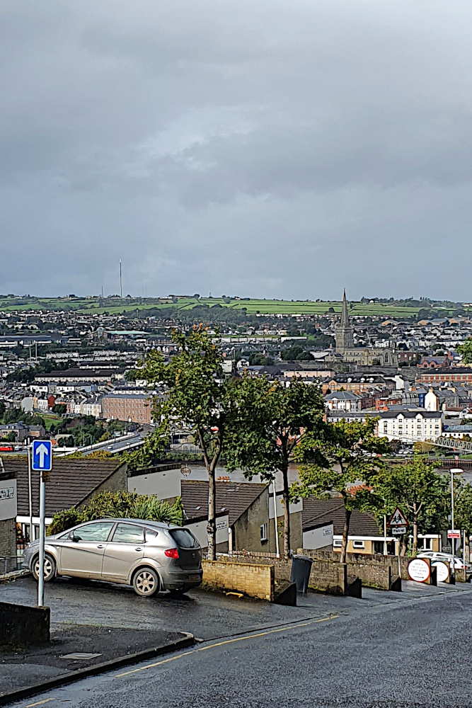
I’m now right up close to the UK’s only land border. Being a set of islands can sometimes make you forget your close links to other countries. It’s unavoidable here, from the mix of British, Irish and Northern Irish registration plates on the cars, to the double name and tumultuous history of Londonderry / Derry (below), one of the hotspots of the Troubles.

20200904 5 Edit

My last visit to this region was a long time ago (at least it feels it, being pre-Covid, pre-Brexit, and even pre-finishing the Round the World ride). It’s probably good to remember that the big problems in Northern Ireland have been over for a lot longer than that,despite occasional rumbles. And it’s great that the country is still as beautiful, and the people as friendly, as they were last time.

Now I just need the showers to stop…

Advertisement

Back Out of the (Former) USSR

The Black Sea isn’t black.

This was not exactly a massive shock.  What was quite surprising was that a day’s bike ride in Georgia can take you from snow-capped mountains to palm-lined seaside resorts so easily.  Though it might, I suppose, be trickier in the other direction.

IMG_1485 Edit

I made the most of what the weather forecast said was going to be the last day of tailwinds (on Sunday), and decided to get as close to Batumi as I could.  Before the wind decided to punish me again.  I ended up only around 30 miles short, and was rewarded by my first view of the non-black Black Sea (above).

Looks nice, doesn’t it?  Those snow-capped mountains in the background, dropping into the sea in the spring sunshine.

The short ride into Batumi on Monday was beautiful, marred only by the knowledge that it would be my last night in the country.  The last chance to stuff my face with delicious, cheap Georgian food.  And the last night for a while that I’d have a language in common with the locals.  I’m going to miss Georgia, I think.

IMG_1490 Edit

Batumi is one of Georgia’s major ports, and also a tourist resort, as well as being the last major town before the Turkish border.  The locals also seem to have developed a taste for architecture, with an impressive array of oddly-shaped towers springing up on the skyline as I approached.

The one aspect of Georgia which I won’t miss is the driving.  A bit like Thailand, they have good roads, but drivers whose skills have not caught up yet.  The massive amount of traffic cops on the roads (mostly in equally massive American police cars, for some reason) is hopefully an indicator that they’re working on it.  I had a sudden thought that I hadn’t seen a bicycle lane for thousands of miles.

A few kilometres north of the centre of Batumi, a cycle track magically appeared.  It took me all the way into town.  And then it multiplied.  The whole city is covered in bike lanes.  It was almost shocking.

IMG_1507 Edit
I had a wander around town in the afternoon, and marvelled at bike lanes zigzagging between cafes and their outside seating areas, between supermarkets and their fruit displays, and dead-ending at busy junctions.  The one above is one of the more sensible ones.  Which just stops at every road it crosses.

There doesn’t seem to be any great planning involved.  And the locals appear genuinely astonished when a bike actually uses a bike lane (which is usually for drinking coffee, walking the dog, or shopping).  But the effort is commendable.  And the major bike lanes along the seafront and the main roads are light years ahead of anything I’ve seen for months.  So, hats off to cycling city Batumi!

IMG_1511 Edit

Still, after my stroll, some seaside ice-cream, and a proper feed, it was time for bed.  And a few hours later, to cover the last ten miles of the Former Soviet section of the trip.  It’s been a great few weeks, all the way from Tashkent.  From the desert to the mountains to the seaside.  More people should come here.

The road to the border (and after the border, for that matter) hugs the shoreline, with the impressive cliffs, and more impressive snowy mountains, dropping straight to the water.  The picture below is from the last headland in Georgia (the border is in the next bay).  So the land ahead is Turkey.  It seems a little strange that the landscape it reminds me most of is New Zealand, which is a long, long way from here.

IMG_1514 Edit

Another five minute border crossing, and I was in country number 23, heading south-west along the Black Sea coast.  A coast which takes you straight to Europe.

It’s starting to feel perilously close to the end of the trip now.  Turkey’s quite familiar to many Europeans as a package holiday destination, and the local time has ticked back to within just two hours of the UK.  It begins to feel like home is just around the corner.  Despite the beautiful scenery, the sunshine, and the wide, smooth road, I was feeling a little melancholy as I trundled along.

Then I heard a muezzin calling from a minaret, and I remembered that there’s still actually a long way to go.  Turkey’s going to take a few weeks, as it’s another big country, and then there’s the huge variety of relatively tiny European countries to look forward to before home finally beckons.  No need to worry about the end just yet.

IMG_1517 Edit

I haven’t formed much of an impression of Turkey so far.  Yesterday was just the pleasant ride from the border, and I’ve cunningly spent today having a rest while the rain hammers down outside (above).  My weather anticipation is definitely getting better.

But the people have been friendly so far, even though I’m back to having significant language barriers.  Things are more expensive than anywhere I’ve been since Vietnam.  And it’s still cold when it rains, so it’s definitely not summer here yet.

I’ll find out more over the next little while.  I’m heading straight along the coast to start with, but I’m still not sure of my exact route after the first week or so.  There are three options, all of which are more-or-less the same length (though with massively different levels of climbing).

I’ll make up my mind on the way.  The Black Sea might not be black, but it is quite big.

So there’s plenty of time to work things out as I go…

Coming Down the Mountains

With the after-effects of that dodgy high-altitude chicken masala still haunting me as I rolled out of Kathmandu, I could have been forgiven for taking it a bit easy on the way back down to the plains.

So I did.

There’s no point in hammering yourself when you’re not 100%, and I’d lost a lot of energy.

IMG_0990 Edit

Nepal’s not the most difficult country if you want to slow down a bit and enjoy the scenery.  After just a few kilometres of gentle climbing on the main drag out of Kathmandu on Monday, I tipped over the pass (above), and had about 1400 metres of altitude to drop off before flattening out on the approach to the Indian border.

It’s not quite as easy as it sounds.  I was still in the Himalayas, after all.  So although there was all that height to drop, there were still quite a few climbs to deal with as the road contoured around valley sides and gorges.

And, despite being foothills, these are not exactly small.  Hopefully, you can get an idea of the scale from the size of the bike in the picture below.

IMG_1014 Edit

Given their proximity, and close economic ties, Nepal and India don’t seem to have a great deal in common.  Nepal loses on economic development (apparently, although it doesn’t feel any poorer than India), but wins on scenery, cleanliness, mobile internet access, traffic levels, chocolate availability, driving skills (marginally), the general level of English spoken, having bikes with gears, and having pavements to walk on in town.

But there is one area where both countries are on a par.  Unannounced, unsignposted, major roadworks.  As I headed down to Bharatpur on Tuesday, I suddenly hit a roadblock.  Loads of irate locals, trucks, buses and all, piled up at a barrier.  There’s only the one road to Bharatpur, so this was a bit of an issue.

It turns out that the highway is shut in both directions from 11 until three every day.  At three, the traffic tsunami at each end is released to smash together somewhere in the middle.  Probably right where the roadworks are.  This didn’t seem like a great idea.  Fortunately, after discussing with a few locals (and promising to carry a couple of them on the back of the bike – I think this was a joke), the fierce guardian of the gate agreed that it would be a tad dangerous to be caught up in the three o’clock stampede.

So I got to ride the valley road pretty much by myself.  This was good, because it was a rather nice valley to ride:

IMG_1022 Edit

After Bharatpur, it was more-or-less back to flat country.  Yesterday (Wednesday) gave me a chance to see if I’d fully recovered from the stomach bug, as I put in the first 100 km ride for a while to bring me to the border.  It went OK, although I still don’t think my energy levels are quite back to where they were.

Just one last big hill, which gave me one last Himalayan downhill to smile about as I headed onto the plain, in company with some of the many bicycle commuters of southern Nepal.

IMG_1041 Edit

Today is another rest, and a chance to refuel and look forward to heading back to India.  A few more decent roads and a little less dust than the eastern side of the country provided would be a good start.  And I’m going to give them one more chance to sort me out with mobile internet.

With the Taj Mahal and Delhi on the route for the next section, there should be a good chance for India Part 2 to improve significantly on Part 1.

Assuming the border presents no more problems than it did on the way into Nepal, I’ll start to find that out tomorrow…

Back to the Future

A long, long time ago (in March), I put up a post based on my (possibly slightly over-stated) surprise at finding myself in the year 2558, Thai style.

What I didn’t know then was that fate would decree a second visit to the the future.  Within a couple of weeks of that post, I’d been squashed by a truck, sampled the Thai healthcare system, and returned home to the UK to recover.

And yet, here I am again, back in 2558, and soon to tick into 2559.  I rolled across the Mekong into the country which temporarily thwarted my round-the-world ambitions on Sunday (27th December).  It still seems like a nice place, just like it did nine months ago.

IMG_0681 Edit

After spending over two hours negotiating the holiday carnage of the border crossing from Laos (what a contrast to my entry to that country, where I was the only person at the border post!), I was across the Mekong, back on the correct – that’s the left – side of the road, and pushing on.

No uncontrollable fear when I heard big diesel engines behind me, which was good (although not entirely unexpected, as I gave this a good dry run in the UK in September).  I am spending a lot of time glancing over my shoulder, though.

The roads up here in the north are just as silky-smooth as those I rode earlier in the year.  Thailand (at least in my experience, so far) has the best road surfaces in south-east Asia, which is saying something, as there are not too many bad surfaces to be found in the region nowadays (except in Indonesia).  UK local councils take note; it is actually possible to build decent roads!

Unfortunately, the miles I’ve ridden here so far have also been just as dull as the main roads in the south, as today’s pictures will testify.  They’re a pretty accurate reflection of quite how visually stunning the last few days have been.  Maybe I’ve been spoiled by Laos?

IMG_0689 Edit

Still, that should all be about to change.  I’m hitting mountains tomorrow.  It’s about 300 miles (maybe 470 km) from here to the border with Myanmar.  And it looks like there are four big ranges of hills before I get there (plus another one after the border).

Two of those ranges are on the menu in the next couple of days.  Two long (70-plus mile), and probably hot, days with 600 vertical-metre ascents (and descents, of course!) through National Parks.  I’m hoping that this will mean less traffic and improved scenery.  I’m also hoping that the hills won’t be quite as steep as some of the Laotian versions.  And that I won’t make any more amateurish hydration errors.

IMG_0691 Edit

And look!  I saw my first Thai hill on the way into town this afternoon!  Things are definitely looking up already…

Those long days through the hills should drop me back onto the flat in time for whatever New Year’s Eve celebrations happen over here.  I’d imagine that I won’t get another post in until New Year’s Day.  So, let me pre-emptively wish you all the best for 2559 (or 2016, if you prefer).

The big New Year’s news, by the way, is likely to be the shaving of my explorer’s beard.  It’s begun to catch its own food, and that must stop…

The Wet, Muddy and Slightly Spooky Way to Perfect Cycling Country

The story of a day of two halves (and the day after, too)…

Sunday started damp in Vietnam, at the foothills of the mountains which form the physical frontier with Laos.  It had rained most of the night, so the roads were wet.  Which translates into dirty.  But, by the time I was ready to go, the weather had decided to restrict itself to low, dark clouds.  So I set off.

The road deteriorated into mucky dirt for a little while.  Then it turned into a four-lane highway for a few hundred metres.  Then it stabilised into a normal, average road.  Gently rising through smaller and smaller villages.  With very little traffic, which was a plus.  If a little odd for one of the main routes between Vietnam and Laos.  Maybe it’s busier during the week?

Then the climb began.  I knew it was about a 15 km, 600-odd metre haul to the border.  Which is just a little different from the Dutch-style flatness of the Vietnam coast, but I was prepared for that.  Jens and Bjorn (the two German cyclists I’d met the night before) had said that the hill to the border was really steep on my side, but that I’d have a great run on the other side in Laos.  So I was prepared for that, too.  And in the end, it wasn’t too bad; three or four steep sections of around 10-12%, with decent stretches of false flat in-between to get my breath back.

What I wasn’t so happy about was riding more than half the climb in the clouds.  Which really means light drizzle, with visibility down to less than 50 metres near the top.  I ended up putting the high-viz jacket and lights on to give the logging trucks half a chance of seeing me.  Several sections of the hill, where the surface had been removed for repairs, had deteriorated to mud and slimy puddles.  One of the muddy puddles was deep enough for me to get my feet wet.  Grr!

And, if I wasn’t happy about it, the Beastlet was even less so, as it clicked and ground its previously spotless drivetrain (and even the disc brakes) on mud:

IMG_0645 Edit

I finally clattered and wheezed my way to the top of the hill to find the spookiest border crossing I’ve yet encountered.  The visibility was down to maybe 20 metres, and I spent a while on the Vietnamese side circling parked trucks, shouting “Lao?” at the handful of ghostly figures who emerged from the gloom from time-to-time.

IMG_0639 Edit

Eventually, I found my way to the apparently deserted border post on the Vietnam side.  I checked a couple of empty rooms which might have been passport control.  I began to worry that I might accidentally leave the country and enter Laos without even seeing an official, let alone having visas or stamps or anything in my passport.  About the fifth ghostly trucker I asked finally pointed me to the passport desk.

I knocked on the glass to wake up the sleeping border guard (as you do), who dealt with my stamp very efficiently, and then, slightly bizarrely, offered me some chewing gum.  I’m still not sure exactly what he was trying to say, but I was out of Vietnam.  Almost.

There’s about a mile of no-mans-land between the two frontiers, with another huddle of parked buses and lorries, and a massive building, which I guess will one day be a new Vietnamese border post.  It’s still completely deserted at the moment, but with near-zero visibility, cost me another few minutes trying to work out if I needed to do anything there.

I gave up in the end, and started down the hill, hoping to come across a border post for Laos.  The clouds began to lift almost immediately.  By the time I glided in to the well-staffed and friendly Laos border at Nam Phao, sorted out my visa on arrival, and had my passport stamped (all of which all only took about 15 minutes, but cost me an extra $2 because it was Sunday), it was dry, and the sun was threatening to put in an appearance.

By the time I’d negotiated my way around a comically aggressive miniature poodle, and got a couple of kilometres down the road, it was wall-to-wall sunshine.  On a perfectly smooth, almost empty road.  With a tailwind.  That is a decent recipe for a big smile on a muddy cycle-tourist’s face.

And I even got a nice sunset, just after I got into Lak Sao, the first town of any size (or the last, I suppose, if you’re going the other way).  I’d only been in Laos for a couple of hours, but I already liked it.

IMG_0643 Edit

If the first impressions of Laos were good, yesterday (Monday) blew me away.  I was only going 60-ish kilometres (still easing in to the ride, so not piling the miles on too hard).  But what a 60 km!

20151222RTW_1 Edit

The road from Lak Sao was stunning from the start, with mountains on both sides.  There was still virtually no traffic.  The sun was out, but up at around 400m altitude, the temperature was around 25C, and the humidity negligible.  And after the permanent haze, diesel fumes and clammy dampness of northern Vietnam, the air was crystal-clear.  Beautiful cycling in a beautiful country.

Towards the end of the ride to the little village of Na Hin (where I’m having my first full rest day of Part 2 today), there was a short, sharp 200 metre climb, with some properly steep (15% plus) sections.  So I got a decent workout.  And then, over the top, a superb, fast, twisty 400 metre decent to Na Hin.  I nearly hit a snake and a deer (not at the same time), and I did hit 40 mph on a loaded touring bike for the first time in ages.  An absolutely spectacular day’s riding.  I’m still smiling now, just writing about it.

20151222RTW_3 Edit

So, what next?  Well, it’s nearly Christmas, apparently.  In marked contrast to Vietnam (which left me never needing to hear Wham’s ‘Last Christmas’, or any form of dance-remixed carols, ever again), it’s no big deal here in Laos.

I’m thinking at the moment of riding through the big day to Vientiane (I should be able to get there by Christmas afternoon if I can get across the mountains to the Mekong river tomorrow; it’s less than 300 km in total), and then having a mini-celebration and another day off on Boxing Day.

But we’ll see.  In case I don’t get another update in beforehand, I hope you all have a great Christmas.  I’ll certainly update this again before New Year.

Meanwhile, I’ll be enjoying this spectacular country on two wheels.  Which feels like a pretty decent present at the moment…

A Month In, and Country Number 6

Well, this is a surprise.  I thought this would be a little retrospective glance at the trip so far (yesterday was the one-calendar month mark since my departure from Greenwich), written from another location somewhere in Southern Ontario.  Instead, I arrived in the seething metropolis of Sandusky, Ohio.  Country number six already, and this one will last for a little while.

I’d intended to head for the big border crossing at Windsor in Ontario, which drops you into Detroit.  I’d built up an impressive collection of shocked facial expressions from the various Canadians regarding this plan.  Responses ranged from “turn left and ride like [insert four-letter-word here]” to “you’re going to ride through Detroit on surface streets?  That’s suicide.”

Now, there may be an element of exaggeration to these reactions.  All the people in Southern Ontario live in a delightful, semi-rural or rural environment with (as far as I could see) very little in the way of crime etc, and no big cities.  So maybe they were overstating things.  I have a standard response to this sort of thing, which is to research.  And a good job too; turns out that the Windsor-Detroit border is very difficult to get a bike through.  The whole place is set up for trucks and cars, and I’d need to bag the bike, put it on a bus, and so on and so on.  Looked like a nightmare.  And the alternative border crossing at Sarnia would take me a few days out of my way to the north.

One final act of Canadian goodwill was to come; a tip-off about the small ferries which run out of Kingsville (the most southerly town in Canada) to Pelee island (the most southerly island in Canada), past Point Pelee (the most southerly point in mainland Canada).  Lots of ‘southerlys’ there, then…  It should then be possible to get another ferry to the US from Pelee Island.  And it worked beautifully; I’m in the USA a few days earlier than expected, having had a nice boat ride, and a very friendly, quick and non-problematic entry to America.  A good route for any bikers heading this way.

IMG_0209The Pelee area of Ontario is quite interesting, by the way, and not just in its role as an important stop for migrating birds, of which I’m sure you’re all aware.  Remember Terry from Brantford?  He’d told me about Point Pelee when we were discussing places to camp, and said that it was so far south that it was level with Northern California.  This seemed extremely unlikely to me, so I checked up.  And it’s actually true; there are tiny bits of Ontario which are to the south of the California / Oregon border.  Who knew?

In any case, I’m getting set for the first day’s ride in the USA; basically I’ll be heading roughly west-south-west for a couple of months.  The plains, the Rockies, the desert and the landmarks of the West (Monument Valley, the Grand Canyon etc) hopefully lie ahead.  Plenty more from the US to come, I’m sure…