travel

Exit, Pursued by Covid Restrictions

The Brecon Beacons were not on my initial plan at all.

Riding them would be lumpier than the coast. It would make the end of my trip unnecessarily hard, and also shorter. I’d miss both the big cities of South Wales, and the southernmost point in Wales. And the apparently beautiful Gower Peninsular. All very irritating…

But, as the clunking fist of Welsh Covid restrictions tightened its grip across the region, it became clear that the detour away from the coast was a good move. Partly because climbing a range of big hills isn’t really all that bad, at least when they look this good.

And partly because the few areas of South Wales which were still navigable when I started out were locked down by yesterday (Sunday), making ‘non-essential travel’ illegal as well as very difficult.

If I’d stayed on the coast, I’d either still be firmly stuck there, or would be finishing the tour on a train instead of under my own steam. Neither of those outcomes would be entirely satisfactory.

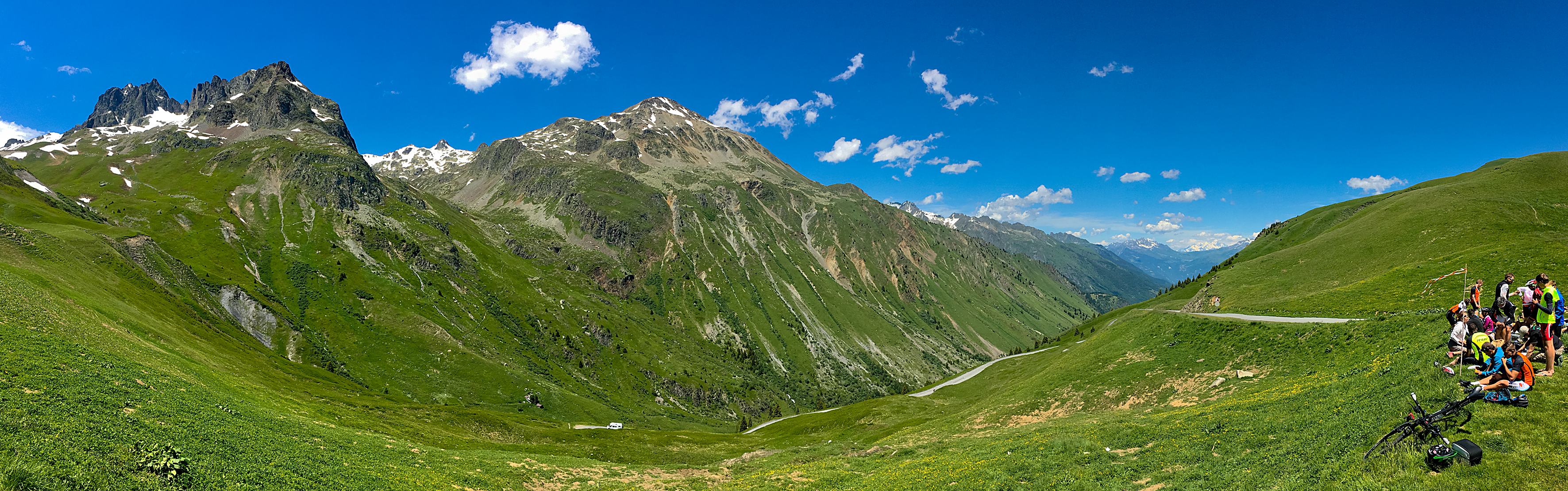
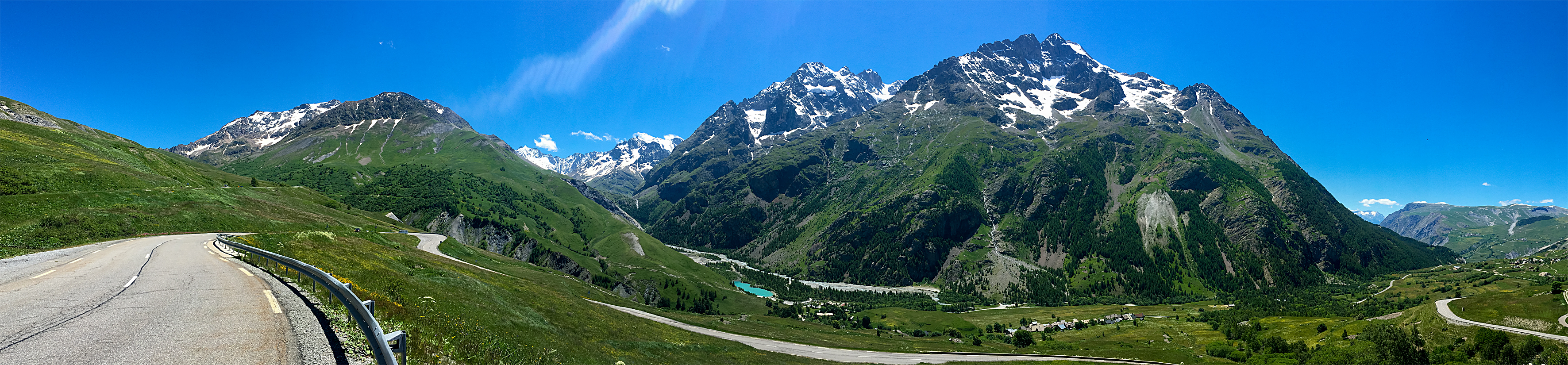
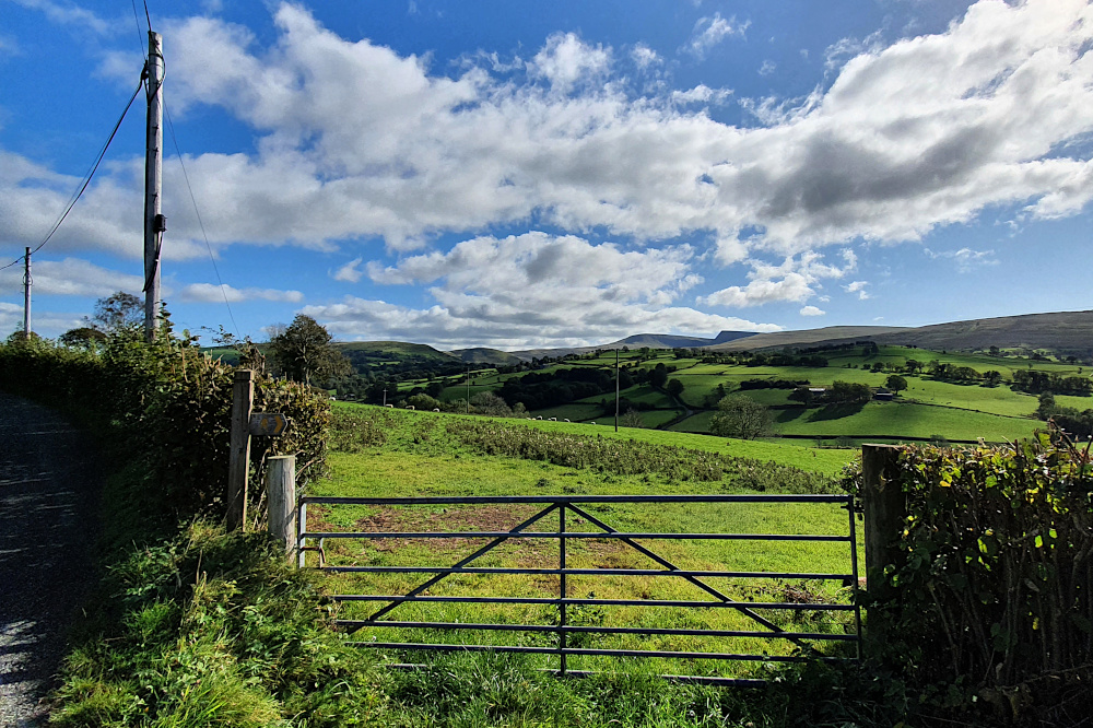
Instead, the biggest climb was over by Saturday lunchtime, and I was admiring the views that usually come from a little bit of altitude. The Brecons are also one of the UK strongholds of the once-extinct Red Kite, and I was lucky enough to watch a magnificent bird of prey riding the thermals over the tops for a few minutes.

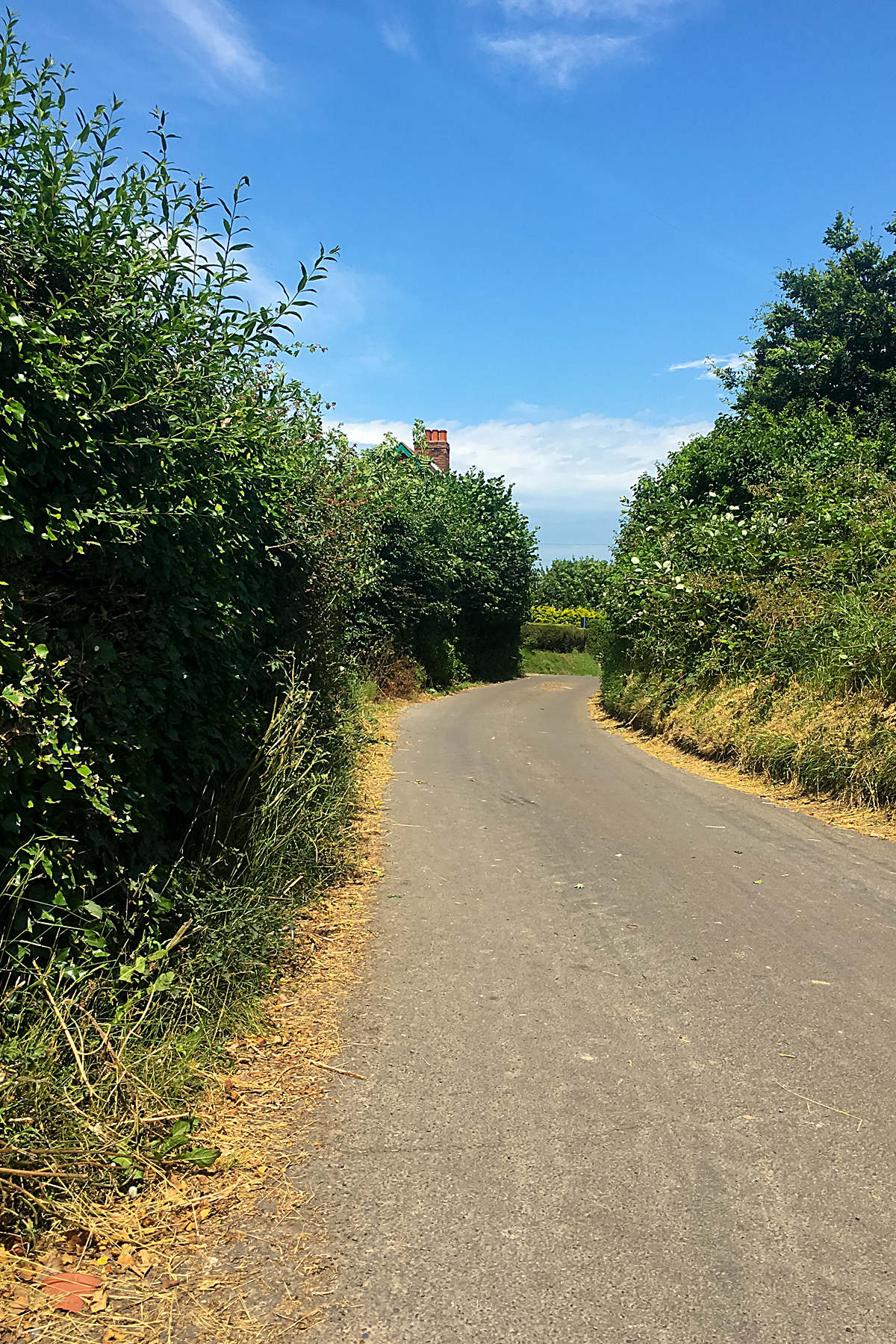
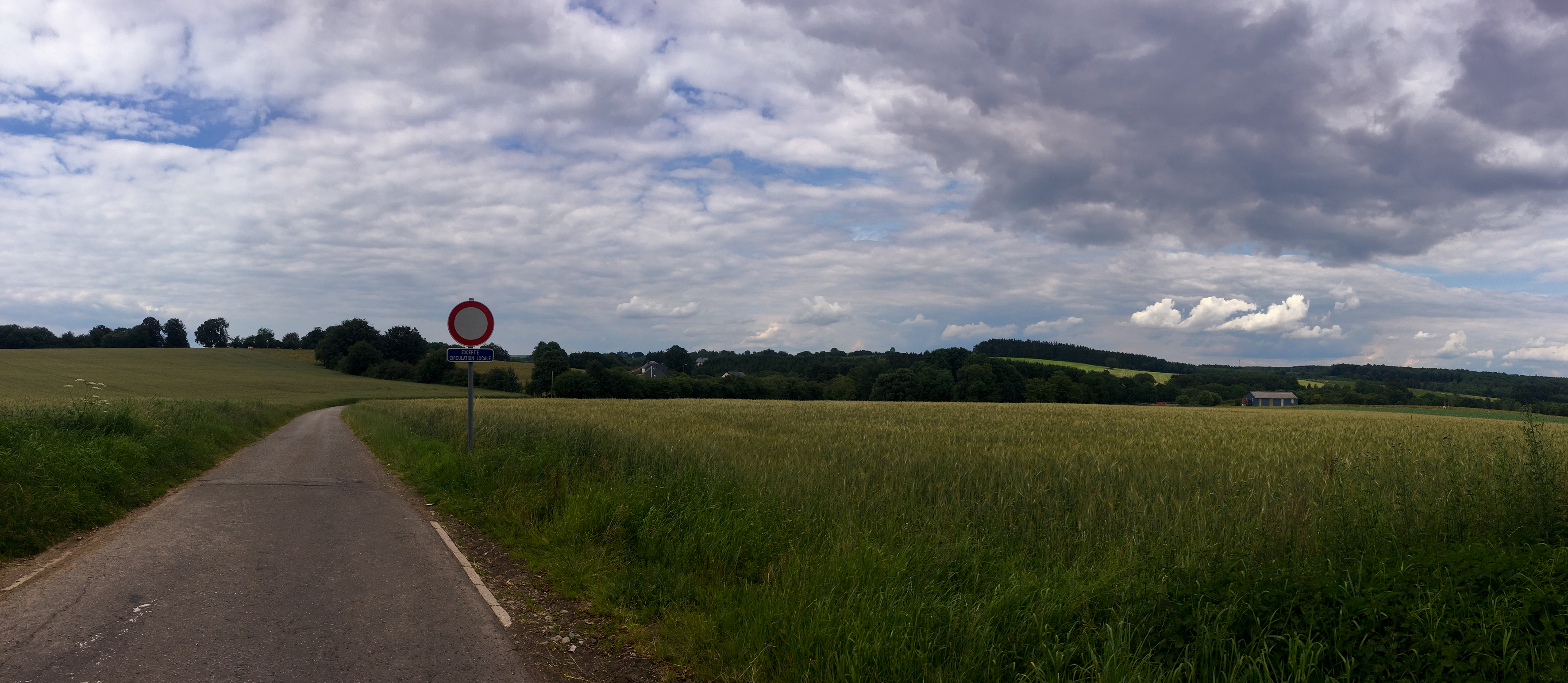
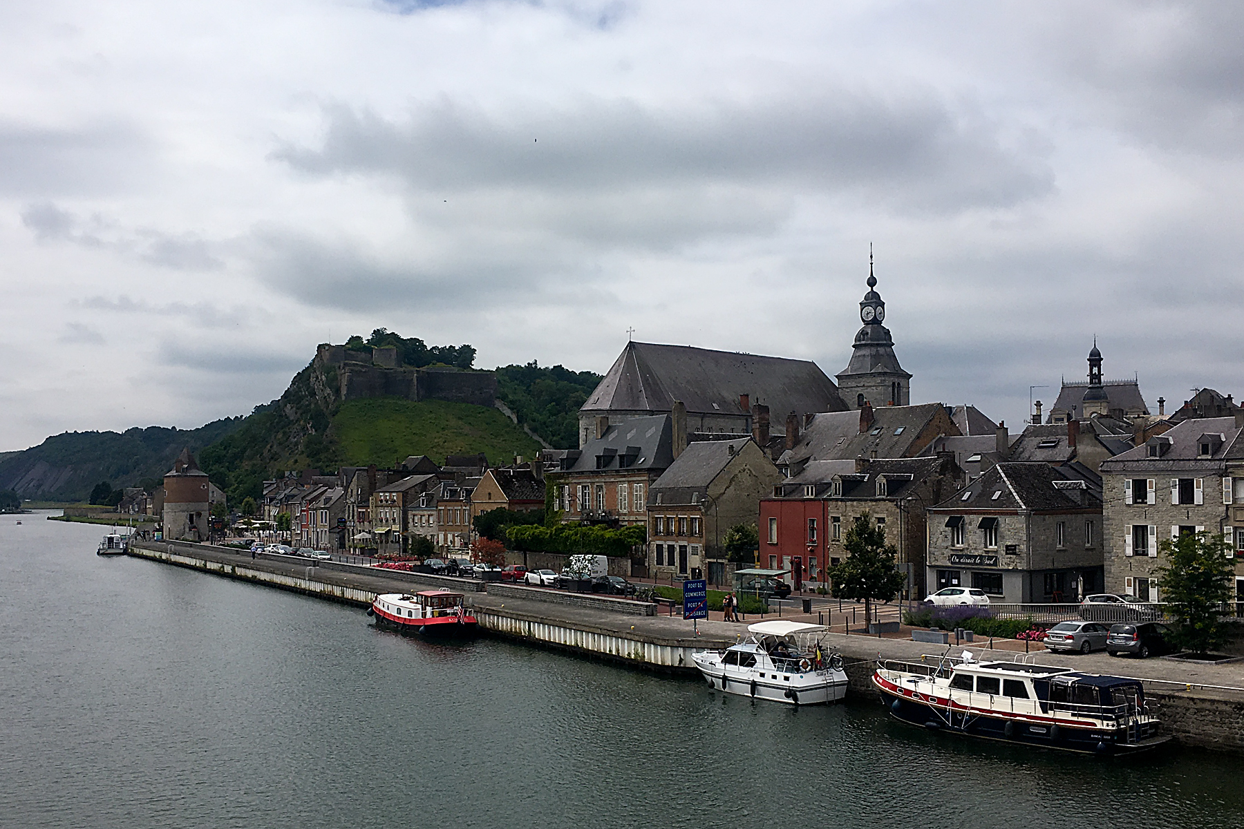
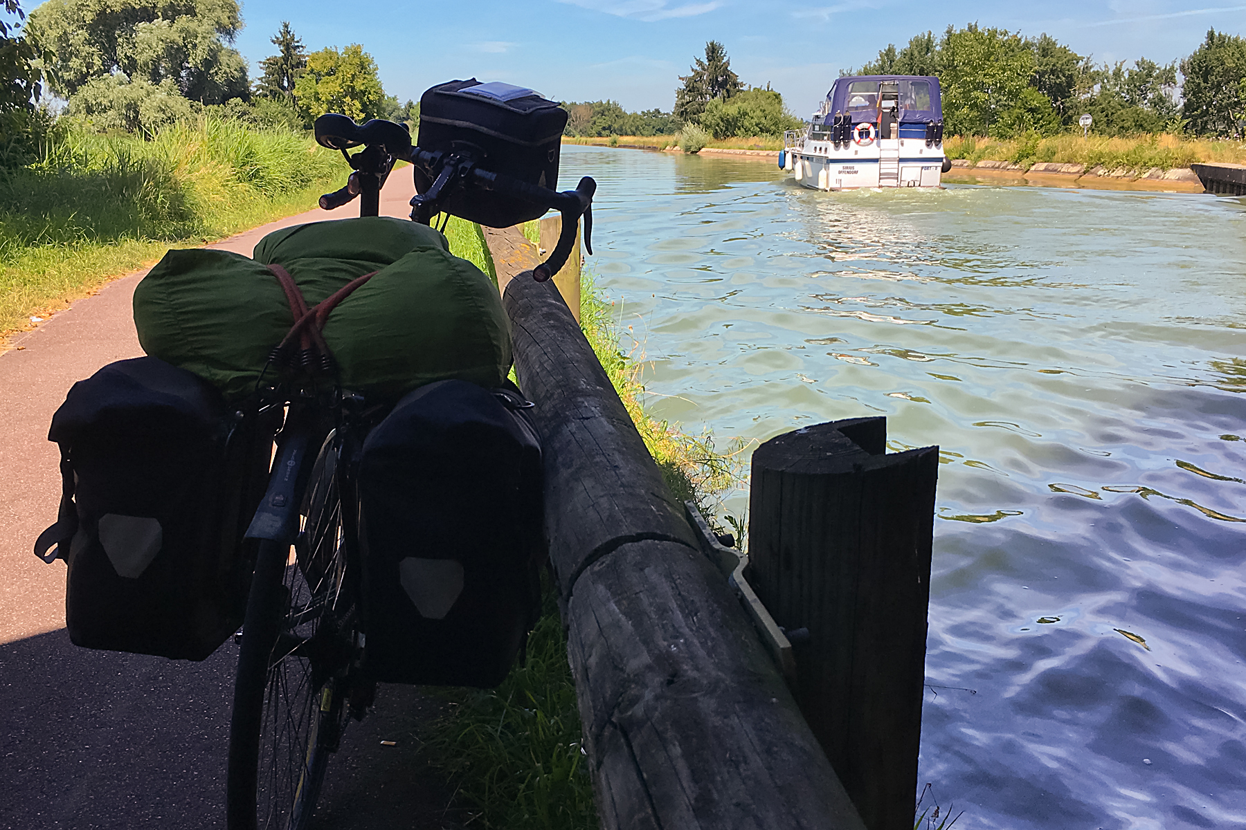
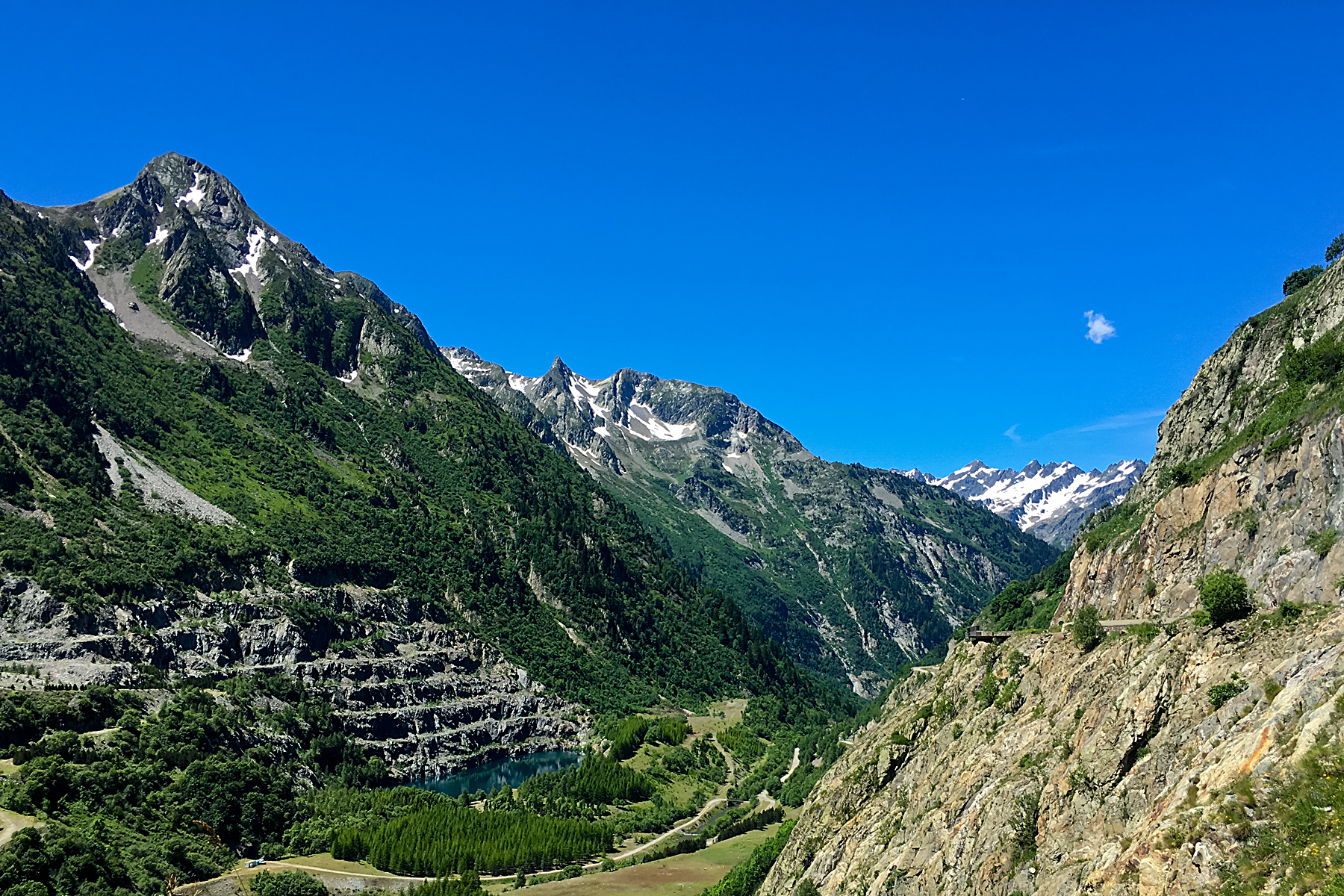
Then it was a fast drop into the Usk valley, before a long, gently downhill (if slightly undulating) afternoon, including a nice stretch on the canal towpath out of Brecon, above.

After a bit over 100kms, my penultimate day on the road was over. I was only a relatively short day’s ride from home, and within a couple of hours of the English border. With worrying about the restrictions, re-planning my direction, and a slightly shorter line than the original coastal route, I’d barely noticed that the ride was basically done.

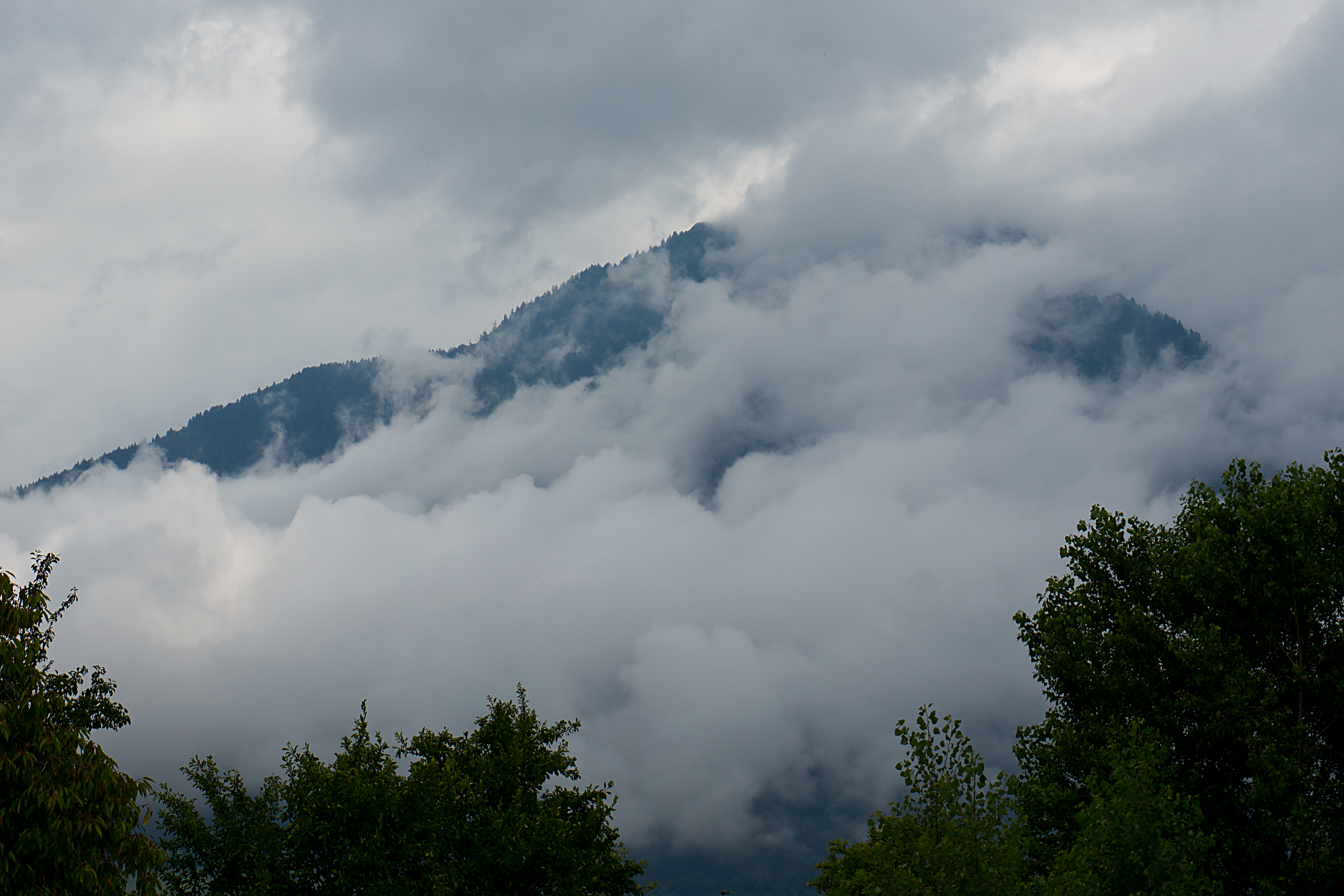
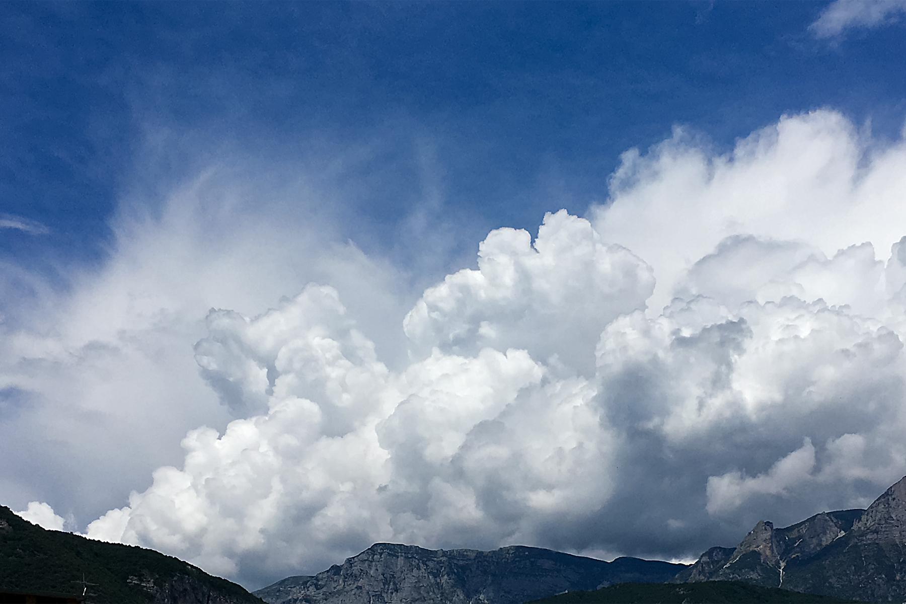
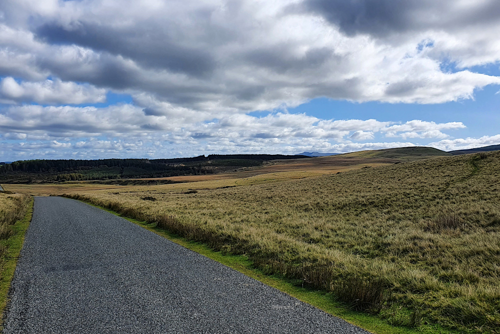
A cold but sunny start yesterday (Sunday), with a northerly wind pushing me straight towards Bristol, and home. Things speeded up with the tailwind. Breakfast in the cold, some country lanes, one more proper hill before the drop to the River Severn. A nice view back into the Welsh countryside from the top of my last 15% ramp (above).

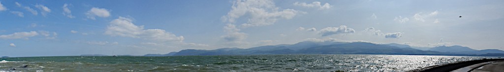
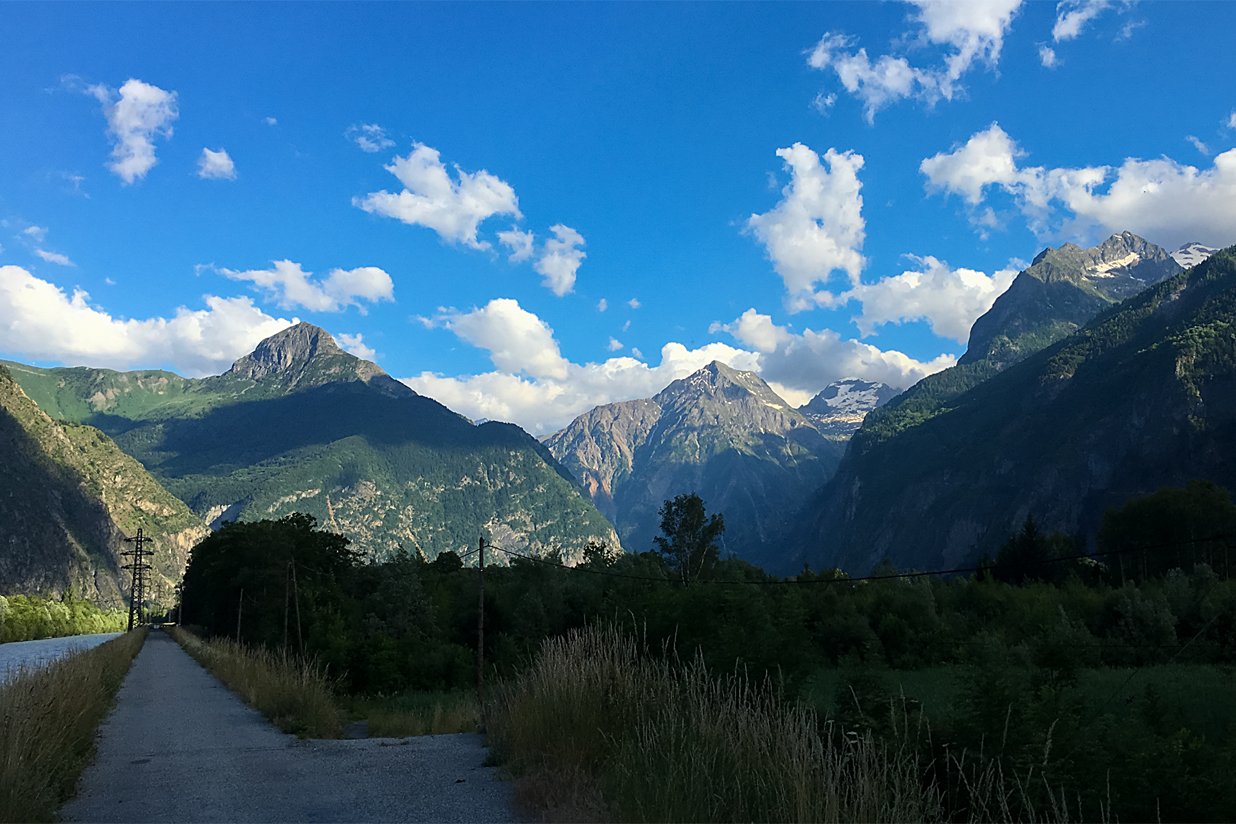
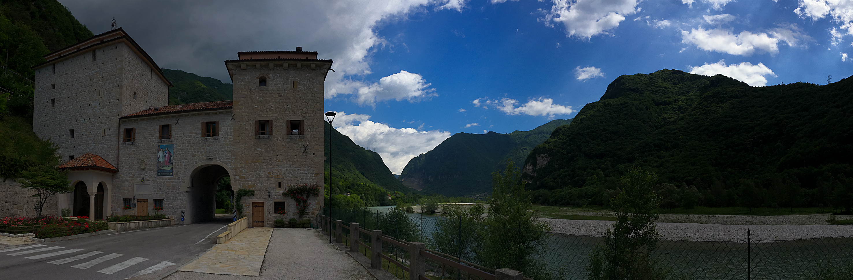
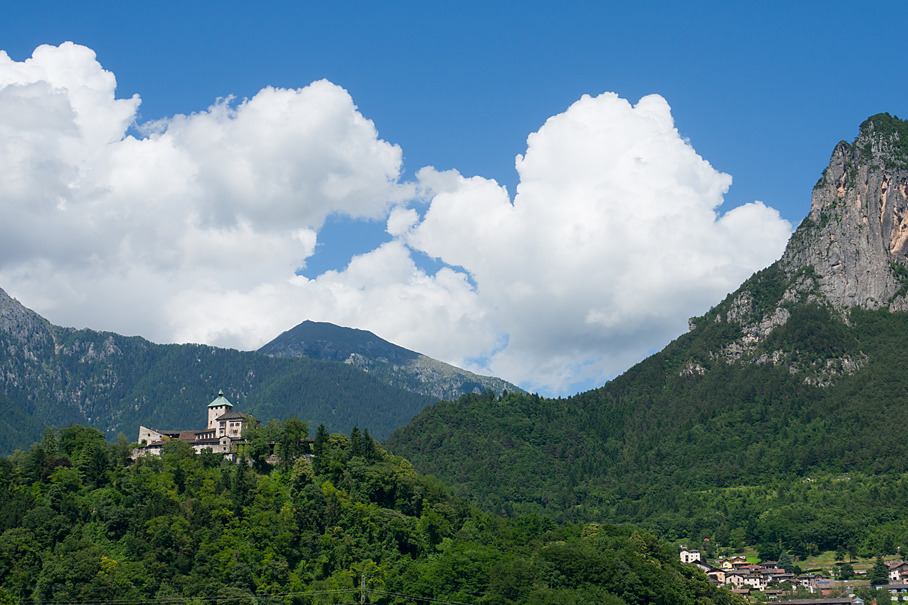
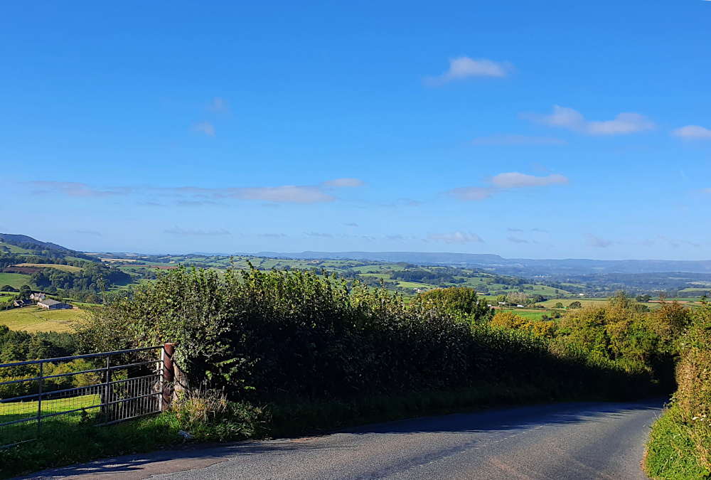
Blown along the ridge above the Wye Valley through Devauden. An even higher-speed drop to Chepstow racecourse, and a gentle but quick run along the gently descending bypass to the original Severn Bridge. The end of Wales. Which, with castles and kites and spectacular coastlines, was actually pretty good, despite the Covid-related frustrations. Diolch, Gymru!

I got to the middle of the mighty River Severn, suspended between Wales and England, before I decided I needed to slow down a little. And actually enjoy the end of the trip, rather than just hammering towards it. I had to slow down and smell the roses, or wake up and smell the coffee. Or something like that.

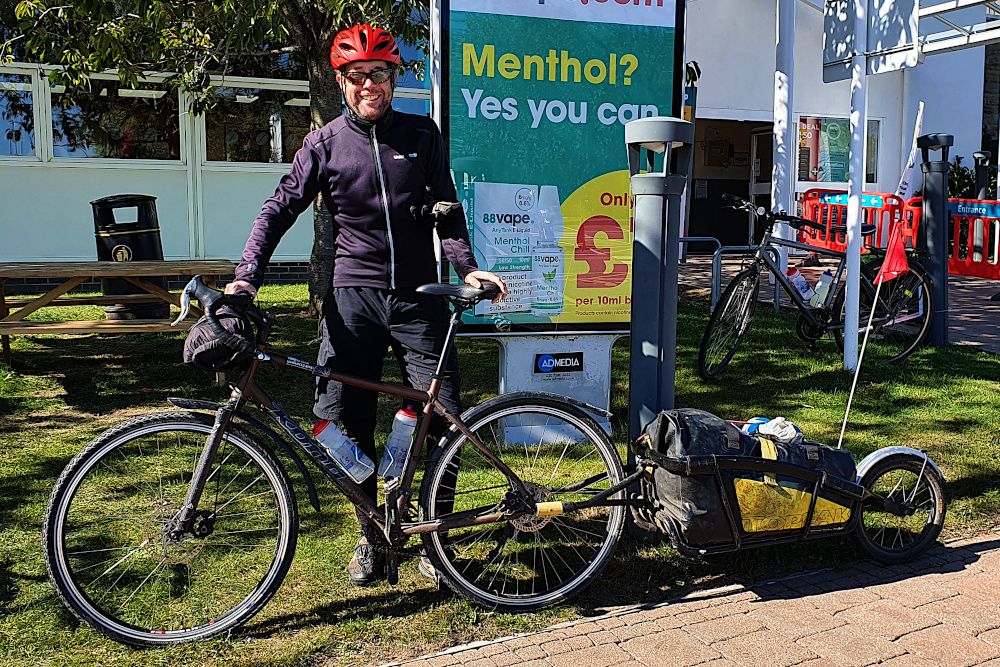
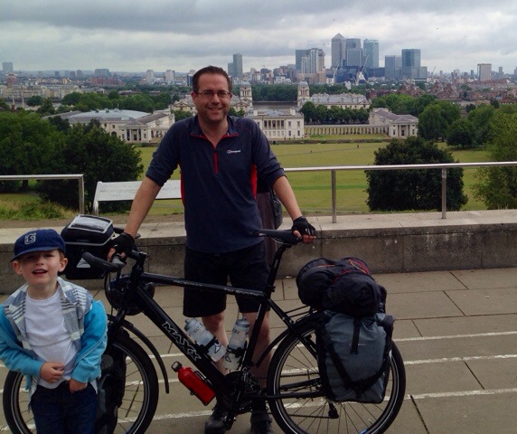
As it happened, it was smelling (and drinking) the coffee. Dan from Bool’s Bicycles and a mate of his were (almost coincidentally) crossing the bridge in the other direction for a couple of days away, so it was a cuppa and a chat at a legendarily disappointing service station, just into England.

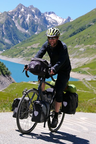
And a rare opportunity to get a picture of the bike, trailer and me all together. Stylish, huh? With possibly the least inspiring background of the whole trip, too…

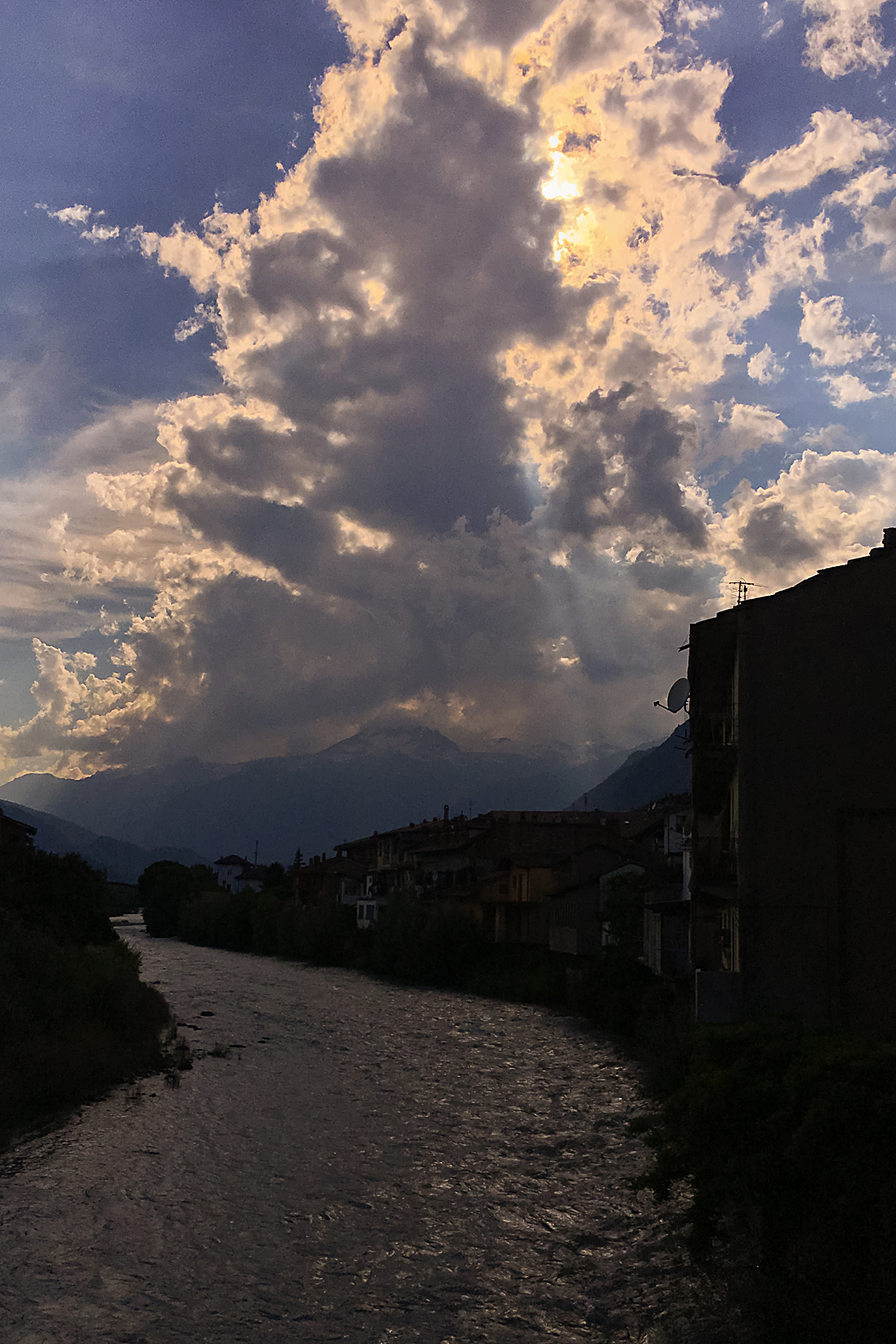
A gentle and flat drift along the floodplains on the Bristol side of the Severn. Marvelling at the industrial warehouses, incinerators and giant wind turbines. It’s not the way I’d normally choose to head into central Bristol – there are plenty more direct and more scenic options.

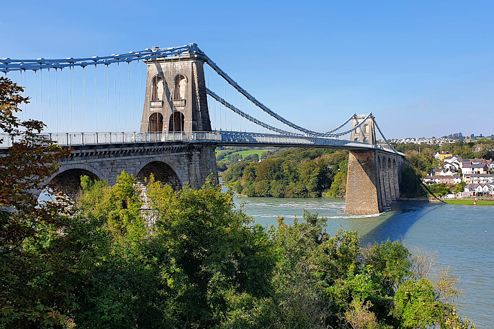
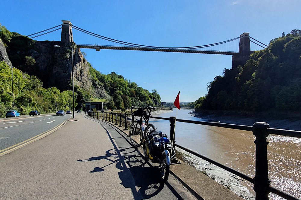
But there’s one big benefit of putting up with the industrial detritus out by the Severn. It means you can follow the River Avon into town, through the gorge. And there’s really only one proper way to enter Bristol centre after a long trip away – under the Clifton Suspension Bridge on a lovely sunny afternoon. Not too bad…

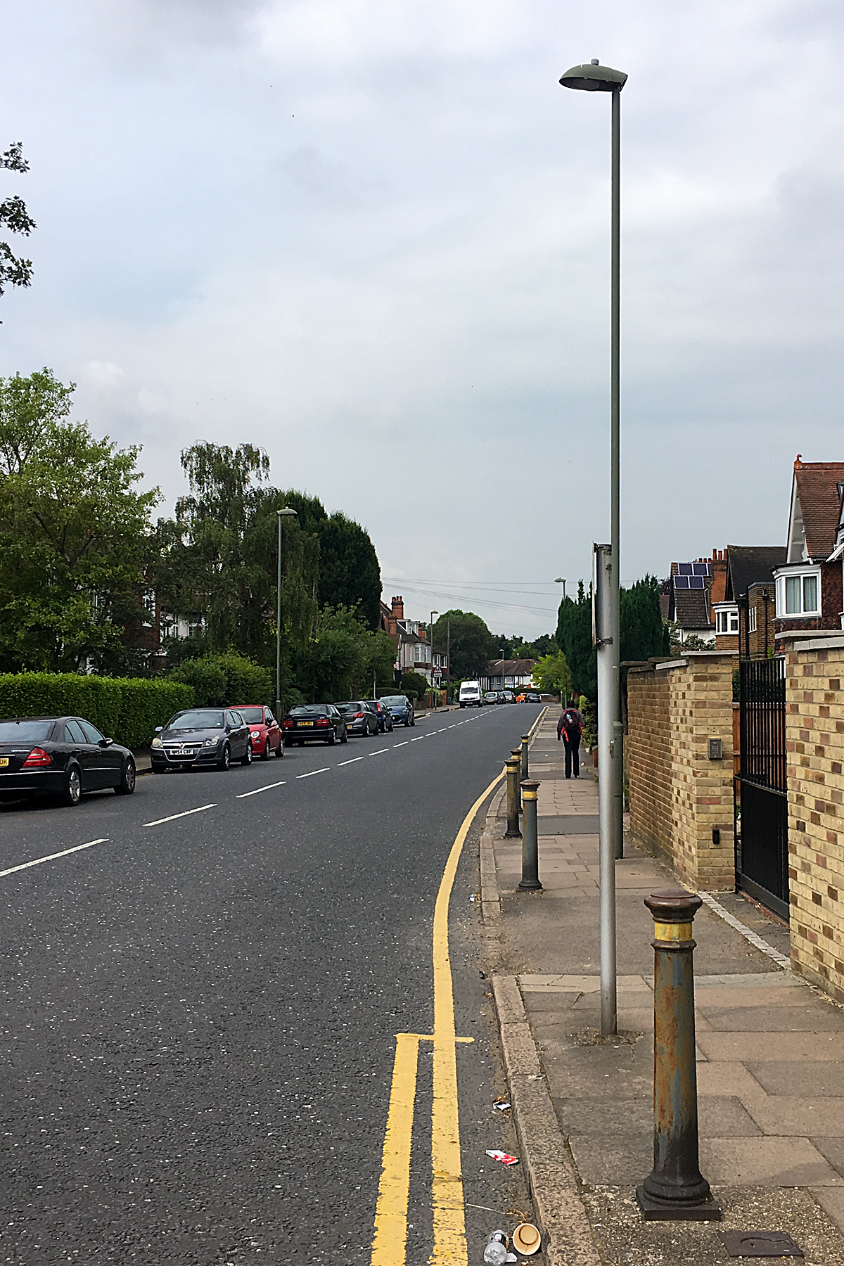
I trundled gently home through the city, past surprisingly large crowds of drinkers on the quays, soaking up the sunshine before the depressing prospect of a dark and virus-dominated autumn and winter.

The post mortem starts almost immediately. Another big ride done. The four corners of the UK covered. A suspiciously round number of miles under the wheels. The mixed feelings of satisfaction at finishing, and wishing that the ride would go on for longer. The warped sense of time that makes it feel like I’ve been away for years, even though it’s been less than 80 days.

And the question that always surfaces for me at the end of a big trip…

Right, then. Where next?

Advertisement

To Anglesey, and the Covid Squeeze

After the stunning success of pretty much every pun I’ve come up with, I’ve spent a chunk of the last few days on the bike trying to come up with a way of getting ‘it’s the angle, see’ into a sensible sentence. Having found no realistic way of doing so, I’ve decided (wisely, I think) to just leave it.

I escaped from Liverpool on the ferry ‘cross the Mersey 24 hours before they announced new Covid restrictions, along with most of the north of England. The only barrier to my departure was a significant number of sand drifts covering the sea-wall bike paths along the edge of the Wirral peninsular.

Just a couple of hours after leaving Liverpool, and fresh from a decent rail path down the west side of the peninsular, I was heading across the valley of the river Dee when I crossed into Wales (the fourth and last of the UK’s constituent bits for this trip).

I’m not sure if the nice boardwalk over the Deeside marshes (above) was in England or Wales, but being confronted by a wooden miner a few miles later (below) confirmed that I had, indeed reached the Welsh side of the border.

The north coast of Wales is a series of holiday resorts, for the most part with broad concrete sea walls to ride along. This should be both nice and quick. And the lack of traffic is nice. But the propensity of wandering pensioners to lose all sense of spatial awareness when grappling with chips or ice cream made things slow. Very slow in places. In a normal (non-Covid) summer, it must be nearly impossible to make any progress at all along the north coast.

Things change after Llandudno. The coastline tilts southwards, faces the island of Anglesey across the Menai Straits, and takes on more of the character of the mountains of Snowdonia, which are never far away.

And castles begin to appear, like at Conwy (above), ringing the areas of Wales which the English found hardest to control back in medieval times. Pretty soon, it’s hard to move without stubbing your toe on another castle.

The pensioners disappear as the coastline becomes more rugged, and the route (still mostly traffic-free) becomes more spectacular. The only downside of this is that progress is a little tougher than it would be on the flat.

I spent most of the last two days lapping Anglesey (the second, after Northern Ireland, of my two laps-within-a-lap). Crossing the Menai Bridge (below) gives you a good view of the ferocious tidal current running between the island and the mainland.

And on Anglesey, the landscape changes again. The south of the island, especially, feels a bit like being back in Devon and Cornwall, with short, but very steep climbs on tiny country lanes. It’s very pleasant, but if you don’t already know the Welsh word for ‘Slow’, you will after pottering around the island.

If you’re in a hurry, the jet fighter trainers buzzing out of RAF Valley will exacerbate any frustration at the lack of speed. I wasn’t hurrying, so it was fun to watch them zipping around in formation for a while, before trundling down to the beach at Trearddur Bay (technically on Holy Island, a sub-island of Anglesey).

Yesterday (Saturday), it was the return to the Menai Straits and the small city of Bangor. There’s been an unusual, really strong north-easterly wind for the last few days, which blew me nicely along the north coast, but was pretty fully in my face as I struggled back towards the bridge. It’s all, erm, about the angles, see?

Ha! Think I got away with that pun, after all…

A quick stop at Beaumaris en route revealed part of another castle, but also a spectacular view back across the straits, almost all the way back to Llandudno. There’s more of that sort of landscape to come as I head south in the next few days.

That’s all assuming that the Covid situation doesn’t finally mess things up. I’ve been very lucky so far, but the last few days have seen restrictions ratchet up all over the country, and serious-sounding talk of further measures to come. Especially worrying for me is that there’s some discussion about areas of South Wales, which are on my route, and would potentially block it.

Having got so close to finishing the trip, it would be pretty gutting to be halted by Covid restrictions just a few days short of home. But it’s out of my control, so I’ll just have to keep plugging away until I can’t. Hopefully, I’ll at least get to somewhere with a direct train connection before things fall over…

The End (Part 2) – Closing the Loop

As you’ll probably have gathered from my brief post last Friday, the long line of red blobs on the map of the world has finally become a loop.

Or, put another way, I’m no longer circumnavigating.

I’ve circumnavigated.

20140715-192620-69980158.jpg
Last Friday was just over two years since I began (above), including the time off after the accident in Thailand.  I can’t quite believe I was that chubby…

Still, after 480 days actually on the road for the round-the-world ride (and considerably thinner), I rolled back into Kent, then Greater London, then Greenwich, and finally back to the viewpoint next to the Royal Observatory where the whole thing started.

It was a pretty relaxed final leg in the end.

Splitting the ride from Calais to London into three days gave me plenty of time to dawdle, and get used to the idea of finishing the trip.  Although I’m pretty sure that even now, after a few more days and a surprisingly large number of intoxicating beverages, it still hasn’t properly sunk in.

From central Calais, it was just a couple of kilometres to the port.  And then another couple around the miles of high security fencing.  Through the French exit checks, then the UK entry checks, then the ferry check-in.  I was (at least bureaucratically) back in the UK before I got on the ship.

A millpond-flat crossing to Dover, a long wait for all the motorised vehicles to clear the ferry before I was allowed off, and I hit English tarmac for the first time in ages.

Turns out the roads are still rubbish.  Though not quite as bad as Belgium, as I now know…

IMG_2341 Edit

Apart from the port, there wasn’t a lot to keep me in Dover, so it was up the hill and into the country lanes towards Canterbury, my first overnight stop back on home soil.  Tiny country lanes, as you can see above.  But full of cyclists; I was running along a National Cycle Network route, and there was a large London-to-Paris group heading the other way.

Nice though it was to be constantly saying ‘hello’ to dozens of other adventurous cyclists, it was also a slightly sobering reminder that, while they were just starting their adventure, I was very close to finishing mine.

When I wasn’t nodding and grinning at the other bikers, I was trying to keep a reasonably straight line through the lanes.  The tiny roads caught me out twice.  Not by getting me lost, but by allowing me to head off on the wrong side of the road after map checks.  Given that I’ve spent most of my life walking, driving and cycling in this country, that’s pretty much unforgivable.  But I guess it was just taking a little while to readjust; the last time I’d been expected to ride on the left was in India…

IMG_2346 Edit

Canterbury was a nice last urban stop before the metropolis.  A bit like York, which is probably better known to many tourists, it’s an ancient cathedral city, with narrow lanes and city walls.  It helped that the weather was (by UK standards) spectacular.  And that it’s not exactly difficult to find a good pub for the first decent cider in a while.

After Canterbury, it was the old pilgrim trail to London on Thursday.  Following pretty much along the line taken by Chaucer’s pilgrims in the Canterbury Tales.  At least until the distinctly less-than-medieval M25 motorway came into sight, marking the visible start of London’s massive gravitational field.

IMG_2351 Edit
And all that was left the next morning was the suburbs.  Only about 20 miles, but back into the urban traffic madness of the capital.  It took me past the end of the entirely unremarkable street where I used to live in Bromley (above).  Where the journey really started (or, at least, the idea for it was born).  I still find it a bit odd that just selling a tiny flat on that road bought me the time (and the bikes and kit) that I needed to get around the globe.  It’s a bit of a shame that I haven’t got another one to sell in order to keep going…

A cup of coffee, and then it was just a mile of parkland and driveway to the end of the road.  And the mandatory approach to finishing something like this (thanks to LG for both the champagne and the photo):

IMG_2365 Edit

If I seem to be concentrating very hard on spraying the champers, I can assure you it was nothing compared to the concentration required to remain upright by the early hours of Saturday.  And I think that waking up with a brutal headache probably masked the mixed feelings produced by finishing the ride.  They’re just starting to crystallise now.

I’m very happy to have made it, of course.  And to be able, finally, to think of myself as a ‘proper’ round-the-world cyclist.  It’s great to be catching up with family and friends (and having drunk arguments with some of them!).  And to be able to look back with a degree of satisfaction on those deserts, high mountains, tropical forests, lakes and coastlines which have provided such a spectacular backdrop for my life in the last couple of years.

I’m also happy that (apart from occasional lingering aches and pains, and a funny-shaped shoulder) I’ve not caused myself any permanent damage on the way around.  And I’m immensely grateful to the people I met all over the world who, without exception, chose free lodging, free food and water, and roadside rescues instead of robbery, theft, or hitting me with their cars.

But there’s definitely sadness too.  No more heading off to see new things and ride new roads every day.  And a slight sense of dislocation.

My life for the last two years has been pretty simple.  Get up, ride, eat, sleep, and then do it all again.  Now, of course, there are things which need sorting out.  I’ve got a blank sheet of paper, which will need filling in.  I’ll need money, and all that tedious sort of stuff, which it’s been so nice to escape for a while.  Where am I going to live?  What am I going to do with myself?  None of this has received a great deal of my attention of late.

20151222RTW_1 Edit

The road ahead may not always be a literal road like the one above.  Although I’m pretty sure that it will be again (and hopefully on a bike) before too long.  The feet are already itchy.

But the Unknown will always be there.  Around the Corner.  I just need to work out how I’m going to keep on finding it…

Flanders Fields

The transition from the hills of the Ardennes to the flat coastal plains of Flanders was my last significant change in terrain on continental Europe.  Next (and last) up will be more rolling hills.  In Kent.  In England.  Tomorrow…

Getting out of the hills was a welcome relief for my legs.  But it’s been accompanied by a rise in temperature into the realms of ‘uncomfortably sweaty’.  It also didn’t improve the Belgian road surfaces.

IMG_2307 Edit

Most places with bad roads that I’ve ridden tend to be trying to improve them.  In Belgium, they just put up a sign saying ‘Knackered Road’ (above), and leave them to deteriorate.  It’s amazing that the country produced Eddy Mercxx, and other world-class cyclists.

Flanders is famous for two things: the cobbled classics of the spring cycling calendar, and the horrendous death and destruction of the First World War.

It used to be famous (in medieval times) for wool, importing the raw material from England, and producing cloth for sale elsewhere in Europe.  Many of the towns became wealthy, with hugely impressive town centres, like that in Mons:

IMG_2298 Edit

But, as I first noticed in Mons (still in French-speaking Belgium), the old buildings here are just a little too straight and well-preserved.  A little too perfect to be truly old.  I noticed the same thing when I got across to Ypres (or Ieper) after crossing into the Flemish part of the country.  Most of the towns in this part of the world have been rebuilt.

There are hints as to why this might be spread all across the Flemish countryside.  Little green signs pointing to rows and rows of headstones in carefully-tended cemeteries.  Millions of of young men from Europe, North America, Africa, Australasia and Asia died in these fields a hundred years ago.  Four years of mechanised trench warfare, where the front line moved just a handful of miles at the cost of millions of lives.

20160718RTW_22 Edit

At Ypres, the Menin Gate is built into the old city walls.  But it looks like it could just as easily be a monument from the centre of London.  It has the names of around 50,000 British and Empire soldiers on it.  It was intended as a memorial to those who died in the area, and who had no other grave.  50,000.  Just the British and Empire troops.  Just in the area of Ypres, and just those with no grave.

And, despite the apparently endless list of names on the Gate, it wasn’t big enough.  The list continues elsewhere.

All quite grim.

IMG_2330 Edit

Thankfully, the roads (very, very flat and not falling apart – above), and the absolutely stunning weather allowed me to shake off the depressing history of this area a little today (Tuesday).  As I headed toward my final stop in continental Europe, the port of Calais.

Probably, like most Brits who began travelling before the Channel Tunnel was constructed, Calais has been familiar to me for a long time.  It’s the French end of the shortest ferry crossing between England and France, and has the most frequent cross-channel ferries.

IMG_2335 Edit
For many people of my advanced years and older, the sight of the Calais from the boat, with its colossal town-hall tower (below), was their first sight of ‘abroad’.

Maybe it’s fitting that it’ll be the last sight I have of ‘abroad’ for this trip, as the ferry pulls out towards Dover tomorrow (Wednesday).  It’s time to float over to the last country on the round-the-world trip.

Back to the UK.  Back home…

The Ardennes

The German Army discovered that it was not especially easy to cross the Ardennes forest in late 1944.  The area was the site of the last major German counter-offensive of World War 2, an offensive which was hampered by the tightly-packed trees, steep hills and narrow valleys of the area.

I’ve spent the last few days confirming their findings.  Even without overwhelming opposing military forces shooting at you, it’s much tougher than it looks on paper.  There’s a reason that some of the hardest one-day races on the professional cycling calendar take place in the area.

IMG_2260 edit

I was still on relatively flat land as I left France on Thursday (after a rain-inflicted extra rest day on Wednesday).  I was happy to be heading back into Germany on the 14th July.  I still remember how difficult it is to find anything whatsoever open in France on Bastille Day (after nearly starving to death on Day 2 of the round-the-world trip in 2014).

The price you pay for a gentle re-introduction to Germany (in the Saar valley, at least), is plenty of heavy industry (above), rather than delightful views.  But, as the hills started to rear up, and I approached the border with Luxembourg, it started to look much prettier.

IMG_2272 Edit

I crossed into Luxembourg at the village of Schengen, where it was finally possible to get a photo with three countries in (above).

The photo’s taken from the German side of the bridge.  The left bank is Germany, the right is Luxembourg.  And the village on the hill in the background is in France.  Needless to say, as all three countries are in the Schengen area, crossing the border is as simple as finishing crossing the bridge.

Luxembourg is tiny.  After breakfast in Schengen, and still absorbing the horrible news that was starting to come in from Nice overnight, I crossed the country before lunchtime.

IMG_2275 Edit

As well as being essentially a giant duty-free shop (every petrol station sells bulk tobacco and alcohol, as well as dirt-cheap fuel), Luxembourg is where the Ardennes really start.  As I got closer to the Belgian border, the landscape became more forested, as well as corrugated by what felt like hundreds of small hills.

It actually feels a lot like riding the bike at home: lots of small, sharp climbs, with equally short descents.  So you don’t really have time to recover before you’re heading uphill again.  It’s taken a bit of getting used to, as I’ve become accustomed to either flat plains or majestic mountains in the last few weeks.

IMG_2281 Edit

And, as I entered Belgium, the sky clouded up, too.  Just so I really felt at home, there was even a little bit of drizzle.

Maybe because it has felt so familiar, or maybe because the forested nature of the countryside means that impressive views are few and far between, both Luxembourg and Belgium (so far) felt kind of pleasant but not super-special.  And that impression’s not helped by the standard of the roads in Belgium, which might give the UK a run for it’s money for the ‘worst in Europe’ award.

IMG_2292 edit

Still, I find myself this evening, in the small town of Givet, on the Meuse river (above).  It’s a really nice little town, surrounded by some of the last of the Ardennes hills.  But it’s not in Luxembourg or Belgium – I’m back in France for about ten kilometres.  So that’s France, Germany, Luxembourg, Belgium, and back to France in three days’ riding.  Small world.

But it’ll be Belgium for me again tomorrow.  Out of the hills, and on to the flat lands which lead to the English Channel.  The last few days outside the UK.

I really am nearly finished now.  The good news is that the hair’s starting to grow back, slowly…

Crossing Alsace: Canals and Cols. And a Scalping.

On Saturday morning, I woke up in Germany, just a couple of hundred yards across the river from the French border.  Today (Tuesday), I’m having a rest in France, just a couple of hundred yards across the river from the German border.

Which makes it sound a little bit like I’ve not gone very far.  Just crossing the river would’ve done it, wouldn’t it?

IMG_2230 Edit

In fact, I’ve left the wide, flat plains of the Rhine valley, crossed Alsace and Lorraine, and arrived on the banks of the Saar.  I’ve moved from the eastern border of France to the northern border of France.

The Rhine is like a motorway between northern and southern Europe.  Traditionally, it’s been freight that has made the journey, either on the river itself, or on the canals which flank it (pic above).

Today, it seems to be just as much a ‘motorway’ for cyclists, with a surfeit of choices of waymarked route; do you want to be on the road, or car free?  By the canal, or by the river?  Through the towns, or bypassing them?

The only thing you don’t get a choice about is the terrain.  It’s either flat, pan flat, or billiard-table flat.  Which, after the drama of the Alps, and the hills, lakes and gorges of Switzerland, was just a bit, well…  Boring, I suppose.  Good for making distance, but no expansive views, and the sort of area where a headwind can make your day a misery.

IMG_2235 Edit

I opted for the canals for the first couple of days.  No navigational issues; you just follow the (generally) well-surfaced paths.  Fairly straight lines, too, so you’re not doing lots of extra miles like you do on the roads.

And the canals here take you straight into the town centres, like Strasbourg (above).  A nice, straight, traffic free route into the city centre.  And straight out of the other side.  Like many canal paths, it’s not necessarily the quickest riding, as you avoid tree roots, kids, dogs and the elderly.  But the lack of traffic lights (and traffic) make it just as fast overall as the road, and without any of the stress.

IMG_2238 Edit

Still, as I trundled further along the canal path to the north of Strasbourg (above), I’d had enough of the flat lands.  It was time to cut away from the canals, and to give my legs a little bit of work to do.

The thing that’s very obvious in Alsace is that it used to be part of Germany.  It was given to France after the First World War, which is a reminder that I’m quickly heading towards some of the areas most affected by that horrible conflict just a century ago.

And as I headed into the rolling hills towards Lorraine, it was easy to forget I was in France at all.  The villages all look German, and the names on the signposts all look like this:

IMG_2248 Edit

Of course, you never forget completely.  Whether it’s having to speak French to people, or the amazing (in this 24/7 age) habit of closing everything for a two hour lunch break, you’re always reminded that this is France.

And France had one more little surprise for me.  I rode up a fairly large hill to discover that I’d just bagged my last French col (below).  It says something about the size of the hills around here that this is considered to be a ‘Col’ at just 350 metres high.

IMG_2250 Edit

And it says something about how much my climbing has improved in the last few weeks that I cruised up it in the big ring, without even really noticing.  I’d have struggled to do that without the bags before I left on the trip in 2014.  There’s not much doubt that loaded climbing makes you a stronger bike rider.

I said ‘one last surprise’, didn’t I?  Well, I got another this morning.  After putting it off (arguably) far too long, I finally got my first haircut since Kazakhstan.  Despite being sure that I asked the guy to cut it short, but not too short, I’ve ended up with the hair of an eighteen-year-old army recruit.

Which is something to remember France by as I head back into Germany tomorrow (two years to the day since I set off from London), and towards Luxembourg and Belgium.  I just hope it grows out a bit before I get home; it scares me a little every time I catch sight of my reflection…

Swiss Rolling

Another long gap between posts.

Who’d have thought that Switzerland, and then Germany, would produce such formidable technical challenges?  No electricity in one, and virtually no internet in the other…

I should’ve known things were going to get tricky.  Just a few kilometres out of Albertville on Sunday, the road towards Chamonix was closed.  This was, on the face of it, a bad thing.

It meant that I missed my reconnaissance of the Tour de France mountain time trial, which I’d been intending to ride (in reverse) on the way towards the Swiss border, as well as the Col du Forclaz on the border.  A swift re-routing was required.  This was a pain.

On the other hand, the only alternative was up a long, and very pretty, cycle route to (and along) Lake Annecy:

IMG_2167 Edit

Which was the first in a series of spectacular lakes.

And after one more (low) alpine pass, I was done with the French Alps, and parked up near the Swiss border.  Ready to have a proper look at the country, after my 90-minute preview a couple of weeks ago.

Like several Swiss towns which sit on the border with other countries, Geneva has ‘foreign’ suburbs.  So it was only a few minutes on the bike from my overnight stop in France to the centre of town, and Lake Geneva:

IMG_2183 Edit

The first thing you notice (as a cyclist) in Switzerland is the proliferation of bike lanes.  You can roll into pretty much any town on marked routes.  Often, these are segregated, although a lot are just British-style paint on the road, too.  In either case, it makes a nice change from having to fight for space on crowded streets.

The second thing you notice is how hideously expensive everything is.  This is obviously exacerbated for me by the inevitable economic damage done by the ‘Brexit’ vote – thanks for the extra 15% on everything, Britain!  But Switzerland is outrageously expensive anyway.

IMG_2186 Edit.jpg

For example, my campsite at Lausanne was in a beautiful lakeside location (above).  But US $24 for one person and a tent is not exactly as economical as camping should be.  A fizzy drink and a bottle of water costs US $6 in the average cafe or petrol station.  A ‘value’ meal in a well-known burger chain runs to US $13, (and those prices are against a pretty strong US dollar).  So you know you just need to cross the country as quickly as possible.  To get somewhere (anywhere!) where you can survive on less than a banker’s salary.

While I was out of the Alps, I still had to cross another range of big hills (the Jura) before reaching Basel, and the Rhine valley.  At first glance on the map, the Jura look quite intimidating; ridge after ridge after ridge of fairly high, steep hills barring the way north.

IMG_2204 Edit

But a little more planning reveals that there are little gorges between the valleys, so you actually ride all the way from Neuchatel to Basel with only one major climb.  Despite fairly often heading into apparently closed valleys with dismayingly steep sides, there’s always a little ‘doorway’ through which you can escape (like the one above).

Which made for a fairly relaxing run down from the lakes, and through the hills on Wednesday and Thursday.

The city of Basel is another Swiss border city.  I’d been flipping between French and German-speaking Switzerland every few kilometres from Neuchatel, and Basel sits on the border of three countries, with France and Germany both sitting across the city limits to the north.

Given that this triple border lies on the Rhine, which is one of Europe’s great rivers, I was hoping to get a picture of the wide river, with all three countries in one photo.  Unfortunately (certainly when heading to Germany), all you see is warehouses and industrial buildings before the – empty – border post.  At which point, you enter Germany, while your phone lights up with a ‘Welcome to France’ message.

IMG_2212 Edit

Thankfully, there are some flags to make the ‘triple border’ point without the panoramic picture or the inaccurate text messages.

And so, yesterday (Thursday) afternoon, I rolled along the flat Rhine valley in yet another country; Germany.  I can’t say much about it yet, as the area’s heavily forested (it’s on the edge of the Black Forest, in fact).

So it’s short on stunning views so far.  I do know that it’s much cheaper than Switzerland, which is good.  And that staying in a small spa-town with ‘lots of old people’ (as I had it described to me) is not a recipe for a decent internet connection.

It was also the wrong choice of country.  Had I chosen the French side of the river, I’d have watched a glorious footballing victory last night, instead of a bitter footballing disappointment.

Still, I’ll hopefully find out more about Germany as I go along.  In the meanwhile, the weather is good, the roads are flat, and I have exactly two weeks left to enjoy my ride around the world (I’m expecting to get into Greenwich on 22nd July, barring any problems).

Oh, and I received the photo I mentioned last time, which is nice.  For those who haven’t seen it on Facebook yet, the picture below is me and the bike taking on the Col du Glandon last Wednesday.

KV6B4807 Edit.jpg

Not quite in the style of the Tour riders (including Steve Cummings, who just won today’s stage up the Col d’Aspin in the Pyrenees), but a professional photographer certainly makes it look easier than it was…

More from the heart of Europe next time (hopefully a bit quicker, and with fewer technical problems).

* * *

For UK-based Touring Cyclists

Note that most ‘universal’ adaptors for UK electrical devices do not fit modern Swiss electric sockets.  The socket design prevents anything other than narrow, two-pin European plugs from fitting.  There are a few old sockets around (I managed to find one in the whole country), which will work, but it makes sense to check whether your adaptor will fit Swiss sockets before you get there.

Otherwise, you might not be able to update your blog for a week 😉

Climbing and Procrastination

The 2016 Tour de France began today, with a fantastic win for Mark Cavendish in Normandy – hurrah!  Entirely irrelevant though it may be, here’s a picture I took of him a few years ago (2013), while he was British champion, just to celebrate:

IMG_6282 Edit

The Tour takes just over three weeks to complete its journey around France.  Since leaving Italy, I’ve been riding some of its most famous roads.  Tomorrow, I’ll head towards Switzerland, and will ride a bit of this year’s route.  I’ll touch it again inside Switzerland.

But, by the time the 2016 Tour is decided, my round-the-world trip will be over.  Unless some sort of catastrophe strikes, of course…

I’m nearer to London than the Tour is to Paris.  Which is making me a bit sad, as well as possibly contributing to my lack of progress in the last few days.  I don’t really want to finish, and I think I’m slowing down accordingly.

IMG_2138 Edit

I didn’t have much of this reflective melancholy going on as I left Bourg d’Oisans on Wednesday morning.  The sun was out, the roads were full of cyclists (mostly preparing for today’s La Marmotte sportive), and the Col du Glandon was waiting (above).

The Glandon is another pass regularly used by the TdF, most recently last year (the road is still covered with painted encouragement for the riders).  It’s a long, long climb, and I was happy to have company.  Lots of company.  Mostly, but not exclusively, on very light and expensive carbon-fibre road bikes.

Despite the relatively crazy weight of the Beastlet when loaded, things went OK (the advantage of taking your time and having tiny gears).  I was actually quicker than a few of the roadies, which surprised me (and must have upset them no end).

IMG_2150 Edit

There were three good things about making it to the top of the pass.

There was a cafe (immensely overpriced, naturally), where the bike got to lounge around with its skinnier, race-orientated cousins.  Presumably telling them tall tales about the Uzbek desert, or Nepal.  Meanwhile, I got endlessly ribbed by Scandinavians about Iceland knocking England out of the Euros.  And endlessly questioned about what on earth the UK was doing knocking itself out of the EU.

There was also a professional photographer snapping away as the cyclists approached the top.  So I’ve paid for, but not yet received, a very fetching (if I do say so myself) portrait of the Beastlet and me, ‘powering’ up the higher slopes.  It’s amazing how you can get your head off the handlebars and stop dribbling for a second or two when someone points a camera at you…

IMG_2152 Edit

And the third good thing was the view from the top (above).  And knowing that I was about to plunge down that valley for well over a thousand vertical metres.  Cue smelly brakes, overtaking cars, and panicked unclipping of feet as I nearly overshot a hairpin.  Oops!

There were storms forecast for Thursday, and, after three high passes in three days, I (quite reasonably, I think) felt the time was right for a day off.

The trouble was, I still felt like a day off on Friday.  Maybe partly because of the sun; the temperature was up to slightly uncomfortable levels.  I trundled a few kilometres along the valley to Albertville (former Winter Olympic host town), and decided that was enough for the day.

The alternative was hitting a (gentle) 900-metre climb, so I suppose I can justify my lack of application to some extent.  On the other hand, I know the temperature and the climbing were only partly to blame.

It was really my reluctance to end the trip.  I was procrastinating.  Because Bourg d’Oisans was, literally, a turning point.  My route from there stops wiggling around, and begins heading relentlessly, and all too quickly, north towards the English Channel.

20160702RTW_6 Edit

So I wasn’t too upset when I woke up this morning (Saturday) to find that the mountains had been smothered in clouds, and the rain was beating down – how come raindrops are so much bigger in the mountains, by the way?  Another day in the Alps without the effort.  Another day watching cycling on TV instead of cycling.  And another day no closer to the end of the trip.

But I know I can’t stay here for ever.  The journey home must continue.  And I still have mountains, rivers and seas to cross, as well as (at least) four countries to visit, before I get back.

Even the Tour de France can’t match that.  Which should really give me the motivation to get the pedals turning homewards tomorrow…

Alpine Balm

This update’s been a long time coming.

For those who see my Facebook, you’ll know why.  It was because I’ve been afraid since Thursday that, if I started writing, you would just end up getting a rant about the fact that my country has gone completely nuts in my absence.

So, I thought I’d get back to the big mountains, and see if they calmed me down.  And they have.  If only by tiring me out.

IMG_2058 Edit
I’d made it to Novara, (roughly) between Milan and Turin by the time the Brexit nonsense began on Thursday night.  I’d already decided on a day off there, partly because I was due one, and partly because it was getting very hot on the flat, northern Italian plains.

It was a decent plan, as the temperature flirted with 40 degrees centigrade (104 F) on Friday.  I didn’t feel like doing much anyway, so lounging around and keeping cool was all that was going to happen.

But on Saturday, the weather had freshened up.  The temperature was back to being reasonable to ride in, and the plains remained flat.  Oh, and the wind was at my back for the first time in a while.  I piled on the miles, stopping that night just north of Turin.  And then getting back into the mountains by Sunday evening, rolling up a long valley towards the French Alps.

IMG_2074 Edit
Although I was still extremely grumpy at that point, it was time for the therapy to start.  As seems to be traditional with borders in mountains, my entry to France would take place close to the top of a high pass.  It was time to get the climbing legs out again.

A whole day of climbing got me close to the border by yesterday (Monday) afternoon.  The heat was back, and I was struggling as I hit around 1100 metres (3600 ft) of vertical gain for the day.  Then the road steepened as it set course for the top of the col.  Plenty more climbing to go.  Ouch!

IMG_2097 Edit

And then, amazingly, a bike tunnel appeared (above).  A couple of kilometres long, it was the old road tunnel.  More importantly, although I was still climbing, it was shady, cool, and with a nice breeze rushing through it.  Just in time to save my climbing bacon.

And so, as refreshed as you can be while still climbing a 6% gradient, I popped out of the tunnel, through a little village, and into France.  Within another mile or two, I finally hit my first col of the French Alps:

IMG_2109 Edit
After a very fun plunge off the top (the French downhills have been superb so far, if over much too quickly), I was in Briancon last night.  Watching England’s football team shamefully following the rest of the country out of Europe.  Two results that are hard to understand in less than a week…

Still, I had to do it all again today.  Another huge col, this one the Lauteret, which is a Tour de France regular, and goes up to over 2000 metres (6500 ft).  This time, I was helped out on the climb by already being reasonably high up at Briancon.  And also by getting a bit of company from Ivor, a semi-expat Brit, who was riding up a whole lot quicker than me (though without the bags, in my defence).  Nice to have a cuppa and a chat at the pass, rather than just dropping straight over…

IMG_2123 Edit

And then, it was another long, long downhill.  So long that I’m going to try to illustrate it with two pictures.  The landscape changed as I dropped from the high peaks at the top (above), to the narrow, but still massive, gorges and valleys (below, on a rare uphill section – spot the big truck).

IMG_2127 Edit
And I eventually got down off the mountain to the town of Bourg d’Oisans, which is right in the middle of a whole ring of enormous climbs.  Bizarrely, the smallest of these (or at least, it looks the smallest from the town) is the legendary Alpe d’Huez, which zigzags up the side of the valley, and is one of the most iconic Tour de France climbs (often, as in 2015, it’s where the race is decided).  Most of the other climbs around here are much bigger.

But, as a result of having the Alpe just across the road from town, the area is swamped with recreational cyclists.  I rolled into town in the company of a little peloton coming back from an afternoon run up to Huez.  They said it’s not actually a difficult climb.  I’m not so sure that’s likely to be the case on a 40kg touring rig, though…

IMG_2130 Edit

So I’m still considering whether it will be Alpe d’Huez, or one of the other famous cols near here tomorrow.  What I do know is that the rhythm of climbing all morning, and then dropping down a vertical kilometre of twists and turns in the afternoon, is very soothing.  It’s almost stopped me brooding about Brexit, which is quite an achievement.

Maybe the answer to all the world’s problems can be found in the French Alps, on a bike…

Rediscovering the Adventure Mojo

What a difference a day or two and some sunshine makes.  And the mountains, of course.

Thursday was the last of the flat, straight roads for a while.  Constantly harassed by showers and big black clouds.  But I realised halfway through the day that my diversion plan must actually be working.  Despite missing the north of Slovenia and a little bit of Austria, I was still moving.  I was beating the big storms.

And yesterday morning (Friday), I awoke at the entrance to the mountains.  The sun was out.  And I was ready to get my exploring head back on.  No more whining about being nearly home.  Or the weather, if I can help it.

IMG_1968 Edit

The nice thing about the Alps (and the Dolomites, to which they are joined with no obvious boundary – I think I’m in the Dolomites at the moment, but will apparently be climbing in the Alps tomorrow) is that, although the mountains are big, the valleys in-between tend to be wide and quite flat.

There is the odd place where you have to climb, and then drop, a few hundred metres to cross to another valley, which can be quite spectacular:

IMG_1974 Edit

But, if you hit the right valley, you can make quite a lot of progress without too much climbing.  The flip side of this, of course, is that when you do hit a proper climb, it’s likely to be massive.

Anyway, this part of Italy is a mixed area.  There are German speakers as well as Italian speakers here, and many of the towns have two names.  It’s probably the only place in the world where a frankfurter pizza is actually an authentic local dish.  Or at least, that’s what they told me… Which suits my healthy touring cyclist’s diet perfectly.

20160617RTW_6 Edit

It’s also an area with more fairytale castles than you can shake a stick at (one pictured above).  And as you roll up the valleys, you hardly notice that you’re gaining height, as the mountains on either side just open up more and more astonishingly beautiful vistas.

But there are definitely easier ways to climb in the mountains than by pedalling.  I’ve always fancied having a go at paramotoring (essentially flying around on a parachute with a propeller attached to your back), and the guy below was having a great time dive-bombing cyclists in the valley this morning:

20160618RTW_6 Edit

Maybe that’s the next challenge; it’s certainly a lot less sweaty than cycle touring, but possibly more dangerous in thunderstorms…

My musings about how I could attach a bike to a parachute were, however, rudely interrupted by the tunnels.  As you can see from the rugged landscape, there’s a lot of call for them, and the Italians seem to love building them.  This is the entrance to the second of three on the drop down to Trento:

IMG_1984 Edit

The last of the three tunnels was by far the longest I’ve done on the trip so far, at over 3km.  And it was pretty steeply downhill.

Downhill tunnels on a touring bike are a bit like a theme-park ride.  Italian tunnels are well-lit, and I remembered to take my shades off this time (I’ve done a few nearly blind due to dark glasses), but the inside is still dark enough compared to the bright sunshine to to be disorientating.  Then there’s the noise, with every engine echoing and amplified by the tunnel walls.

And then there’s the wind, as every truck, bus and car creates a pressure-wave of air which has nowhere to go.  So it pushes you about.  And pushes you forward.  Faster and faster and faster.  The Italians have electronic speed warnings on a lot of their roads.  I hit the speed trap in tunnel three at 77 kph (48 mph).  And still accelerating.  If you want to know the speed limit, I’ll refer you back to the photo above.  Oops…

IMG_1985 Edit

I exploded out of the end of the last tunnel like a cork out of a bottle, and, after a little break to let the adrenaline subside, headed up the valley through Trento.  I was on a short day today, which ultimately joined me up with my original intended route, after the longish detour of the last few days.

Returning to the original plan made me happy, and I began looking at the slightly menacing clouds over the valley walls (above) as just a spectacular landscape feature rather than anything to worry about.

This was nearly a mistake, as there was a rogue downpour lurking, which almost pinged me before I got to shelter:

IMG_1988 Edit

The benefit of that shower is that it stopped me getting too intimidated by being able to see much of tomorrow’s climb.  It’s the only hill I’d class as a ‘monster’ before I get to the French border (I’m using the valleys to good effect), but it’s unavoidable if I want to get further west.

Nearly 1900 metres (or nearly 6200 ft).  Gulp…

Here’s how much my attitude to the weather has adjusted itself.  There’s a chance of heavy rain tomorrow afternoon.  Just for a few hours.  I’m thinking that I might be glad of an excuse to break that climb into two manageable chunks.

It’s just possible that I’ll actually be wishing for rain…