Cycle Touring

Big(ish) Miles in the Big Dust

So… back in India again.  How’s it working out?

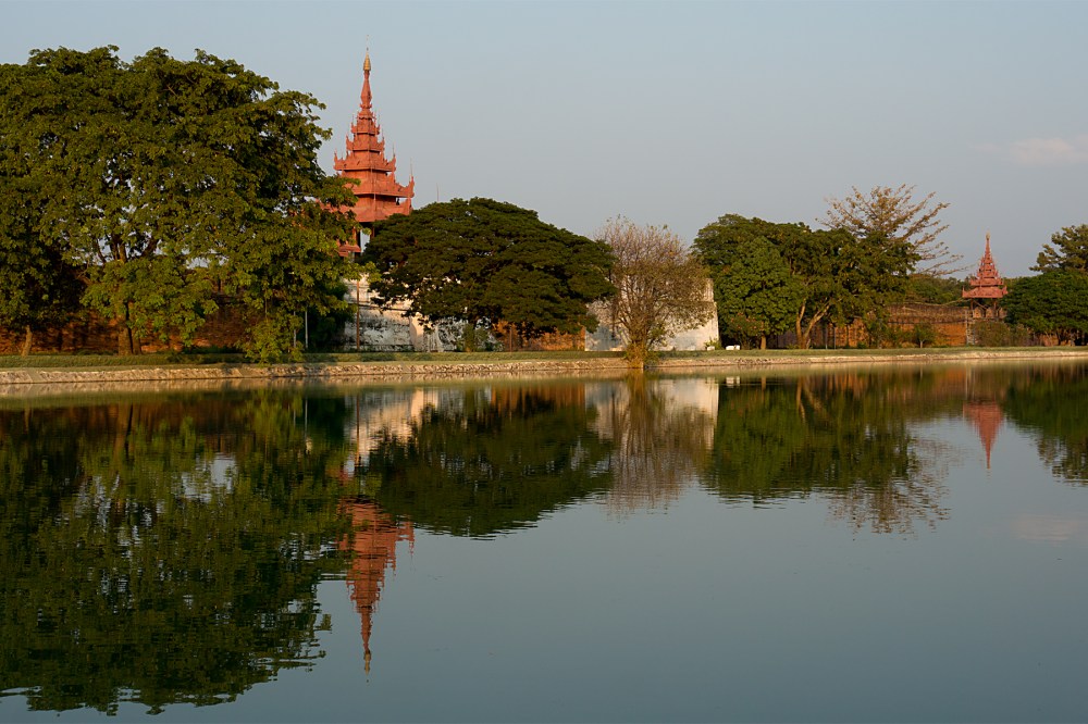
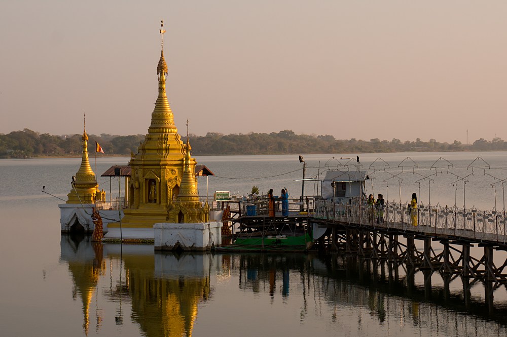
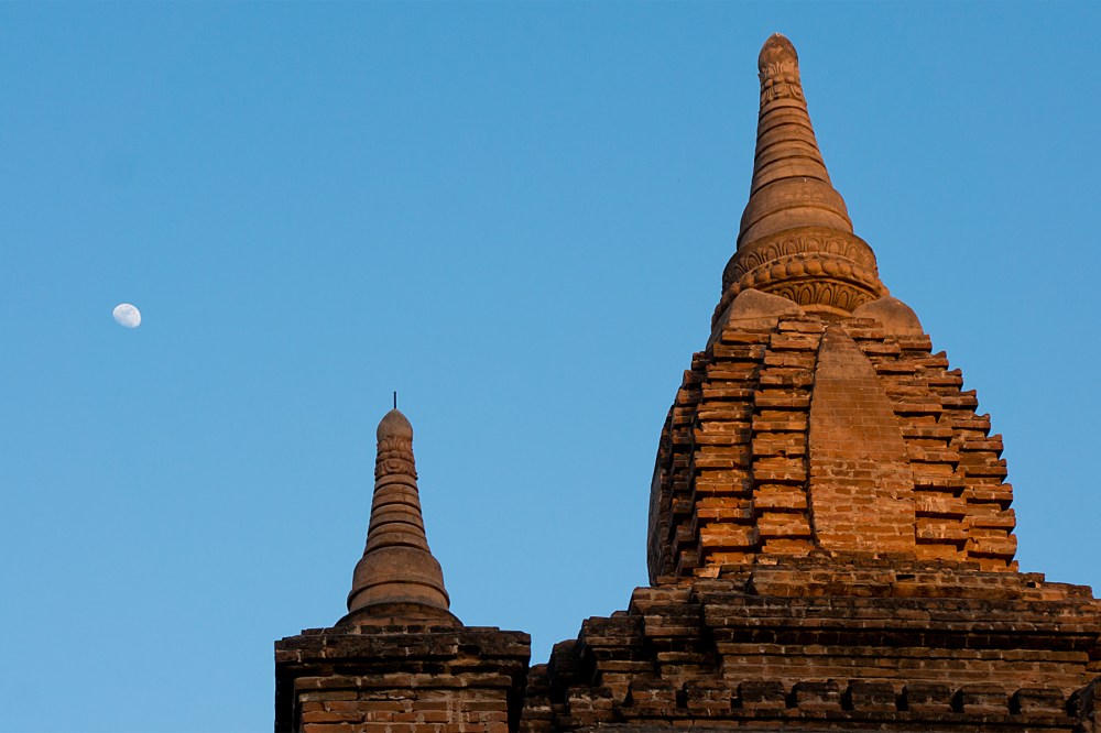
Well, to be honest, it’s much the same as the first time.  But with better roads.  Long, flat miles, unchanging scenery, sweat and dust.  A few interesting temples and imperial relics (and kite flyers, below) in town centres.  A third (so far, but I suppose you never know) non-activated SIM.  Oh, and headwinds, for a ‘nice’ change.

IMG_1048 Edit

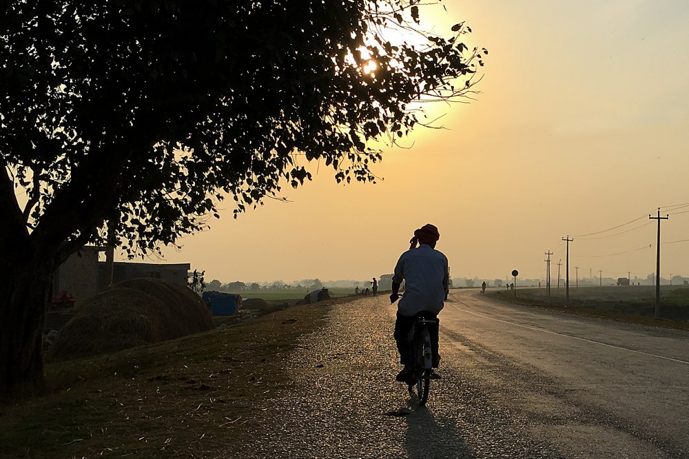
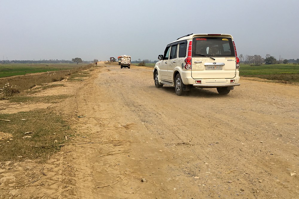
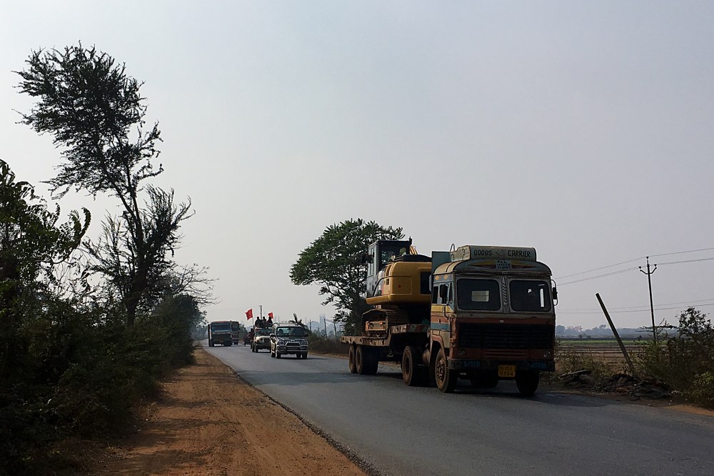
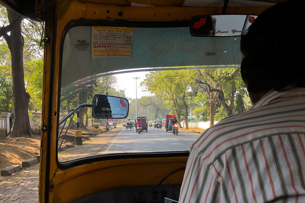
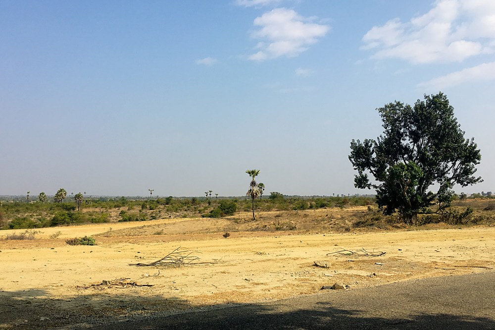
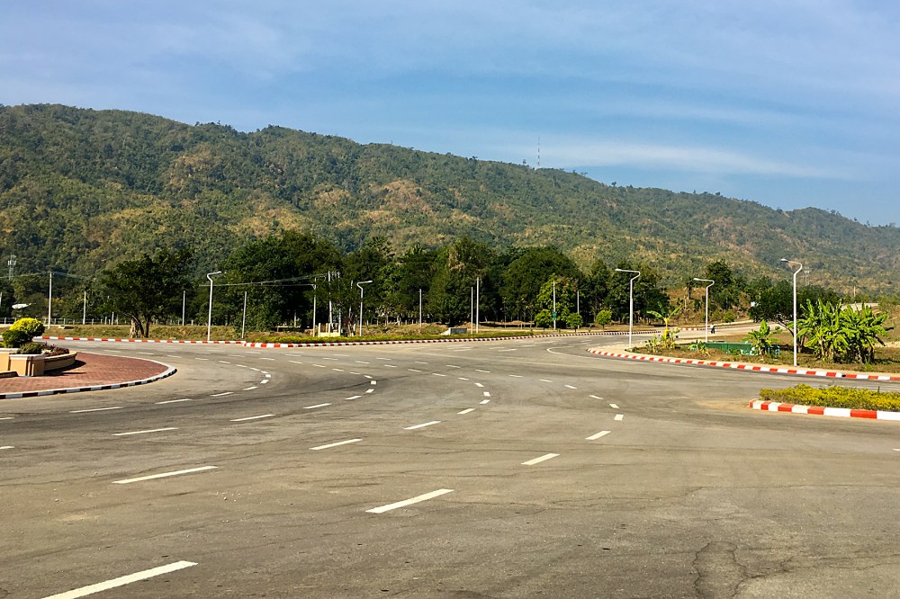
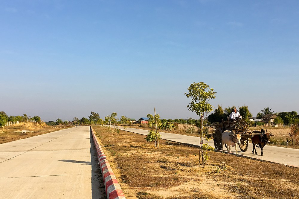
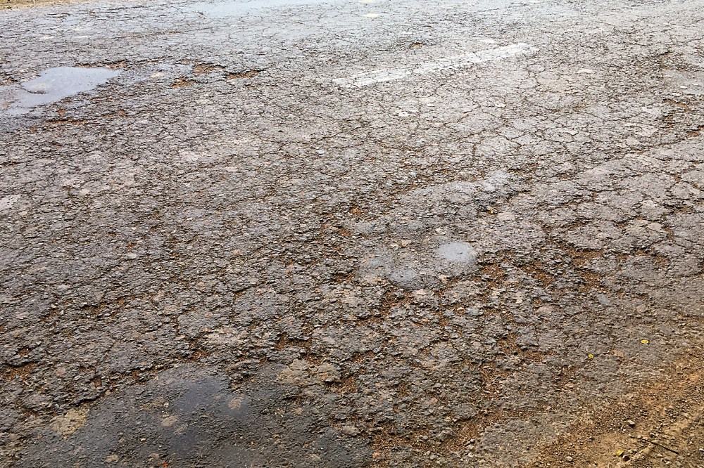
The main roads which I’m following have the great merit of being flat and smooth.  If you were looking to set round-the-world cycling records, heading along here (with the wind, rather than against it) would be a good way to get your 200+ kms a day.

I’m not, of course, trying to set any records.  So for me, it’s more a case of trying not to lose concentration.  Because the second the long, straight road lulls me into relaxation, a piece of Indian driving insanity is likely to cause me significant amount of grief.

IMG_1055 Edit

It’s a bit like that famous definition of war; long periods of boredom, punctuated by moments of sheer terror.

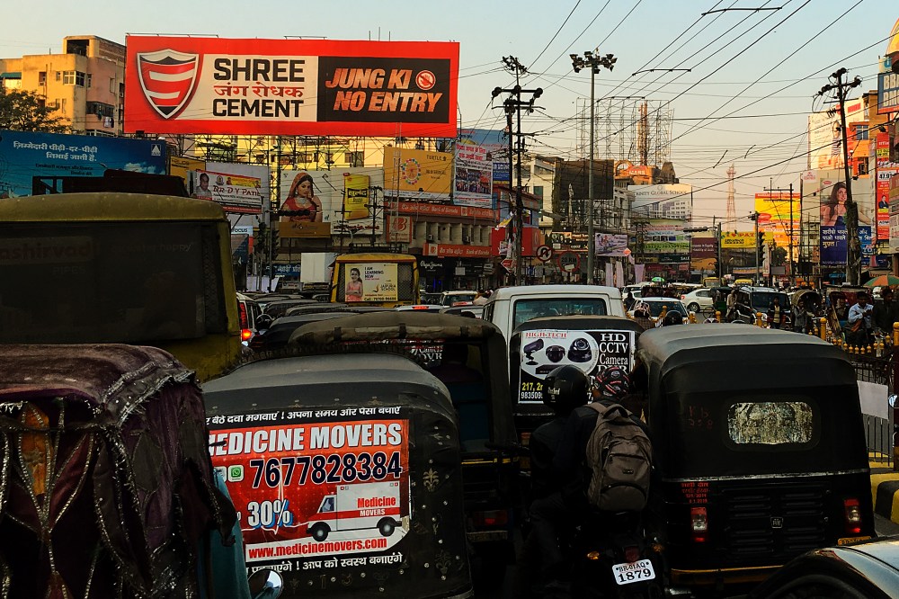
I think I’ve sorted out the ‘rules’ of the road here, now.  Which is helpful, if not exactly encouraging.  Essentially, it’s all about the horn.  And I haven’t got a horn on the bike.

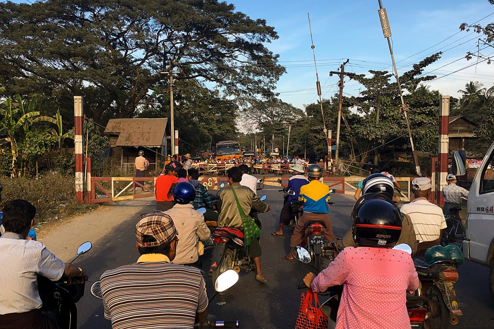
If you hit the horn, you are in the right.  It doesn’t matter which level of motoring insanity you’ve just descended to.  It doesn’t matter if you’re doing things (like driving a car the wrong way down the fast lane of a dual carriageway) which would get you imprisoned in most countries.

If your hand is on the horn, you can do exactly what you want, and expect everyone else to get out of the way.  Or die.  And, best of all, you get to stare aggressively at people who have the temerity to remain on their own side of the road, minding their own business, while you try your best to kill them and yourself.

IMG_1050 Edit

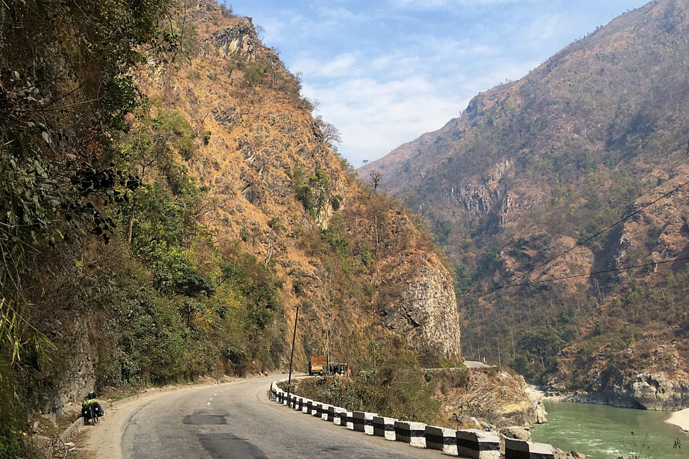
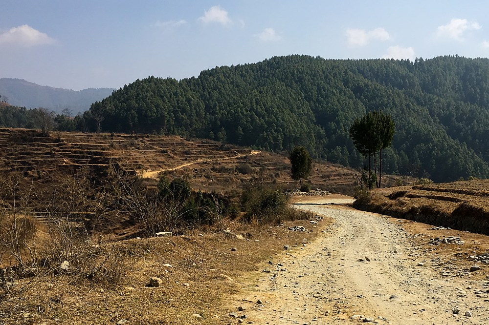
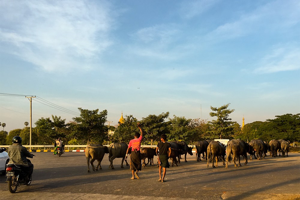
For the last few days, the trick to keeping myself alert (and therefore alive) has been cows.  Uttar Pradesh, which is the region I’ve been traversing since crossing the border from Nepal on Friday, seems to have a lot more of them than the other parts of India I’ve been.

Yesterday, I had the privilege to witness a lengthy tug-of-war between cow and man at a large roadside cattle market (above).  But I’ve also seen cows in vans, small cows in rickshaws, and cows wandering across the highway (relying on bells, rather than their horns, strangely).

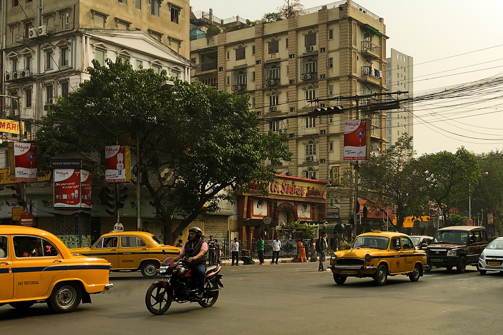
And, of course, there’s that classic Indian ‘cows lounging in the middle of the street in the city centre’ thing going on, too:

IMG_1059 Edit

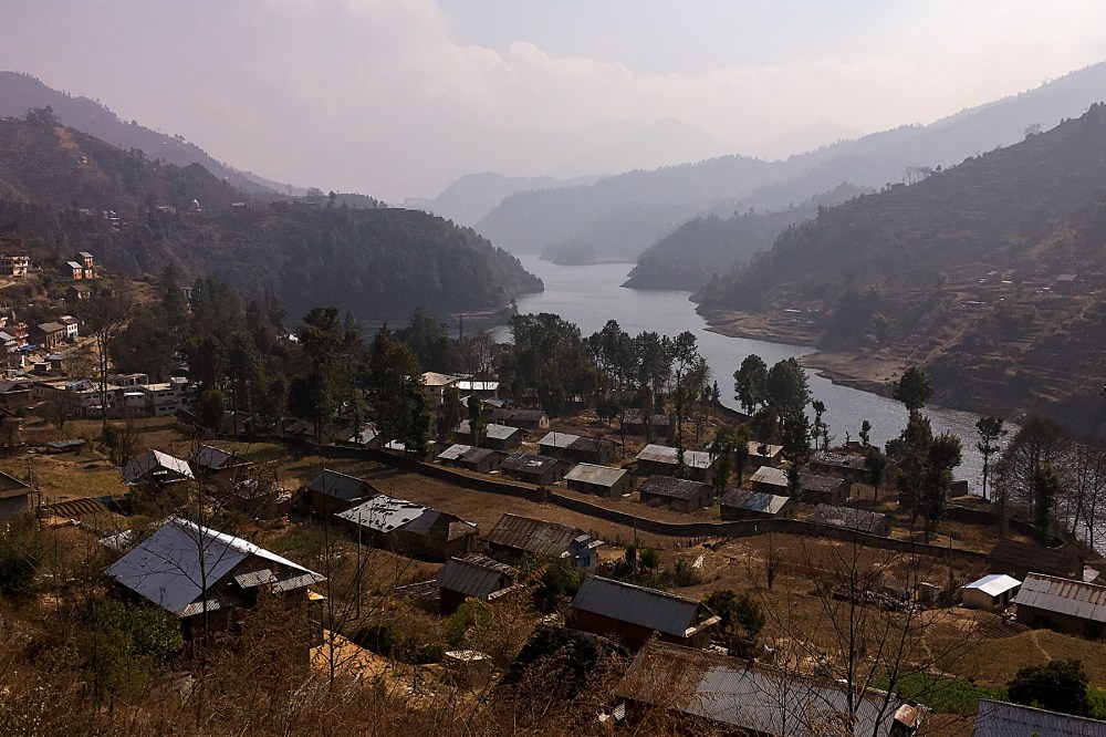
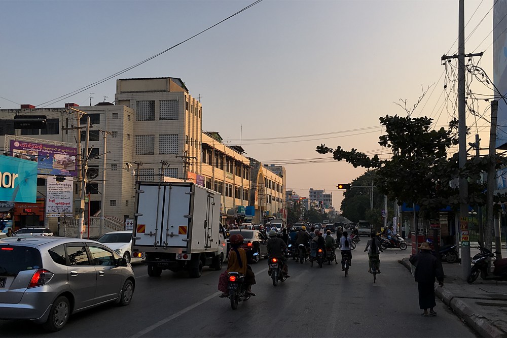
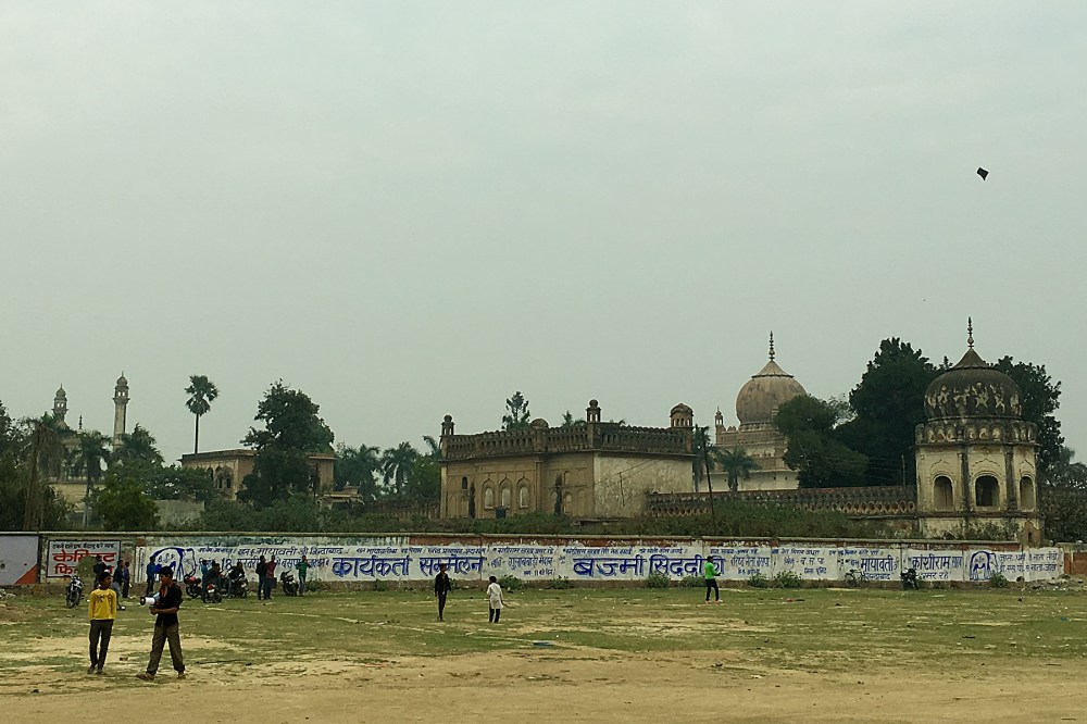
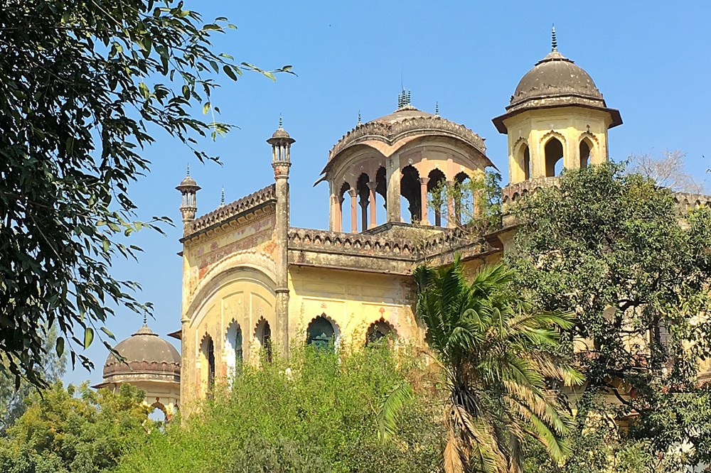
I’m in Lucknow at the moment, which is the biggest city around here by a margin.  It’s a major centre in northern India, home to about a million colleges, a large Muslim population, and stacks of historic buildings, running right through from the Mughal Empire to the British Raj.  It’s actually a really interesting town to stroll around (once you’ve reminded yourself that you’re not a pedestrian in Nepal any more).

IMG_1063 edit

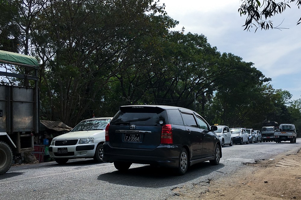
From here, the road should remain flat and smooth all the way to Delhi.  Hopefully, the headwinds will give it a rest for a day or two.  No doubt the driving clowns will still be out in abundance, but there’s another possible cloud on the horizon.  There’s a lot of civil unrest just to the north of Delhi at the moment, which The Times of India says has spread around the country a bit.

The main road to Agra (which I’ll be taking) was blocked for a few hours yesterday.  And most of the highways to the north of Delhi – towards Amritsar, which is my final target in India – have been disrupted by protests too.  Apparently, the water supply to Delhi’s been interrupted, too; it’s clearly all kicking off.

This is one situation where being on a bike may work to my advantage.  There are still a few days before I get to Agra, and another few from there to Delhi.  So there’s a chance that things will have calmed down up there by the time I get that far north.

I’ll just have to wait and see whether this ends up affecting things or not.  With a bit of luck, a change of plan won’t be required, but I’m not going to know for a while.

In the meantime, it’s back on those crazy, dusty roads tomorrow (Tuesday).  Wish me luck!

Coming Down the Mountains

With the after-effects of that dodgy high-altitude chicken masala still haunting me as I rolled out of Kathmandu, I could have been forgiven for taking it a bit easy on the way back down to the plains.

So I did.

There’s no point in hammering yourself when you’re not 100%, and I’d lost a lot of energy.

IMG_0990 Edit

Nepal’s not the most difficult country if you want to slow down a bit and enjoy the scenery.  After just a few kilometres of gentle climbing on the main drag out of Kathmandu on Monday, I tipped over the pass (above), and had about 1400 metres of altitude to drop off before flattening out on the approach to the Indian border.

It’s not quite as easy as it sounds.  I was still in the Himalayas, after all.  So although there was all that height to drop, there were still quite a few climbs to deal with as the road contoured around valley sides and gorges.

And, despite being foothills, these are not exactly small.  Hopefully, you can get an idea of the scale from the size of the bike in the picture below.

IMG_1014 Edit

Given their proximity, and close economic ties, Nepal and India don’t seem to have a great deal in common.  Nepal loses on economic development (apparently, although it doesn’t feel any poorer than India), but wins on scenery, cleanliness, mobile internet access, traffic levels, chocolate availability, driving skills (marginally), the general level of English spoken, having bikes with gears, and having pavements to walk on in town.

But there is one area where both countries are on a par.  Unannounced, unsignposted, major roadworks.  As I headed down to Bharatpur on Tuesday, I suddenly hit a roadblock.  Loads of irate locals, trucks, buses and all, piled up at a barrier.  There’s only the one road to Bharatpur, so this was a bit of an issue.

It turns out that the highway is shut in both directions from 11 until three every day.  At three, the traffic tsunami at each end is released to smash together somewhere in the middle.  Probably right where the roadworks are.  This didn’t seem like a great idea.  Fortunately, after discussing with a few locals (and promising to carry a couple of them on the back of the bike – I think this was a joke), the fierce guardian of the gate agreed that it would be a tad dangerous to be caught up in the three o’clock stampede.

So I got to ride the valley road pretty much by myself.  This was good, because it was a rather nice valley to ride:

IMG_1022 Edit

After Bharatpur, it was more-or-less back to flat country.  Yesterday (Wednesday) gave me a chance to see if I’d fully recovered from the stomach bug, as I put in the first 100 km ride for a while to bring me to the border.  It went OK, although I still don’t think my energy levels are quite back to where they were.

Just one last big hill, which gave me one last Himalayan downhill to smile about as I headed onto the plain, in company with some of the many bicycle commuters of southern Nepal.

IMG_1041 Edit

Today is another rest, and a chance to refuel and look forward to heading back to India.  A few more decent roads and a little less dust than the eastern side of the country provided would be a good start.  And I’m going to give them one more chance to sort me out with mobile internet.

With the Taj Mahal and Delhi on the route for the next section, there should be a good chance for India Part 2 to improve significantly on Part 1.

Assuming the border presents no more problems than it did on the way into Nepal, I’ll start to find that out tomorrow…

Rocky Roads

It’s about 30 miles from Hetauda to Kathmandu.

That’s in a straight line, obviously.  Which is probably why someone invented helicopters.  Because by road, on a bike, it proved to be a bit of an ordeal.  On several levels.

A lot more than 30 miles.  A lot of climbing.  A lot of extra effort occasioned by more Google Map deficiencies.  A nice bit of food poisoning.  And a slightly scary ride in a 4×4 (I know that’s cheating, but read the circumstances before you judge me!).  All these good things were squeezed in before I finally got the chance to have a look around Kathmandu today (Saturday).

The helicopter would have done it all in a few minutes with none of the drama.  But that would be to miss all the fun, I suppose.

I’d better start at the start.  With the climbing…

IMG_0929 Edit

There are a few hills in Nepal, as you might be aware.  The climbing started pretty much immediately as I left Hetauda on Wednesday.  To get to Kathmandu from there, you need to clear the ‘small’ front range of the Himalayas.  Which means you just have to ride straight up the main road to the pass.

‘Up’ is the operative word here.  The pass is at nearly 2500m, and it took all day for me to crawl the 50 kms to the top.  I was taking it relatively easy, given that it’s by far the single biggest hill that I’ve tacked loaded, and also given the altitude.  I’ve not been near those heights since the Rockies.

Plus, I was heading to the most over-priced accommodation I’ve yet stayed in on the whole trip.  And it was just a mile over the top of the pass.  So getting up there at dusk was fine.  I was quite pleased with the day as a whole.

IMG_0944 Edit

It was dark by the time I got to my room for the night.  The temperature dropped like a stone as soon as the sun set, and there was frost all over the bike by the time I headed for dinner, wrapped up in my down jacket.

Dinner was a little disappointing (at the time I ate it – it became progressively more disappointing over the next two days), and, despite the sub-zero temperatures outside, there was no heating in the room.  I spent the rest of the evening tucked up in bed, alternating between watching TV and watching my breath condense in the air inside the room.  And wondering why I’d been stupid enough to stump up $60 for one night’s B&B in this hole.

There was a rationale to the madness, but it wouldn’t become apparent until morning.

When it did, it looked like this:

DSC02437 Edit

There aren’t that many places in the world where you can get a view like that.  The high Nepalese Himalayas rolled out across the horizon.  A pretty stunning start to the day.

And, of course, starting Thursday at 2400 metres high, with my finishing point being Kathmandu at only around 1200 metres, meant that it would be pretty much all downhill from there.

It was.  Just not quite in the way I expected.

My stomach was feeling a little iffy in the morning, but that was soon forgotten in the plunge down into the valley.  There was just one decision to make on the way down the hill; which way to go over the smallish last ridge before the capital.  The eighty-odd kms and bit of climbing on the main road.  Or Google Maps’ preferred option, the sixty kms and a bit more climbing via the northern tip of Lake Markhu.

Twenty-odd extra kilometres vs 100 metres of extra climbing.  Main road or lake view?  Got to be the shorter route, hasn’t it?  Smaller road, so less traffic.  Probably nicer views.  Less distance on the highway into town at the end.  And, of course, it’s where Google advises you to drive your car, so the road must be reasonable, mustn’t it?

IMG_0962 Edit

One question.  What on Earth are you thinking, Google?  This is not even a road.  It’s a track.  A particularly rough track, too, I can say with the benefit of painful experience.  A rough track that reduced me to walking pace.  I should have stuck to the main road.  Google should have told me to stick to the main road; it’s clearly farcical to suggest that this goat track could be quicker than 20 extra kilometres of tarmac, whatever vehicle you’re using.

And whatever state you’re in.  My already incredibly slow progress up the goat track was shortly brought to a shuddering halt by an urgent call of nature.  My first emergency, al-fresco, number two since I was a student.  Not great given that I was already going to struggle to make Kathmandu by dark.  But at least the lake was pretty.

IMG_0963 Edit

I was feeling weak by three-thirty.  Roughly two-and-a-half hours of daylight left.  A three hundred metre climb on sand and rock immediately ahead.  Followed by a thousand metre decent on the same surface.  No prospect of making more than seven or eight kph either up or down.  A policeman who said that all the transport out to Kathmandu was gone for the day.  This could be a big problem.

The hill was unrideable on a loaded bike.  I began pushing, knowing it was hopeless; there was no way I was making it to town, and more importantly (I have a tent, after all), to a toilet, by nightfall.  This was going to get messy.  Literally.

Then, miraculously, I heard a diesel engine behind me.  It was a 4×4 pickup truck.  The kind that are often shared taxis hereabouts.  I waved.  He stopped.  I looked.  Two in front, three in the back seat, two in the load area already.  Was there space?  It would be touch and go.

A couple of minutes later, I was in.  I didn’t argue about the price.  It didn’t matter.  We rattled off up the hill, not a huge amount faster than I was pushing, but definitely a bit.  Me in the back seat with three others (a bit tight, to be fair), the Beastlet in the load area along with the two other guys.  I’d got the last spot.  I was happy.

I was right to be happy, but wrong to think I’d got the last spot.  By the time we reached journey’s end at the highway, we’d picked up a lad with a broken leg (he’d fallen off the road on his scooter, probably down to believing Google again), and three girl hikers who weren’t going to make it down before dark.  So as we slithered down an increasingly muddy track towards town, the pickup contained 13 people, one bike, and a couple of crates of what might have been fish.  Remarkable.

I’ll cut the rest of this (mercifully) short.  I got out of the truck, and pedalled for my life towards town.  I made it to the hotel in Kathmandu with about ten minutes to spare before intestinal armageddon.  I spent yesterday (Friday) shuttling between bedroom and bathroom so frequently that I wore a groove in the floor.

And today, I resorted to the nuclear medicine option, which seems to be holding things together for now.  So I went for a stroll around Kathmandu.  A beautiful city, which still bears a lot of the scars from the recent catastrophic earthquake.

20160213RTW_5 Edit

Sadly, while there are only a few signs of damage elsewhere, the historical centre took a proper battering.  Many of the old buildings are unsafe, and nearly all are propped up with scaffolding.  Some of the stupas have been reduced to their foundations.  It’s sad, because it’s still impressive.  And it’s hard to imagine how much more so it must have been before the quake.

Visiting the scene of an event like that certainly puts my issues into perspective.  It might have been a ‘challenging’ few days for me, but nothing genuinely awful actually happened.  Nobody died.

And, assuming that the medicine keeps working, I’ll be back on the road tomorrow.  No doubt finding something else to moan about, but actually loving riding a bike in one of the most beautiful countries on Earth.

It’s safe to say that things could be a lot worse…

Kansas to Colorado – the Sequel

To answer the question that I know has been burning in your minds since the last update: no, neither of my Indian SIM cards ever activated.  Hence the long gap between posts, again.

Needless to say, within half-an-hour of crossing the slightly shambolic, but unusually friendly border into Nepal this morning (Tuesday), I had a new, shiny, fully-functioning mobile internet connection.

A tiny, poor, landlocked country can make this work perfectly.  A country with both nuclear weapons and a space programme just messes you about for a fortnight without success.  Go figure…

IMG_0909 Edit

Anyway, it’s not been a bad few days to be off the air.  Almost nothing of interest has occurred, except that the unfortunate rash cleared up, and I developed a rather brutal cough from my daily doses of dust and diesel.

After crossing the Ganges (above) on the way out of Patna on Saturday, there’s been a lot of flat, flat country.  Fields, a few trees.  Then some more fields and a few more trees.  Northern Bihar is just like Kansas was.  Minus the soybeans and sweetcorn, but plus a total lack of driving standards.

Take five seconds to spot the two people in the picture below.  That’s about as exciting as things got…

IMG_0913 Edit

The roads were, at least, of a pretty reasonable quality.  Most of the way.  Nice, quick riding all the way from Patna to Motihari.  Motihari, for the trivia buffs amongst you, is the birthplace of George Orwell.  Who knew?

And then…

IMG_0919 Edit

The short, 35 mile run to the border at Raxaul yesterday was meant to be a formality.  Pan flat, and on an international highway to a reasonable-sized border crossing.  It might become a formality in a few years, once they’ve bothered to finish the road.  For now, it’s an unsurfaced nightmare, meaning that India (Part 1) finished in a cloud of dust and a rattling of racks and panniers.  An all-too familiar feeling for me and the Beastlet.

So, the verdict on India so far?  Nice food and people, but could do better in a few areas.  Like roads, driving standards, pollution, dirt, bureaucracy and (guess what?) internet connectivity for travellers.  Hopefully it will improve when I return for India (Part 2).

Nepal looked much the same for the first few kilometres.  This was fairly unsurprising, as the miles after the border are still part of the same plain as I’d been thrashing across for days.  And most of the lowland population there are ethnically Indian.

IMG_0923 Edit

But as soon as the road started rising into the first ripples of the Himalayas, things started to change.  The air cleared.  The road was a little bit lumpy in places, but not bad at all.  There was hardly any traffic, given that I’m piling up the main highway to Kathmandu.  And the scenery got quite pretty quite quickly, although I’m still very much in the foothills.  The high mountains should be spectacular.

And you can feel the culture change as well.  I’m only 60 kms up the road from India, but the feeling of Nepal is completely different.  There’s a significant wealth differential (India, on paper, is a lot richer than Nepal), so I was expecting the country to feel much poorer.

IMG_0926 Edit

But it doesn’t.  It feels much more relaxed (maybe because of the relatively low population).  And the town where I am this evening, Hetauda (picture above), has an unexpectedly European feel to it.  I had a wander along the smooth, wide pavements this evening.  Yes, that’s smooth, wide pavements!  You can walk around town without risking getting mown down or tripping over an exposed electrical cable!

Families were wandering about doing a bit of shopping or a bit of eating out.  Some drunks were playing in the traffic.  Almost British behaviour…

There’s a bar on the ground floor of the hotel, which feels like a nice cosy pub, and there seems to be more English spoken than in India, too.  And, of course, there are those big mountains looming at the end of the high street.

The Himalayas are just beginning, but I already feel like I’m going to like Nepal.  Now it just has to live up to my impression that it’s the subcontinent’s Colorado to northern India’s Kansas…

The Land of Enlightenment and Salvation

Those awful roads and outrageous levels of dust couldn’t last for ever.

They just felt like they did.

One more day north from Jamshedpur, which got me even filthier than the road there, and things started to improve.

They kind of had to, or I’d have gone completely round the twist by now.

IMG_0879 Edit

The roads smoothed out, and, with the odd exception, have remained decently-surfaced since Ranchi, which I reached on Sunday.  I even found a few small hills to play around on, though the views haven’t been too spectacular (the picture above is about as exciting as the scenery has got).  And I’ve piled on some fairly big miles before another rest day here in Patna today (actually, the first rest was on Thursday; I’ve ended up having two days off here due to the still-ongoing SIM card saga…).

IMG_0891 Edit

While the scenery hasn’t been much of a distraction, the driving standards remain hysterical, and have kept me simultaneously entertained and terrified whenever I’m not on a dual carriageway.  It’s odd that the two German cyclists I met back in Vietnam were shocked by Hanoi’s traffic once they got there.  While Hanoi was pretty ‘interesting’, every large-ish town in India makes it look fairly tame, in my opinion.

My favourite Indian move is the ‘Double-Take, Double-Overtake’.  Usually carried out by a motorcycle with passenger, but can also be committed by tuk-tuk, or car.  You overtake a foreign cyclist.  You stare a couple of times, then slam your brakes on, and dive into the side of the road to let him back past.  Then you re-overtake with the smartphone snapping pictures or video.  Or just waving and shouting.

It’s clearly fun for the locals, but it makes for a few more mobile chicanes than I really need to be dealing with, given the general driving standards here.

And I never got driven right off the road in Vietnam.  I’m at 11 times and counting so far in India.  You definitely need your wits about you here…

IMG_0893 Edit

Still, mainly larger roads brought me into the state of Bihar on Tuesday.  A state with the best slogan I’ve seen in ages: ‘Welcome to the Land of Enlightenment and Salvation’.  A lot to live up to.  From what I’ve seen of Bihar so far, it actually seems to be the Land of Small Brickworks (pic above), at least in the more rural parts.

IMG_0897 Edt

I rolled into the state capital, Patna, on Wednesday evening (or, at least, pushed and scraped my way in through the gridlock), with the prospect of a day off and another attempt to get a working SIM card on the agenda.  As I said, it’s ended up being two days off, partly because of yet more comedy registration issues at the mobile phone shop (and no, I still don’t have a working phone, eight days after I got my first SIM card!).  And partly because I’ve developed a weird heat rash which seems oddly reluctant to go away.  I don’t really want to push on too far from a major city in case it gets worse, though it seems to be improving a bit now.  Fingers crossed.

20160204RTW Edit.jpg

In any case, I’ve made it to the Ganges, India’s sacred river.  The picture above is just the arm of the river which runs closest to Patna city.  The whole thing is apparently somewhat bigger.  I’ll cross it when I leave here.

Even with the extra day off, I’m still making decent time.  It should only be a couple of days from here to the border with Nepal, which I understand will provide a little more in the way of scenic views.

And just a wee bit more climbing…

Bumps, Fibs and SIM Cards – An ‘Interesting’ Intro to India

I don’t know why some people lie.

I was on a long one yesterday; over 90 miles.  All was well until I turned north towards Jamshedpur.  The road had got steadily narrower ever since Kolkata, but had been lovely and smooth throughout.  It was probably getting a little too narrow by lunchtime; diving off the road to avoid overtaking lorries was already getting a bit old.

IMG_0861 Edit

But I was going fine.  About 90 kms still to go.  I should have been OK to get to Jamshedpur just before the sun went down (which happens ridiculously early here; clearly yet another country of morning people).

Then it all fell apart.  The tarmac cracked a little.  A couple of holes appeared.  Then more.  The traffic slowed down and started to weave (a little iffy when it’s that narrow).  After a while, you couldn’t even call it potholed any more; there was nothing flat to define where the holes weren’t.

Clunk, rattle, stop to clip the panniers back on the rack.  Repeat endlessly.  Grrr…

20 km later, a minor miracle.  A road surfacing crew, and pristine tarmac beyond! Happy days!

10 km later, a stop for a drink.  A man coming the other way in a car.  He stops.  We chat.  He confirms that it’s about 60 km to Jamshedpur, and that there were about three hours of daylight left.  Still tight, but on the beautiful new tarmac, it should be OK.  I ask how the road is.  The man confirms that the smooth track runs all the way to the city.

He lied.  Big time.

Ten minutes down the road, I passed a decent-looking guesthouse.  I could have stopped, but I knew I could make town, because I’d been told that the road was good.  Half an hour down the road, the roadworks began.  Potholes, followed by dusty gravel, followed by more of the ploughed surface I’d been struggling with before.

I rolled into Jamshedpur about an hour after dark.  Looking like this:

IMG_0866 Edit

I don’t think the lies are meant to be malicious.  I think people here might just not like telling you bad news.  I hope it’s just that, in any case.  Because there’s a bit of a pattern developing.

It’s been a while since I arrived in India, after all.  Why no updates?  Well, there’s another fib involved in that.  But first things first…

IMG_0859 Edit

I arrived in Kolkata (Calcutta) in the very early hours of Tuesday morning.  After a hair-raising introduction to Indian driving tactics in an antique Ambassador taxi (like the ones above), and a nice long sleep, I was up and about around lunchtime.  As with everywhere else I go, I went straight out to have a look at town, and get a data SIM, so I could get some reliable internet access.

Tuesday was Republic Day, so most of the shops were shut.  This was bad news.  After a while, I found a little place plastered in advertising for a mobile phone company.  The sort of place that had sorted me out with instantly-functioning SIMs in Indonesia, Thailand, Vietnam, Laos and Myanmar.  Great.

He sold top-ups, but not SIMs.  The place across the road sold them.  But not to foreigners.  They said I’d have to go to an official store, for registration purposes.  But the official stores were closed until Wednesday.  This was my first inkling that it’s almost impossible for a travelling foreigner to get a working SIM card in India.

So, I went to have a look around town, and watch some cricket in the park.  Which was nice.

20160126RTW_4 Edit

Cutting a very long story short, two days later I finally had a SIM card in my phone.  But, having been told when I purchased it, that it would be activated within two hours, it’s now over 50 hours, and it’s still not showing any sign of working.  Another lie.

Grrr.  Again…

So, three official shops in three cities; one was closed, one sold me a duff card, one couldn’t help because the card was bought out of town (don’t ask why, it doesn’t make sense).  Mind-boggling levels of bureaucratic nonsense.

While there’s only half a chance (at best) that I’ll get proper communications back before I get to Nepal, I’m pretty sure that there’s every chance that the roads will remain a bit interesting (at least away from the nice, smooth major highways).

IMG_0870 Edit

On the plus side, there’s also every chance that I can continue to gorge myself on curry.  Also, to add to the scary taxi drive, I’ve had the opportunity to get the more outdoor version of town-driving craziness on the back of a scooter and in a tuk-tuk (I know that’s the Thai word, but I can’t remember what they’re called here).  The temperature’s about 5C cooler than Myanmar, too, so the riding is a little easier.

And, once again (and even including the fibbers, who seemed nice at the time), people here are really great.  Not quite as smily as the South-East Asians, but friendly enough, and helpful with directions etc.

And they really seem to like bikes over here.  The Beastlet is getting stared at, prodded and admired every time I stop for a drink.  It’s getting a big head, which will only be truly justified if it continues not to break on the roads for another few hundred miles.  It’s doing well so far, but I do worry a bit.

Anyway, until I stay somewhere else with wifi (wifi that actually works is a bit of a rarity), or until the SIM card miraculously activates (some hope!), that’s it from India for now.  An interesting start.

It would be nice if things got just a little bit smoother, though.  And if I could get a blog post with pictures uploaded in less than two hours…

To Mandalay, and Beyond

Well, that’s Myanmar done, then.

Due to the whims of international flights (primarily down to the fact that there aren’t many out of Myanmar) and pricing, I find myself briefly in Bangkok this evening, en route for Kolkata (Calcutta) in India tomorrow.

I’m a bit sad to be finished with Myanmar, to be honest.  Dodgy road surfaces apart, it was a really interesting place, with truly lovely inhabitants.  And I never did work out some of the odder aspects of the country.  Especially what the point of Nay Pyi Taw is…

IMG_0838 Edit

Still, as I rolled out of beautiful Bagan on Thursday, beginning the last hundred miles or so of the long road to Mandalay, there were already a few thoughts running ahead to India, and what I’ll find there.  I think this was partly influenced by the landscape, which had got much dryer and more scrubby than it was in the south of Myanmar.  More like what I (probably inaccurately) imagine India will look like.

I was also slightly haunted by the nagging feeling that I should be riding to India, rather than flying.  The German guys I met in Vietnam had made it through the high mountains of India’s far east, and entered Myanmar overland.  I should really be doing the same in reverse, shouldn’t I?

I still feel that I might be missing out a little, but there are (I hope) fairly sound reasons behind the decision to fly for a little bit.  The north-eastern states of India have ongoing issues with Maoist insurgents (how old-school is that?), and the UK Foreign Office, probably over-cautiously, advises against all but essential travel there.

That wouldn’t necessarily be a problem in itself (I’m fairly sure the FCO would advise everyone just to stay at home if it could), but it tends to affect the willingness of travel insurance to cover you.  And, having required repatriation to the UK not so long ago, I’m not sure I’ve got the appetite for risk required to enter a low-level war zone uninsured.

Plus, there was a fairly major earthquake just a few weeks ago, centred on Imphal, the first big town across the border.  So after a fair bit of umm-ing and ah-ing on the way up Myanmar, the short hop to Kolkata seemed the better option.

Possibly a little cowardly, but there you go…

In any case, I had to finish Myanmar first.  The road toward Mandalay proved to be decently surfaced and full of cycle tourists.  Well, it had three other cycle tourists on it while I was there, and that’s pretty much a crowd.  On my very last day’s riding in the country, I met Alastair and Rachel (from London) in the morning, having stayed in the same hotel, and then I caught up with a French girl on her second-ever day of touring later in the day.

Whatever Kipling wrote about the ‘Road to Mandalay’ that made it so famous, it’s certainly true that (on Friday at least) the road to Mandalay is where the touring cyclists play.

IMG_0852 Edit

Mandalay itself has the great benefit (especially after the confusing nothingness of Nay Pyi Taw) of being a proper city.  ‘Bustling’ would probably be the appropriate adjective.

It also has the unparalleled tourist attraction of the best precariously-balancing-keepy-uppy-lady (as I believe the name of her act translates) in the world:

20160123RTW_1 Edit

Through a remarkable coincidence, I ended up watching the stool-climbing and bamboo-football-juggling display with Alastair and Rachel, who’d (entirely independently) turned up to stay at the same hotel as me again.  Even more remarkably, it turned out we were on the same flight out today.  So I got to see people over a longer-than two-day period for the first time since Vietnam.  And, even better, we got to irritate the airline staff with three bikes rather than just the one.

It’s hard to imagine more excitement, I know.

But I did manage a couple of exciting round-the-world milestones on the way to Mandalay: 11,000 miles for the overall trip so far, and my vertical climb finally reached the equivalent of 9 times up Mount Everest from sea level.  Phew!

Oh, and if you’ve ever wondered what the end of the road to Mandalay looks like, it looks like this:

20160123RTW_3 Edit

A massive, square red fortress, surrounded by a moat.  I reckon it’s over a mile on each side, so massive is definitely the right word for it.

It’s well worth getting to.  And hopefully, India will be too.  I’ll find out soon enough…

Hills, Temples, Beards and Monkeys

A hot, dry day in central Myanmar.  A thirsty cyclist pulls up at a battered lean-to cafe at the side of a dusty, but surprisingly smooth road.

It’s a quiet day, just before lunchtime, and the owners are happy to see a customer (once they’ve stopped giggling at the sweating mass before them).

Then their toddler starts screaming.  And screaming, and screaming.  The cyclist waves, smiles, pulls faces and removes his reflective shades.  Nothing works.  The screaming just goes on and on, until the poor child is eventually removed to next door by his grandmother.

It’s the beard (the family explained in sign language).

As well as irritating me by its continued presence (it’s close to preventing me from eating properly now), it means small children think your head’s the wrong way up.  Which would be a little scary, I guess.

It’s staying ’til the end of Myanmar, though.  It’s itchy, and probably quite heavy, as well as apparently terrifying.  But it’s saving me a lot of sunscreen.

IMG_0817 Edit

Anyway, it’s been a few miles since the last post.

I never did find the centre of Nay Pyi Taw (if, indeed, it has one).  I entered from the south, crossed the urban area, and left to the north.  Plenty more massive and empty roads (above).  Quite a few imposing buildings in colossal plots of land.  But barely any people, and no city to speak of.  Very peculiar.

Soon enough, I was back on the bumpy highway, and heading through many towns and small villages, all with populations which might well be bigger than the capital’s.  A couple of humdrum and rattly days later, I’d made it as far as Meiktila.

20160118RTW_1 Edit

It’s an unsung little town, but was significant to me for three (I think) very good reasons.  It was rather beautifully located on a lake (above).  It was the point where I left the highway on a long, westward detour.  And it had a giant golden duck in the town centre.

Heading west, away from the highway, I was expecting the roads to get worse.  After all, the surface on the main road was (generally) pretty ropey, so the minor roads were bound to be hopeless, weren’t they?

So it was with some surprise that I found myself cruising along on the nicest road I’ve seen here in Myanmar (except for that lovely Thai highway at the start).  It’s not that the smaller roads are any better built than the highway.  They seem to be exactly the same – tarmac poured pretty much straight onto the ground, and then patted listlessly with shovels.  But the lack of trucks ploughing the road up makes a big difference.

It was great until that kid started screaming…

And so, after a relatively long, but pleasant run yesterday (Tuesday), I arrived at Mount Popa.

20160119RTW Edit

Mount Popa is, for obvious reasons, a very literally big landmark around here.  To give you some scale, the temple complex (on the separate ‘little’ hill to the left of the picture) sits at about 750m above sea level.  Popa is just a bit bigger, as you can see.  And given that most of this part of Myanmar (in fact all the way up from Yangon) is at only around 100-200m altitude, it sticks out like the proverbial sore thumb.

Of course, I’d decided that a mountain-top finish was just what I needed after 100km in the saddle.  Not all the way up, obviously (that would just be silly), but up to the base of the temple rock.  How hard could that be?

IMG_0833 Edit

Well, it was a beautiful location, but the hill was a bit of a beast.  To say the least.  After a few kilometres of gently rising road, the last push to the summit was 350 vertical metres (call it 1000 ft).  No big deal, right?  Even after a longish ride.  With a 40-kilo bike and bags combo.  No big deal at all…

That’s true if the 350 metres is knocked off over 10 km or so.  The issue with Popa is that the 350 metres is reached in only two-and-a-half kilometres.  That’s just 2500 metres.  Or an average gradient of over 14%.  Now, I can do that sort of steepness with the bags on for a short while.  But 10% is about the most I can sustain for any length of time.  So trying to recover on a 7% or 8% section, before another 25% ramp heaves you skywards again, is just ridiculous.  Especially when there are monkeys trying to hitch a ride (or rob your bags) for the last few minutes of the climb.  Ouch!

Thankfully, it’s highly unlikely that I’ll have to ride another hill that steep on this trip.

Because I’ll be very carefully avoiding them.

Of course, there’s a major upside to overnighting high up.  It means that it’s (usually) all downhill the next day.  Today (Wednesday) was an absolute joy.  A steep, twisting descent off the mountain, followed by a fairly constant gentle downhill all the way (well, all of thirty short miles) to Bagan.

20160120RTW_3 Edit

And Bagan is an absolute gem (at least, if you’re into temples, pagodas and ruins).  It’s essentially a large plain between the mountains and the river Ayeyarwaddy (which used to be the more-easily-spelled Irrawaddy).  And the entire area is covered in archaeological marvels, dating back, basically, forever.

I had a poke around this evening.  You pretty much can’t walk for a hundred yards without stubbing your toe on another piece of history.

20160120RTW_10 Edit

And it looks pretty good as the sun goes down.  Well worth the (long) detour from the straight line to Mandalay.

It’s been a good few days, all in all.  I’ve even worked out how to fix a broken pannier with a water-bottle bolt –  a skill which I’m sure will be immensely useful in future.

Now I just need to sort out the scary beard…

Records and the Elusive Capital

It’s been a long few days since Yangon.  Over 400 km.  Two (sort of) records set.  And my first puncture of Part 2.

And yes, punctures are noteworthy enough to get a mention.  That’s only the sixth I’ve had in 12,000 miles of loaded touring.  I like my tyres.

Anyway, most of that mileage has been undertaken on the old Yangon to Mandalay Highway, which essentially runs pretty vertically northwards along the spine of Myanmar.  It’s remained crowded, bumpy, dusty and diesely.  But also flat, which is a bonus.

IMG_0795 Edit

After the excitement of my first day with zero climbing last week, you’re probably salivating at the thought of what other records could have been set in the last few days.  I’ll warn you now that they may also be slightly underwhelming.

The first ‘record’ was set on the first day out of Yangon (Tuesday).  I stopped overnight at Bago.  I’d also stopped at Bago on the night before I got to Yangon.  Which makes it the first place I’ve stayed overnight on two separate occasions.  In fact, if the rest of my planned route remains as it currently is, it’ll be the only place on the whole round-the-world trip to achieve this honour.

Well, I hope that met your expectations.

The second record is marginally more impressive, as I managed to put together the longest day I’ve yet done on Wednesday: 101 miles (162 km).  And all because of another glitch in the world of online maps.  They really don’t seem to have Myanmar dialled in properly yet.

It was hot, dirty and bumpy, but I did get to meet Marisa and Jiri, an Austrian / German couple, who were heading in the opposite direction.  We had the usual long-distance cyclists’ comparison of notes before they headed south and I headed on north.

After those hard miles, it was great to finally find the first of the smooth, empty highways I was obsessing about last time.  It’s the ‘Expressway’ between Yangon and the new, artificial capital of Myanmar, Nay Pyi Taw.  For some reason, while running parallel, and only a few miles apart from, the old highway, it’s barely used.  Maybe the tolls are too high, or something.

Unfortunately, it was only about 20 km of beautifully smooth dual carriageway before I had to turn off.  And the road (also kindly recommended by online mapping) suddenly looked like this:

IMG_0800 Edit

Still, I was well on the way to Nay Pyi Taw by then.  If you haven’t had enough of Myanmar’s oddities yet, Nay Pyi Taw is a classic.  The country had a perfectly good capital, Yangon, but the government decided to move to, essentially, the middle of nowhere.  They built several dual carriageway ring roads, and masses of hotels, conference centres and so on.  It covers a truly massive area.  I think they expected that everyone else would follow them here.

Nobody has, yet.

IMG_0807 Edit

This was one of those ring roads this afternoon.  Again, beautifully smooth.  With absolutely nothing on it, except for me and an ox-cart (or are they buffaloes? Some research required…), which was on the wrong side of the road (so clearly not expecting to face a huge amount of oncoming traffic).

I arrived in the city itself just after five this evening.  I’m about a mile from the city centre, apparently, although I’ve not seen it yet.

But this is what the Friday afternoon rush hour looks like in Nay Pyi Taw:

IMG_0811 Edit

Yup.  An entire herd of buffalo (or oxen?) crossing the main drag.  They would have been holding up the traffic, if there was any.

And so, I’ve apparently arrived at the heart of the capital city of Myanmar.  Anything resembling a city is elusive in the extreme.  But it seems like an extremely odd place, and I quite like odd places.

I should find out more tomorrow (Saturday), as I’m having another rest day.  Recovering from the road before, and looking forward to some more big miles afterwards.  So hopefully, a bit more intrigue and mystery, and a few more smooth and empty highways to come…

Rough Roads to Yangon

I’ve read a bunch of times about the joys of riding Myanmar’s smooth and empty highways.

This worries me.  Because I’ve not found any such roads in this country so far (with the honourable exception first few kilometres of Thai-built road from the border).  And because I have a sneaking feeling that most people are comparing Myanmar’s roads to India’s, having ridden India first.  Trouble is, that’s where I’m going next.

The average Burmese road surface between Hpa An and Yangon looks a bit like this:

IMG_0770 Edit

So if India’s too much worse, I’ll be looking to get some serious suspension for the Beastlet.  Or my teeth will rattle loose before I get to central Asia.

IMG_0773 Edit

The traffic’s varied from ‘interesting’ to ‘lunatic’, but that seems par for the course in Asia.  The trouble here, as in Indonesia, is that the roads are generally much to narrow for the number of vehicles.  A lot of the highways are being widened, to be fair, but a lot of that work appears to be done (literally) by hand, so it may take a while before they improve hugely.

All I can do is hope that the roads will get better en route to Mandalay.  However, I can’t ask that the people improve, as they’ve kept me endlessly entertained so far.  Despite clearly having some slightly uncouth English teachers (the standard shout here is ‘Hey, You!’ rather than ‘Hello!’).

My smiling muscles are having a hard time, again.  The entertainment value is considerably enhanced by the Burmese people’s 1970s attitude to health and safety.  I’ve been cut up by scooters, trying to stop me so they can offer me a tow to the next town.  I’ve watched two young sisters putting plastic carrier bags over each others’ heads as their parents looked on nonchalantly.  And I’ve had to get used to right-hand-drive buses dumping passengers into the middle of the road when they stop.

And the 1970s attitudes even extend to things we used to do at home, back before everyone got afraid to let kids leave the house.  As dusk fell, last night, hundreds of lads were out in the park, kicking footballs around, barefoot in the gloom.  Jumpers for goalposts, anybody?

20160110RTW_3 Edit

I suppose I should point out that I never had to play football barefoot when I was a kid.  And that my football days were probably mostly in the 1980s.

Anyway, for the last 30 hours or so, I’ve been resting up in Yangon, Myanmar’s biggest city.  A bit like Vientiane in Laos, Yangon is completely different from the rural areas I’ve been through so far.  Totally unlike Vientiane, it’s a bustling, high energy, 24-hour sort of place.

There are a few havens of peace in the city noise, though.  There are some nice parks to wander through, and then there’s the Shwedagon Pagoda complex.

20160111RTW_10 Edit

Perched up on a slight hill (there’s been nothing but slight hills for a couple of hundred miles now), the Shwedagon is an absolutely stunning temple complex, built up over hundreds of years.  It made a change to be wandering around somewhere on my legs, rather than on wheels, too.

20160111RTW_39 Edit

And a swift return to the centre, and a nice cold beer on a rooftop terrace, gave me the chance to appreciate the Shwedagon from afar, as well.  A view only slightly spoiled by the mobile phone mast in the foreground, which I guess is a decent indicator of the speed of change in Myanmar.

It’s still a slightly confusing place.  As well as the various unanswered questions I already had about Myanmar, I’ve added one more.  If you rename a country, surely you rename the adjectives and the people as well?  But no.  People in Myanmar are Burmese (that’s the nationality, rather than the various ethnic groups), and the language is Burmese too.  Everything is Burmese except for the country’s name.

Frankly, I’m becoming less and less sure that I’ll get sensible answers to any of these questions before I finish riding Myanmar.  But I’m not sure it matters.  It’s been a great few days so far, and a few more to come yet.  Just hope those roads improve a little bit…