northern ireland

A Circle Formed

Until yesterday (Tuesday), I’d ridden most of the way around three of the UK’s constituent parts, but not all the way around anything. But as I rolled off a segregated bike path into the centre of Belfast, I realised that I was about to meet the Big Fish again, and complete the circuit in Northern Ireland (‘NI’).

I’d spent the previous days in border country. On both sides of the border, in fact, as it’s pretty much impossible to avoid crossing over a few times. At the moment, it makes little difference; it’s all largely rural, there are vehicles from the UK mainland, NI and the Republic on the roads, and the rain showers pursued me regardless of which country I was in.

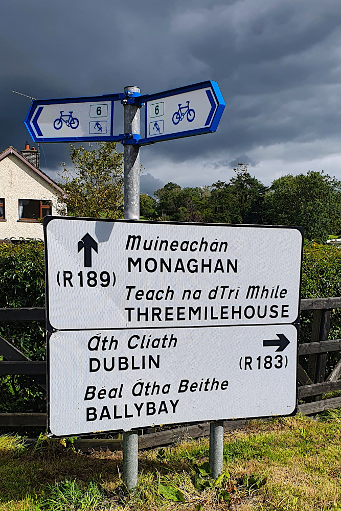
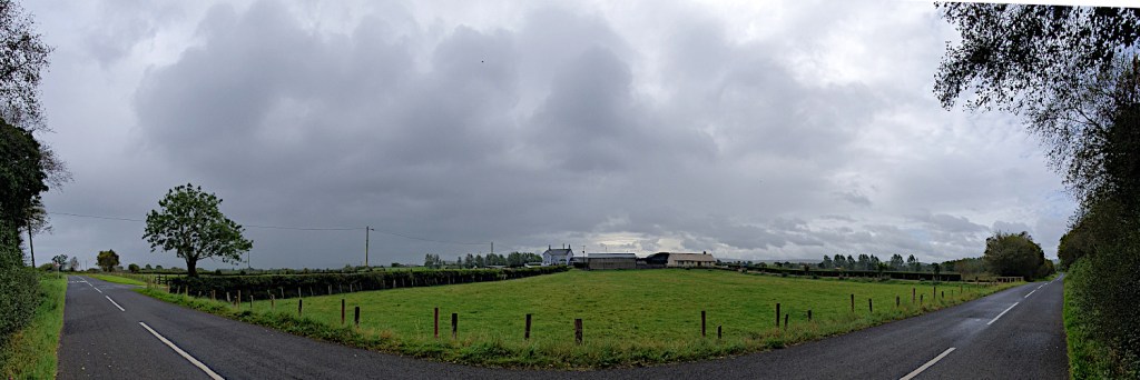
If you ever need the info for a quiz question, the westernmost settlement in the UK is called Belleek, and is a pretty little town between the western end of Lough Erne and the Atlantic. If you have a swift half in the last pub in the UK, and then turn the corner, you’re faced with the border (pic above).

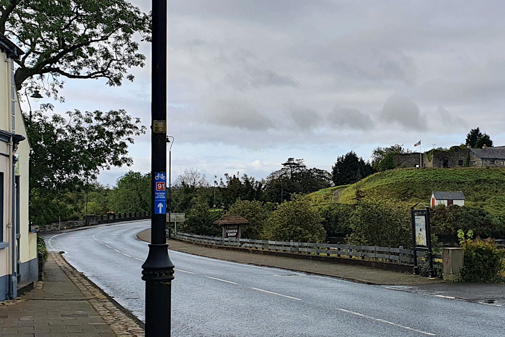
As you can probably see, there really isn’t one. A British cycle route sign points you straight across the international border into Ireland. And 150 metres later, you hit a junction with the main road, and are back in the UK again. Who knows how all this would work if the Brexit negotiations go wrong?

I cut across a somewhat larger chunk of Ireland later that day. County Monaghan pushes the border way to the north, which would have made an awfully long diversion. So I cut across it. Despite some incredibly black clouds floating about close to where I was, I managed to navigate this excursion into ‘abroad’ without too many issues, and popped back into Northern Ireland on the ferry across Carlingford Lough on Monday morning.

Sadly, although I wasn’t getting all that wet, the proximity of rain was definitely affecting the views as I rumbled up the eastern coast of NI. The Mourne Mountains were mostly hidden under clouds, and, although they look quite atmospheric in the gloom (above), it would have been nice to see their full magnificence.

The flip-side of the south-westerly wind that was pushing all the rain my way was a decent tailwind, so I made good progress back towards Belfast. Even the extra wait to cross Strangford Lough (due to the school ferry taking priority for some reason) didn’t hold me up too much.

And so, yesterday morning (Tuesday), I finally located the awfully-signposted Greenway into central Belfast. This is a lovely piece of infrastructure, with a wide ribbon of nearly-new tarmac whisking you through the suburbs before suddenly dropping you off in central Belfast. It needs much better signs, as it took me nearly half an hour in the small town of Comber to find the far end of it, but once again, it’s good to see decent cycling facilities being put into various UK towns and cities.

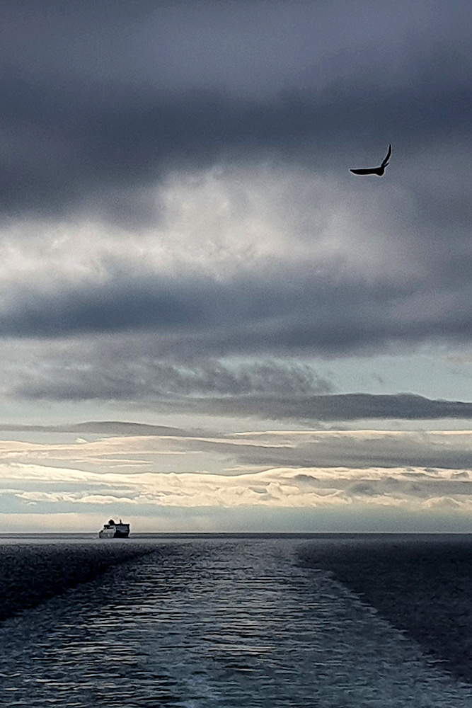
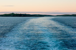
Once I’d met the Big Fish again, thereby completing the circle of NI, it was just a case of retracing my earlier wheel tracks to the ferry port, and on to the Tuesday afternoon sailing back to Scotland, pursued this time not by rain, but by seagulls and competing ferries.

Although I’d have preferred some sort of open-jaw excursion to Ireland, without arriving back exactly where I started, it does at least mean that I get a few more days in Scotland before heading further south, back to England and then Wales.

But with new Covid spikes all over the place at the moment, it’s feeling less likely that I’ll make it back unmolested by local lockdowns or other restrictions. We’ll have to wait and see…

Touring the UK – Map and Stats

After hurtling (relatively speaking) back to Bristol from the top of Shetland in a mere 30 hours, by bike, ferry, train, and bike again, I’ve had a few days off to relax.

And now’s the chance to get a bit of reflection in on the UK tour, before planning begins in earnest for resuming the round-the-world trip in a couple of months (that’s looking like early December now, by the way).  From the Isles of Scilly to Shetland, it was a fair ride, with loads to think about along the way.

20150904RTW_1

I’ll put up a full post-mortem on what went well, what I’d have done differently, and so on, fairly shortly.  It’s also just possible that I’ll finally get around to updating the rest of the pages here to more accurately reflect what’s actually been going on for the last six months or so.

But for now, this is just the bare-bones summary (via a map and some statistics) of my little tour of the length of the UK.

MAP:

Hopefully, the Google maps gremlins of a few weeks ago have given themselves some time off.  This should show the route I took.  The markers show mainly overnight stops, with a few extras to clarify direction or ferry ports etc.

If Google (or even I) have once again failed to deliver any useful information on the map, you’ll just have to imagine it.

And every map needs some statistics to go with it.

STATS:

NB – these are all Bristol to Bristol (i.e. including travel to and from the start and finish of the ride).

Measurements:

Total Cycling Distance – 1814 km / 1127 miles
Total Ascent – 11231 m / 36838 ft (1.27 times the height of Mount Everest)
Overall Toughness Index – 61.91 (100 = Really Tough with bags on)
Toughest Area – Devon and Cornwall (SW England) – Average TI 85.66

Days:

Total Days (Bristol to Bristol) – 28
Full Riding Days – 19
Average Full Riding Day Mileage – 90 km / 56 miles
Rest, Short Ride and Travel Days – 9
Wet days – 2 (which is really quite remarkable for the UK)

20150907RTW_18

Geography and Transport:

Countries Ridden – 1 – the United Kingdom.  Or:
Countries Ridden – 4 – England, Wales, Northern Ireland, Scotland.  And:
British Crown Dependencies Ridden – 1 – Isle of Man
Islands Ridden – 11 – St Mary’s, Great Britain, Isle of Man, Ireland, South Ronaldsay / Burray, Glims Holm, Lamb Holm, Mainland (Orkney), Mainland (Shetland), Yell, Unst
Ferries – 12
Approximate Hours on Ferries – 28
Trains – 2
Approximate Hours on Trains – 14 (a tad longer than flying from London to Singapore)

IMG_0524

Diversity:

Issuers of UK pound-denominated banknotes spotted – 7 – Bank of England, Isle of Man Government, Bank of Ireland, Ulster Bank, Clydesdale Bank, Bank of Scotland, Royal Bank of Scotland (I missed out on the full set; First Trust, and Danske Bank notes – bizarrely, the Danes can apparently print pounds – eluded me in Northern Ireland)

Indigenous Languages Encountered – 6 to 9, depending on what’s a language and what’s a dialect – English, Cornish, Welsh, Manx, Irish Gaelic, Scots, Scots Gaelic, Orcadian, Shetlandic (Orcadian and Shetlandic are basically Scots mixed with Norn, an extinct Norse language)

IMG_0552

Miscellaneous:

Unfortunate Encounters with Trucks – 0
Near Misses with Traffic – 0
General Traffic Behaviour – Good
Dreadful road surfaces – Several, but Ayr (and the towns around it) stood out as actively dangerous to cyclists
Near-Catastrophic Skids due to Sheep Droppings – 1
Canine Confrontations – 1 (not serious)
Illness – just the explosive fish incident in Cornwall
Punctures – 0
Mechanical Problems – 0
Days cut short due to pain / discomfort from Thai accident damage – 1
Ibuprofen capsules taken – 32
Memorials to Russian Warships passed – 1 (and, yes, that’s specifically a memorial for the ship, not the people on it)

IMG_0527

Well, that’s the outline.  As I said above, I’ll post some more detailed thoughts on the ride later.  Those are likely to be fairly positive, due to the lack of any major disasters.  For now, I’ll just point out my clear preference for surface transport over planes.  As I left the Shetlands on the overnight ferry to Aberdeen, I was reminded how getting on a boat to go overseas really feels like travelling.  Far preferable to getting in a little metal tube to pop effortlessly from one concrete-and-glass terminal to another.

20150923RTW_9

And the view’s a little better too…

Ireland Hopping

UK Tour Stage 3 (Isle of Man, through Northern Ireland to Irvine, Scotland):
Cycling Distance – 311km / 193 miles
Ascent – 1960 m / 6429 ft (0.22 times the height of Mount Everest)
Toughness Index – 62.99 (100 = Really Tough)

Total UK Tour Cycling Distance – 1036 km / 644 miles
Total UK Tour Ascent – 6821 m / 22373 ft (0.77 Everests)

My little adventure outside the UK, on the Isle of Man, didn’t last long.

20150907RTW_24
Douglas, the main town, is a nice enough place; a very traditional (Old-fashioned?  Yes, definitely old-fashioned) seaside resort.  Terraces of Victorian hotels, a promenade, horse-drawn trams, and shops that shut at five sharp in the evening.

I wasn’t really on the Isle of Man for its genteel touristic charms, however.  Or its exceptionally low rates of income tax.  There are two things which move a little quicker than the trams, and rank alongside offshore finances as the island’s best-known features.

The first (and slower) of these are some of the finest racing cyclists in the world.  Mark Cavendish and Pete Kennaugh are the current cream of the Manx crop.  I thought it would be good to have a little ride around some of the roads they grew up on.

They’re nice roads, but I’m not sure why Cav can’t climb hills very well:
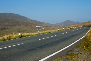
20150908RTW_11
The other fast thing is the Isle of Man TT.  Also on two wheels, but just a little quicker.  If you’ve not seen what motorbikes look like while doing 200 mph on public roads, this video gives you an idea.  I thought it would be good to see how the Beastlet matched up.

I took most of the bags off, and rode up to the top of the TT’s Mountain course (from where the picture above was taken).  It was surprisingly easy, having dropped 20 kilos of weight.  And, having admired the view, I turned around and legged it back down the 400 vertical metres to the TT finishing line as fast as my tiny touring chainrings would allow.  My legs were a blur.

It only took about 15 minutes to pile down the hill.  Which was somewhat quicker than the climb up.  I was quite pleased, as there was a bit of traffic.  But the fastest TT riders are close to 17 minutes for the whole 38-mile lap of the island.  Read that again.  17 minutes for 38 miles.  Hairpin bends, mountain roads, mini-roundabouts and all.  An average speed of over 132 miles an hour (210 kph), and a max 0f 200 mph.  Phew!
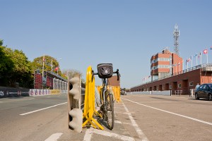
20150908RTW_17
It’s fair to say that I’m unlikely to match that sort of speed pedalling.  And putting engines on bikes is cheating, anyway.  So I reluctantly shelved my racing dreams, had an early night, and awoke in darkness to catch the early boat to Northern Ireland.

I’ve been to the Republic of Ireland loads of times, but never been to the North before.  I guess it’s the same for lots of people my age, as Northern Ireland was, to say the very least, a bit of a mess for most of my life.  It’s a part of the UK which is still struggling with its past issues (to the extent that half the Assembly resigned while I was there).

The armoured police stations with their high fences, watchtowers and cameras are a reminder of the bad old days.  And there are echoes of that past all over the place.

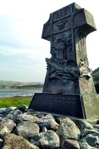
I saw more Union Flags in Northern Ireland than I have anywhere else in the UK, together with red, white and blue painted kerbstones, and war memorials to members of the British army (like the one in Bushmills, below).  There’s not much doubt that people in these areas see themselves as being part of the UK very strongly.

20150909RTW_3
In areas and villages where there were no flags, the school names tended to begin with ‘Saint’, there were Irish Gaelic translations of the road names (add that to the list of languages in the UK), and the kerb stones remained unpainted.

It’s pretty clear that those old divisions (Catholic vs Protestant, Unionist vs Republican) are still there, not so very far under the surface.  Us versus ‘Them’ again…

But things are much, much better than they used to be.  The main terrorist / paramilitary (as usual, it depends on whether they’re on your side or not) groups on both sides aren’t bombing and shooting each other, or the army and police, any more.

I met a local cyclist called Des, who rode with me up a big chunk of a big hill, taking the edge off the gradient and the brutal headwind.  It was a classified climb when the Tour of Italy started in Northern Ireland a couple of years ago, which was some consolation.  Des was around my age, and had grown up with one Catholic and one Protestant parent (I can’t remember which was which).  He told me that his kids don’t believe him when he tells them how things were when he was growing up.

That can only be a good thing.  And I hope it stays that way, because Northern Ireland is stunning.
20150910RTW_8
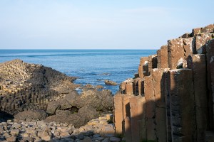
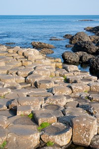
Having spent Wednesday riding up to the north coast from Belfast through rolling farm country, Thursday was spent on the hills and coast of County Antrim.  First stop was the Giant’s Causeway, which is one of the very few places on earth where nature creates straight lines.

It’s actually quite hard to get your head around the fact that it’s not man-made (it’s much easier to understand that it wasn’t actually made by a giant, but don’t tell the kids).  And I managed to get ahead of the tourist hordes, which means that the pictures aren’t full of hiking jackets, which they would have been ten minutes later.
20150910RTW_13
The Antrim coast is beautiful all the way down to the port at Larne, where I was headed to get the boat to Scotland.  It was a hard day’s ride, with a 20 to 30 mph headwind raking the exposed coast once I’d got over the big hills in the morning.  But I wasn’t in a rush, thankfully, so could take plenty of breaks to soak up the scenery; bays and islands to the left, the glens of Antrim away to the right.  Lovely.

20150910RTW_21
I’d highly recommend Northern Ireland on a bike, and I met quite a few tourers on the roads over there.  It’s a beautiful place, there are stacks of sights to see, enough hostels and campsites around, and the roads are much like the Republic of Ireland; small and quiet.  It’s hilly and windy, but that’s par for the course in the British Isles in general.

Another start in the dark, and a slightly spooky pedal through the silent streets of Larne, dropped me down to the ferry for the mainland yesterday morning.  The wind was high by six-thirty (high enough that it managed to blow the bike and bags over when I parked against the fence at the terminal), but it would be pushing me up through Scotland, once I got across the water.

Two hours on the boat, and I arrived into the tiny port of Cairnryan.  Into Scotland, the fourth and last of my UK countries-within-a-country.  And I’m still slightly astonished that I’ve crossed all those borders without showing ID once.

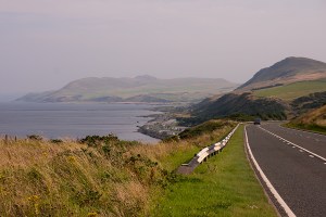
Hitting the coast road north, with the wind at my back, I was running quickly yesterday (Friday).  Progress was marred only by the staggering ugliness of the road, which I kept having to stop to photograph:
20150911RTW_1
This is Robert Burns country; Scotland’s favourite writer (and national hero) was born and died in Ayrshire and Dumfries, and I passed through both areas on the way north.  Which brings me to another British linguistic quirk.  Burns wrote mainly in Scots, but I’m not sure whether it counts as my fifth UK language (I’m disregarding Manx, as the Isle of Man is not in the UK).

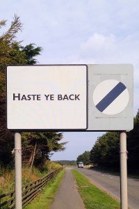
Scots is the language of Burns, and pops up in everyday speech in both Scotland and Northern Ireland (the Ulster-Scots community is strong over there too).  If you’ve ever used the word ‘wee’ to mean ‘small’, you’ve used Scots.  And it’s on the road signs here, too:
20150911xxx
But is it a language or a dialect?  Nobody seems to know.  If you speak English, it’s not hard to work out that the sign above means ‘Come Back Soon’.  Although a really strong Scots accent can be hard to decipher for an English person.  It’s not an official language (unlike Scots Gaelic, which should pop up as I go further north), and most Scottish people don’t think of it as a language.  Even those who identify as Scots speakers.  But it is recognised as a ‘traditional’ language by both the Scottish and Northern Irish governments*.  Once again, it’s all as clear as mud.

One thing that’s definitely true of Scotland, especially in the west, is that it gets a lot of rain.  It’s been hammering down all morning, and after a few hard days in the saddle, and passing the 1000 km mark on the bike, I’ve decided that another rest day is in order today (Saturday).

With a bit of luck, the next few days will be dodging showers, rather than getting soaked, as I pass Glasgow and head on north.  Mountains, lochs, valleys and the mysteries of Loch Ness to come, before I even get to the capital of the Highlands at Inverness.

And no more ferries (I think) until the top end of Great Britain.  Time to focus on the big island again for a little while…

*Thanks to Wikipedia; for the information, and for someone to pass the blame to if any of this is wrong…
Border Country

UK Tour Stage 2 (Bristol to Heysham, Lancashire):
Cycling Distance – 385 km / 239 miles
Ascent – 1949m / 6393 ft (0.22 times the height of Mount Everest)
Toughness Index – 50.66 (100 = Really Tough)

Total UK Tour Cycling Distance – 725 km / 450 miles
Total UK Tour Ascent – 4861m / 15944 ft (0.55 Everests)

Borders are funny things.

Funny in the sense of ‘peculiar’.  And sometimes funny in the sense of ‘not funny at all’.

They’re just (usually squiggly) lines on a map.  Artificial, squiggly lines, by and large.  Created almost at random, by geography, by prehistoric tribal areas, by war, by shifting royal alliances, or by the straight, ruled lines of an administrator’s pen.  There’s often no good reason why they cut through one field, rather than the one next door.  And there’s usually no significant difference between the people on one side and the people on the other.

But then we, our governments, and our media define ourselves against (and it’s pretty much always against) the people on the other side of the imaginary line.  We are good.  ‘They’ are bad.  Our religion is right.  ‘Theirs’ is wrong.  We go overseas to work.  ‘They’ come here to steal our jobs.  We retire abroad.  ‘They’ sponge off our healthcare system.  ‘They’ need to be controlled, or we’ll be ‘swamped’ by a ‘swarm’.

So we build the borders higher, and wonder why desperate people turn to smugglers to help them escape from death or persecution.  ‘They’ must be stupid, too, mustn’t they?  And we scratch our heads in puzzlement, and watch ‘them’ die against our fences.  For years.

Until a picture of a dead child on a Turkish beach reminds us that ‘they’ might be people, just like us, after all.  I wonder how long that little glimmer of truth will last…

As you can probably tell, riding long distances on a bike can give you a bit too much time to think.

20150904RTW_6
Thankfully, the border I was concerned with as I rolled out of Bristol was the border between England and Wales.  It’s been around pretty much since the Romans left Britain, which is quite a while.  The Anglo-Saxons, the English and the Welsh have all fortified chunks of it over the years.  And its history is just as messy as any other border.  Hundreds of years of keeping ‘them’ out of England.  Violently.  But the last couple of centuries have been a bit quieter.

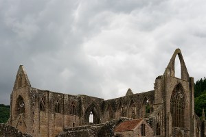
Straight over the Severn Estuary from Bristol, you hit the Wye valley.  It’s a steep, beautiful river valley, with England on one bank and Wales on the other.  The ruins of Tintern Abbey (above) dominate the Welsh side at the southern end of the valley.

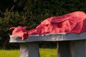
I lost track of how many times I crossed the border over the next couple of days.  Sometimes there were bilingual signs (that’s UK language number three, after Cornish and English) welcoming you to Wales.  The ‘Welcome to England’ signs were all monolingual.  Sometimes, there was a (thankfully) sleepy guard dragon instead of a sign:

20150904RTW_15
And sometimes, I only noticed that I’d swapped countries again when I saw the word ‘SLOW’ painted on the road.  If it just said ‘SLOW’, I was in England.  If it said ‘ARAF’ too, I was in Wales.

As I was approaching Welshpool, after a lovely-but-hilly day through the border area, I saw this signpost, which illustrates how hard it could be to remember how many border crossings had happened:

20150904xxx
It’s bilingual, so I know I’m in Wales.  Chirbury (2 miles down the road) is in England.  Church Stoke (another 2 miles down the road) is in Wales again.  I think that’s right, anyway.

After Welshpool, I headed into North Wales (or at least, in and out of North Wales).  The hills had levelled out, as I was avoiding beautiful Snowdonia, where the big Welsh mountains are.  But there was one more hill I had to climb before I left Wales.

Because I wanted to see the canal boats in the sky.

20150905RTW_6
I’ve come to the unexpected conclusion that there aren’t enough aqueducts in the world.  Many of those that do exist just move water from one place to another.  But the Pontcysyllte aqueduct is a little more ambitious.  It takes boats across a valley.  A couple of hundred feet in the air.  Over a river.  Well worth the detour.

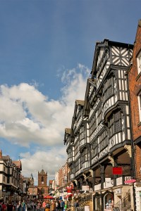
After the excitement of the aqueduct (boats go across it as fast as 2 mph!), it was back to the flatlands.  A quick nip through Chester, which was once a Roman fort, for controlling the Welsh border.  And a pause to appreciate what’s reckoned to be the world’s first ‘indoor shopping centre’ (note the medieval covered galleries on the buildings, to enable the wealthy shoppers to avoid the toilet buckets thrown from the upper storeys.  And the rain of course).

20150905RTW_13
At this point, I was only a few tens of miles from finishing the English section of the tour.  It was nearly time to depart the UK for a couple of days.  I just had the flattest day so far, across the plains of Lancashire, to go.

Liverpool is only a few miles up the road from Chester, and I trundled up the Wirral peninsular to take the ferry across the river into town on Sunday morning.  As you’d expect, no clichés were spared; The Beatles were playing on loop in the cafe while I waited for the boat to arrive, and they managed to play ‘Ferry ‘cross the Mersey’ twice over the PA on the boat during the short crossing.

20150906RTW_8
I’d not really seen much of central Liverpool before, but the waterfront, which saw so many migrants depart from Europe (that’s right – hundreds of thousands of migrants leaving Europe; who’d have thought?) for Canada and the US, is really impressive.  And the city was quiet as I headed north across the flat lands for Lancaster.

20150906RTW_13
Another Roman city, this time with one eye aimed at the Scottish rather than the Welsh.  The last major Roman outpost before Carlisle, which sits right on the border of the Roman empire at Hadrian’s Wall.  It’s a bit of a shame that my route takes me away from there, and the Lake District national park between them.  But there’s new stuff to see, and I’ve been there before.

And so it was that I set sail yesterday, leaving England behind.  And leaving the UK behind, temporarily.

20150907RTW_6
A short ride from Lancaster brings you to the small port of Heysham.  Journey’s end for the English and Welsh section of the ride.  To the north of the port, you get stunning views across the bay to the Lake District.  To the south you get nuclear power stations.  Lovely.

Across the water to the west are new places for me to explore.  Tomorrow (Weds), I’m on an early boat to Northern Ireland.  For today, I’m offshore on the Isle of Man.  Same language, same accents, same buildings.  Different money, different taxes, and a roaming mobile phone.

But more on that next time.

I crossed a lot of borders on my half-way round the world trip.  Lots of border guards taking things very seriously.  Lots of people stuck on one side or the other because of their luck (or lack of it) in where they happened to be born.

On this ride, I’ve carelessly criss-crossed a border that was fought over for centuries, and left my country without showing any ID.  These are borders that don’t (at least generally) kill any more.  Nobody storming the ferry or sitting desperately behind a fence peering in.

Funny things, borders.